Community Corner
WEATHER ALERT: More Snow Forecast for Greenwich on Thursday
Local meteorologists predict how much more snow we may be shoveling by Friday morning.

By Brian McCready and Barbara Heins (Patch Staff)
Not again!
There is another chance for accumulating snow in the near future as a winter storm could dump up to six inches of snow on Connecticut on Thursday, but the confidence in that prediction currently is low, according to local meteorologists.
Find out what's happening in Greenwichfor free with the latest updates from Patch.
Here’s what we currently know about the latest snow threat.
WFSB 3 TV Meteorologist Scott Haney says the state could see between 2-4 or possibly 3-6 inches of new snow accumulation by early Friday morning. The snow could begin after noon on Thursday.
Find out what's happening in Greenwichfor free with the latest updates from Patch.
“(Weather) models don’t agree, so confidence is low regarding this part of the forecast,” Haney wrote for WFSB 3.
NBC Connecticut Meteorologist Brad Field says the exact track of the storm will be the key in determining whether we get a few inches or a few snow flurries from this latest snow threat.
WTNH News 8 Meteorologist Gil Simmons is currently predicting a “round of accumulating snow likely” on Thursday.
And after this snowfall, it’s going to get cold, really cold — temperatures will drop like a rock and bottom out at -5 to -13 degrees by Sunday night.
But the silver lining in the latest weather cloud — only 38 days until spring.
And here is what the National Weather Service is predicting for Greenwich in their latest hyperlocal forecast for Thursday’s snow chance.
- Thursday: Snow. High near 29. Calm wind becoming southeast around 6 mph in the afternoon. Chance of precipitation is 80%. New snow accumulation of 1 to 2 inches possible.
- Thursday Night: Snow likely, mainly before midnight. Mostly cloudy, with a low around 11. Blustery. Chance of precipitation is 60%. New snow accumulation of 1 to 2 inches possible.
To sign up for Greenwich news alerts and more, click here.
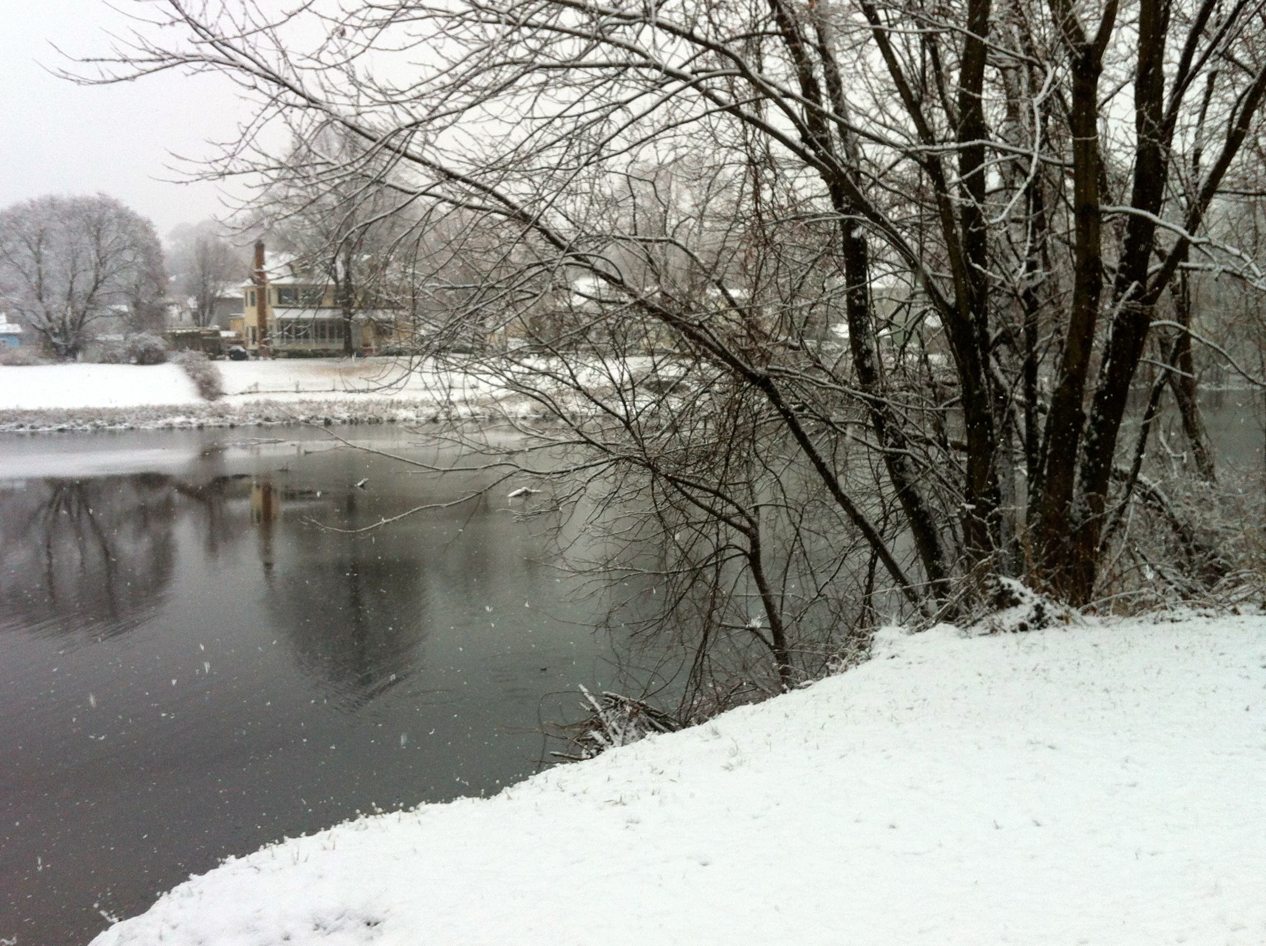
Photo credit: Barbara Heins.
Get more local news delivered straight to your inbox. Sign up for free Patch newsletters and alerts.