Weather
Storm Threat Sunday PM: Latest from National Weather Service
Maryland could see isolated flash flooding Sunday evening, thunderstorms packing damaging winds ahead of an expected cold front, NWS says.

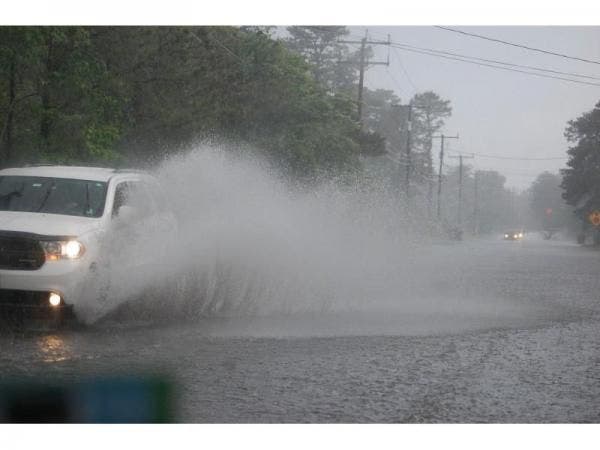
The National Weather Service says Sunday that much of Maryland, including the Baltimore and DC areas, could see thunderstorms Sunday afternoon and evening packing damaging winds, as well as isolated flash flooding, ahead of an expected cold front.
The timing for any thunderstorms? The Weather Service predicts that we could see activity through 7 p.m. The weather service says the area has a 90 percent chance of seeing rain Sunday afternoon.
Areas in the advisory include parts of Baltimore, Prince George's, Anne Arundel and Harford counties, along with DC and the Chesapeake Bay region.
Find out what's happening in Dundalkfor free with the latest updates from Patch.
The Washington Post's Capital Weather Gang is forecasting a similar timeframe, with potential thunderstorms hitting from 2-7 p.m. Sunday, targeting 4 p.m. as a potential prime time for a thunderstorm, based on the latest weather models.
Any flooding in the DC metro area could occur in poor drainage areas as well as in creeks and streams, the NWS warns. The weather service notes wind damage could occur mainly along the I-95 area.
Find out what's happening in Dundalkfor free with the latest updates from Patch.
The cold front is set to usher in cooler, less humid weather for the DC metro area, with a work week featuring highs in the low to mid-80s, the weather service predicts. By Friday, Northern Virginia will see highs reach about 90 degrees, according to the NWS.
Get more local news delivered straight to your inbox. Sign up for free Patch newsletters and alerts.


