Weather
50 MPH Winds, Rain To Batter Maryland: Weather Alert
Winds of up to 55 mph are expected to hit Maryland overnight and much of Sunday; power outages are likely. Here are the latest details.


BALTIMORE, MD — Winds gusting up to 55 mph are expected to hit Maryland overnight and much of Sunday, causing downed tree limbs and power outages. In its hazardous weather outlook, the National Weather Service says a cold front sweeping through the area will bring strong west winds, and has issued a wind advisory, a gale warning and a coastal flood advisory for parts of the state.
The hazardous weather outlook is for Chesapeake Bay and the inland waters surrounding the District of Columbia, Baltimore, Prince George's, Anne Arundel, St. Marys, Calvert and Harford counties. A gale warning is in effect for the waters Saturday night and a wind advisory is in effect starting at 4 a.m. Sunday and runs through 3 p.m.
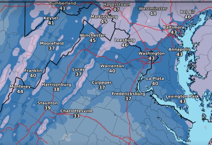
Rain chances are 90 percent after 11 p.m. Saturday, the forecast says. Expect a low around 49. On Sunday look for partly sunny skies with a high near 53.
Find out what's happening in Dundalkfor free with the latest updates from Patch.
Passage of a strong cold front late tonight mean winds may diminish and then increase again, peaking mid- to late morning Sunday before diminishing in the late afternoon. Expect west winds from 25 to 35 mph with gusts up to 50 mph. In the wind advisory area, winds of 45 to 55 mph are predicted.
Strong winds may blow down limbs, trees, and power lines. Scattered power outages are expected, forecasters say. Winds this strong can make driving difficult, especially for high-profile vehicles.
Find out what's happening in Dundalkfor free with the latest updates from Patch.
Areas in the wind advisory include all or parts of: Baltimore, Prince George's, Anne Arundel, Charles, St. Marys, Calvert, Montgomery, Howard and Harford counties.
Cities under the wind advisory include: Washington, DC, Baltimore, Eldersburg, Westminster, Reisterstown, Cockeysville, Bowie, Suitland-Silver Hill, Clinton, College Park, Greenbelt, Laurel, Camp Springs, Glen Burnie, Annapolis, Severn, South Gate, Severna Park, Arnold, Odenton, St. Charles, Waldorf, Lexington Park, California, Chesapeake Beach, Huntingtown, Dunkirk, North Beach, Lusby, Prince Frederick, Germantown, Damascus, Bethesda, Rockville, Gaithersburg, Silver Spring, Lisbon, Columbia, Ellicott City, Jarrettsville, and Aberdeen.
Anne Arundel County Fire officials shared these tips for staying safe during high wind warnings. If you are caught outside during high winds:
- Take cover next to a building or under a secure shelter.
- Stand clear of roadways or train tracks, as a gust may blow you into the path of an oncoming vehicle.
- Use handrails where available and avoid elevated areas such as roofs.
If you come across a downed power line:
- Report downed lines to your local utility emergency center and to the police.
- Avoid anything that may be touching downed lines, including vehicles or tree branches.
- If a line falls on your car, stay inside the vehicle. Do not touch any part of the metal frame of your vehicle.
- Honk your horn, roll down the window and warn anyone who may approach of the danger. Ask someone to call the police.
- Do not leave the car until help arrives, unless it catches fire. To exit, open the door, but do not step out. Jump without touching any of the metal portions of the car's exterior, and quickly get safe ground.
If you are driving:
- Keep both hands on the wheel and slow down.
- Watch for objects blowing across the roadway and into your path.
- Keep a safe distance from cars in adjacent lanes, as strong gusts could push a car outside its lane of travel.
- Take extra care in a high-profile vehicle such as trucks, vans, SUVs, or when towing a trailer, as these are more prone to being pushed or flipped by high wind gusts.
- If winds are severe enough to prevent safe driving, safely pull over onto the shoulder of the road and stop, making sure you are away from trees or other tall objects that could fall onto your vehicle.
A coastal flood advisory remains in effect until 9 p.m. Saturday for the Anne Arundel County shoreline. The Weather Service says high tide will be 1 to 1.5 feet above normal. Water is expected to pond in the parking lot at Annapolis City Dock.
Patch graphic, wind advisory graphic by the National Weather Service
Get more local news delivered straight to your inbox. Sign up for free Patch newsletters and alerts.


