Weather
MD Winter Weather Advisory Extended For Freezing Rain Feb 4
Breaking: Maryland's winter weather advisory for freezing rain on Sunday has been extended by the National Weather Service.

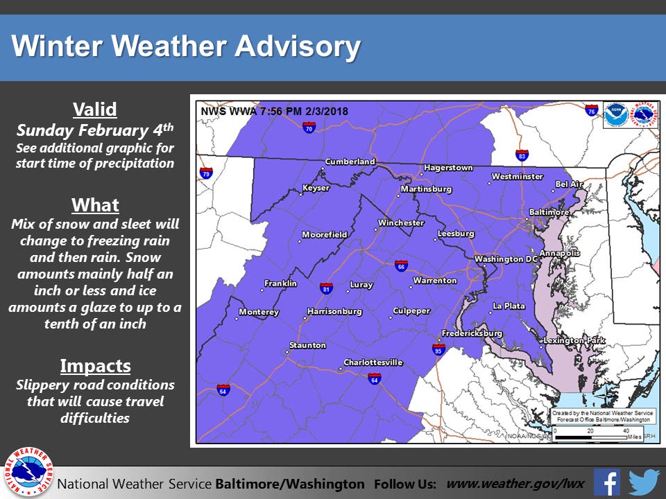
BALTIMORE, MD — Raining and freezing rain could make driving to a Super Bowl party treacherous and the National Weather Service has extended the winter weather advisory that includes the city of Baltimore and several Maryland counties. Forecasters say rain and freezing rain are most likely. The advisory now runs until 7 p.m. Sunday.
The advisory remains in place for Baltimore, Howard, Harford, Anne Arundel, and Montgomery counties. Additional accumulations of glaze ice will be less than one tenth inch, mainly confined to elevated surfaces such as trees, according to Accuweather.
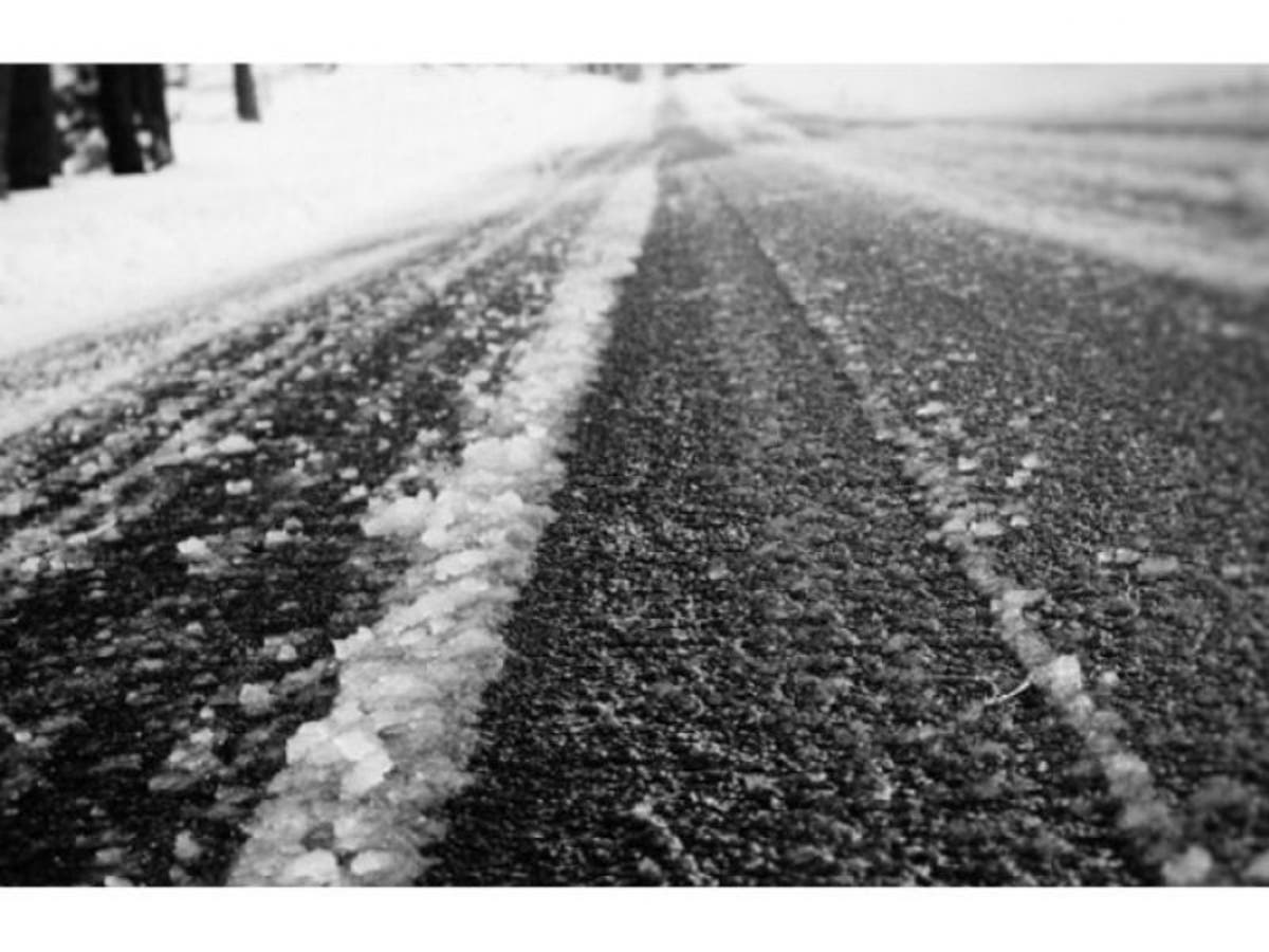
A wintry mix of snow, sleet and freezing rain wasexpected in the Washington and Baltimore metropolitan areas through 11 a.m. Precipitation will change quickly to rain and pockets of freezing rain by noon. Snow and sleet accumulations will range from a coating across most areas up to one-half inch in the far northern and western suburbs of Washington and Baltimore, says the Weather Service. A light glaze of ice from freezing rain is also expected during this time, especially on elevated surfaces.
Find out what's happening in Dundalkfor free with the latest updates from Patch.
Temperatures will fall into the lower 30s once precipitation starts, then temperatures will rise back into the middle 30s this afternoon.
Visibility will be reduced to less than 2 miles at times because of the precipitation and fog. Road conditions for the state you are traveling in can be found by calling 511.
Find out what's happening in Dundalkfor free with the latest updates from Patch.
The wintry mix is part of a system that the Weather Channel says will greet much of the northeastern part of the country on Super Bowl Sunday.
After this, the next chance of snow is Wednesday night. Here's the latest forecast from the National Weather Service:
Sunday: Snow, freezing rain, and sleet likely before noon, then freezing rain and sleet between noon and 1pm, then rain after 1pm. Patchy fog after 1pm. High near 37. Chance of precipitation is 100%. Little or no ice accumulation expected. New snow and sleet accumulation of less than a half inch possible.
Sunday Night: Rain or freezing rain before 11pm, then a slight chance of rain between 11pm and midnight. Patchy fog before midnight. Low around 29. Light and variable wind becoming west 5 to 9 mph in the evening. Winds could gust as high as 20 mph. Chance of precipitation is 80%. Little or no ice accumulation expected.
Monday: Sunny, with a high near 34. Breezy, with a northwest wind 15 to 20 mph decreasing to 9 to 14 mph in the afternoon. Winds could gust as high as 39 mph.
Monday Night: Mostly cloudy, with a low around 25. Northwest wind around 5 mph becoming calm in the evening.
Tuesday: Mostly cloudy, with a high near 42.
Tuesday Night: Rain likely. Mostly cloudy, with a low around 35. Chance of precipitation is 60%.
Wednesday: Rain. High near 50. Chance of precipitation is 90%.
Wednesday Night: Rain likely before 1am, then a chance of rain and snow showers. Mostly cloudy, with a low around 29. Chance of precipitation is 60%.
Thursday: Mostly sunny, with a high near 38.
Thursday Night: Partly cloudy, with a low around 25.
Friday: Mostly sunny, with a high near 42.
Friday Night: Partly cloudy, with a low around 31.
Saturday: A chance of rain. Mostly cloudy, with a high near 46. Chance of precipitation is 50%.
Image via Shutterstock
Get more local news delivered straight to your inbox. Sign up for free Patch newsletters and alerts.


