Weather
Tropical Storm Erin In Atlantic: Maryland Beaches To Feel Effects
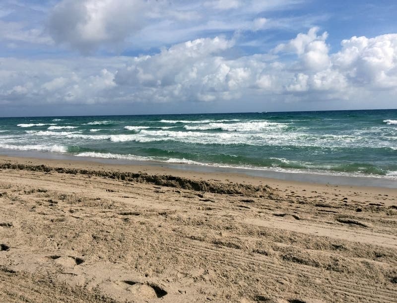
Tropical Storm Erin has heightened the risk of rip currents along the Maryland and Virginia coasts ahead of Labor Day weekend.

MARYLAND — Tropical Storm Erin will move well off the Maryland coast today, and the National Weather Service says the storm that carries 40- to 60-mph winds will have some effects that could affect your beach plans. The National Weather Service says Erin will be strong enough to cause strong rip currents, prompting the agency to post a beach hazards statement and a small craft advisory in effect through Wednesday evening.
Those rip currents could start as early as Wednesday afternoon. They're expected to last through Thursday and could continue into the weekend if Tropical Storm Dorian also decides to take a turn toward the North, the NWS says.
"Newly formed Tropical Storm Erin will remain well off the East Coast as it tracks north and northeast through Friday. No impacts are expected locally other than elevated seas and enhanced rip currents along the coast," the National Weather Service office in Wakefield, Virginia, said Wednesday morning.
Find out what's happening in Dundalkfor free with the latest updates from Patch.
Closer to home, much of Maryland may see scattered thunderstorms Wednesday afternoon as a cold front moves in.
Tropical storm-force winds are expected off the Maryland coast throughout Wednesday, the NWS said, but the storm will push north and be off the Massachusetts coast by Thursday. There are no coastal watches or warnings in effect.
Find out what's happening in Dundalkfor free with the latest updates from Patch.
The beach hazards statement applies to beaches in Maryland, Virginia and the Outer Banks. Breaking waves of 3 to 5 feet will result in rough surf conditions and a high risk of rip currents.
A Beach Hazards Statement is issued when threats such as rip currents, longshore currents, sneaker waves and other hazards create life-threatening conditions in the surf zone. Caution
should be used when in or near the water, the weather service said.
Also, a small craft advisory has been issued, which means winds of 18 to 33 knots are imminent or occurring. Boaters operating smaller vessels should avoid navigating in these conditions.
Here are Erin's potential impacted areas:
.jpg)
Rip currents are powerful channels of water flowing quickly away from shore, which occur most often at low spots or breaks in the sandbar and in the vicinity of structures such as jetties and
piers. Heed the advice of lifeguards, beach patrol flags and signs.
If you become caught in a rip current you should relax and float, the NWS says. Don't swim against the current. If able, swim in a direction following the shoreline. If unable to escape, face the shore and call or wave for help.
SEE ALSO: Dorian Could Hit FL As Cat 2 Hurricane; Closes In On Puerto Rico
Here's the latest forecast:
Wednesday: Isolated showers, then scattered showers and thunderstorms after 2pm. Mostly cloudy, with a high near 83. Light and variable wind. Chance of precipitation is 30%.
Wednesday Night: Scattered showers and thunderstorms before 8pm. Mostly cloudy, then gradually becoming mostly clear, with a low around 65. Northwest wind 3 to 8 mph. Chance of precipitation is 30%.
Thursday: Sunny, with a high near 84. Northwest wind 7 to 9 mph, with gusts as high as 18 mph.
Thursday Night: Mostly clear, with a low around 64. West wind around 5 mph becoming calm in the evening.
Friday: Sunny, with a high near 89. Calm wind becoming southwest 5 to 7 mph in the morning.
Friday Night: Partly cloudy, with a low around 67.
Saturday: Mostly sunny, with a high near 83.
Saturday Night: Mostly cloudy, with a low around 67.
Sunday: A chance of showers. Mostly cloudy, with a high near 83. Chance of precipitation is 30%.
Sunday Night: A chance of showers. Mostly cloudy, with a low around 68. Chance of precipitation is 30%.
Labor Day: A chance of showers and thunderstorms. Partly sunny, with a high near 84. Chance of precipitation is 40%.
Monday Night: A chance of showers. Partly cloudy, with a low around 69. Chance of precipitation is 30%.
Get more local news delivered straight to your inbox. Sign up for free Patch newsletters and alerts.


