Weather
Winter Storm May Drop 2-4 Inches Of Snow On Maryland Thursday Night
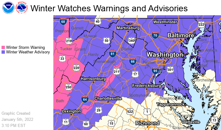
More snow is looming for Maryland. National Weather Service issued a winter weather advisory for Thursday with 2-5 inches of snow possible.

MARYLAND — Another round of snow is in the forecast for Thursday night that could bring up to five inches of snow to parts of Maryland in time for Friday morning's commute, forecasters said.
A winter weather advisory issued Wednesday afternoon by the National Weather Service will be in effect from 9 p.m. Thursday to 5 a.m. Friday.
Winter weather is expected to move through the District of Columbia, as well as parts of northern and central Maryland and Northern Virginia, from 9 p.m. on Thursday to 5 a.m. on Friday. The storm may bring accumulations of 2 to 4 inches and up to 5 inches of snow in some isolated areas, according to the advisory.
Find out what's happening in Dundalkfor free with the latest updates from Patch.
The heaviest accumulations are expected to occur between 10 p.m. Thursday and 2 a.m. Friday, when snow may accumulate at a rate of 1 inch per hour, the weather service said.
"Plan on slippery road conditions. The hazardous conditions could impact the Friday morning commute," the NWS tweeted.
Find out what's happening in Dundalkfor free with the latest updates from Patch.
As with any storm, there is some degree of uncertainty as to accumulation.
And a look ahead to the weekend shows a chance of freezing rain Sunday morning, then snow Sunday night.
The Maryland Department of Transportation State Highway Administration said the storm could influence both the Thursday evening and Friday morning commutes. Drivers are encouraged to telework if possible or reschedule/cancel their commute to avoid periods when the storm could impact travel, officials said.
“We strongly urge commuters to limit travel during winter storms, as this significantly impacts our team’s ability to keep roadways open and safe,” said MDOT SHA Administrator Tim Smith. “For those who must travel, please use extreme caution and slow down. Posted speed limits are for ideal weather and road conditions and are not intended for snow or ice.”
MDOT SHA operations managers are assessing conditions across the state and preparing to pre-treat roadways. Maintenance shops across the state are getting materials, supplies and trucks ready for the storm.
Here's the latest forecast:
Wednesday Night: Cloudy during the early evening, then gradual clearing, with a low around 31. South wind around 9 mph becoming west after midnight. Winds could gust as high as 18 mph.
Thursday: Partly sunny, with a high near 39. Northwest wind around 6 mph becoming calm in the afternoon.
Thursday Night: Snow, mainly after 9pm. Low around 27. Calm wind becoming northwest around 6 mph after midnight. Chance of precipitation is 100%. New snow accumulation of 2 to 4 inches possible.
Friday: Mostly sunny, with a high near 34. West wind 9 to 17 mph, with gusts as high as 26 mph.
Friday Night: Mostly clear, with a low around 19. Northwest wind 6 to 13 mph.
Saturday: Sunny, with a high near 34.
Saturday Night: Mostly clear, with a low around 25.
Sunday: Rain or freezing rain, becoming all rain after 1pm. High near 45. Chance of precipitation is 80%.
Sunday Night: A chance of rain before 1am, then a chance of snow. Mostly cloudy, with a low around 28. Chance of precipitation is 40%.
Get more local news delivered straight to your inbox. Sign up for free Patch newsletters and alerts.