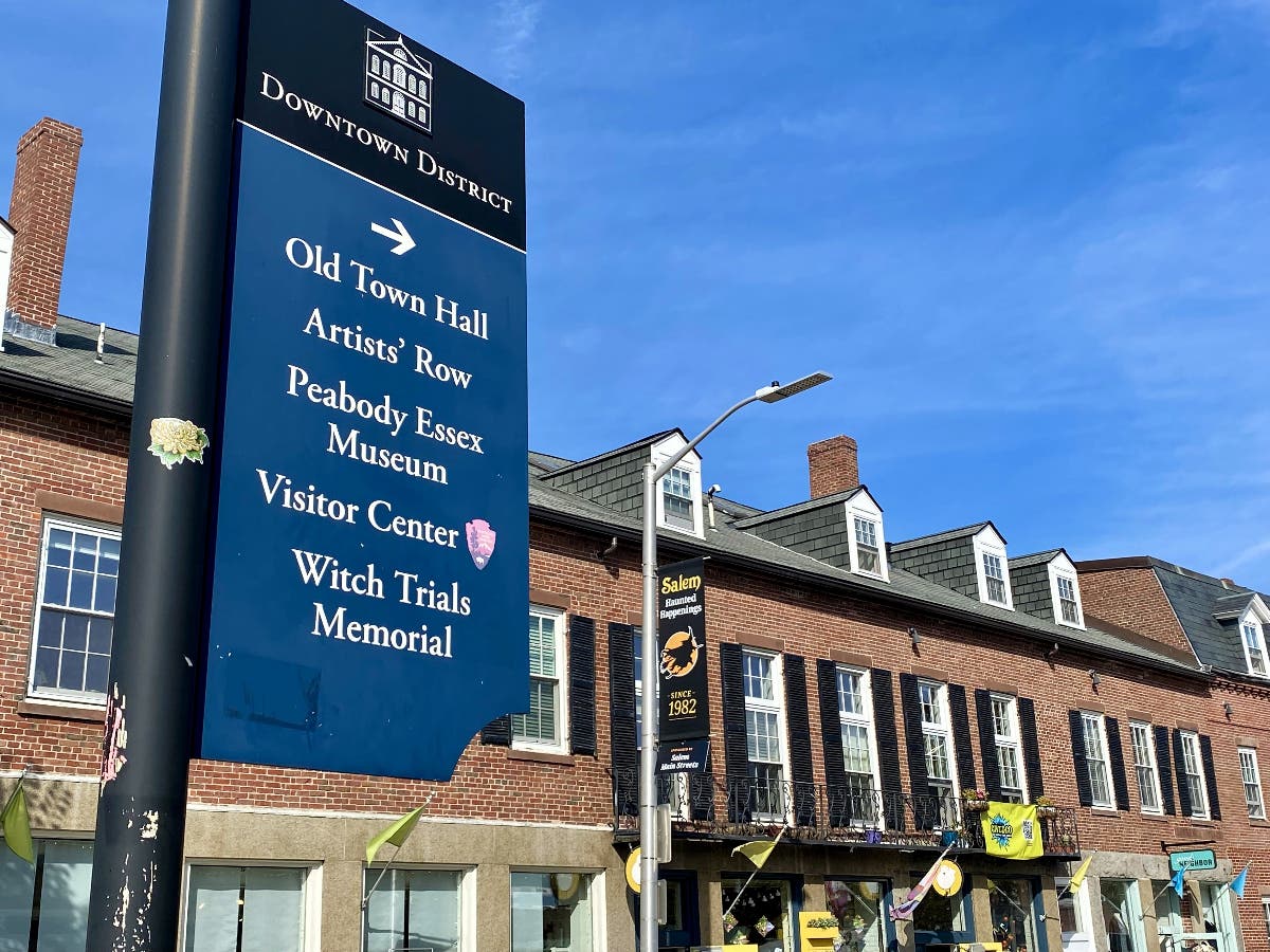
Arts & Entertainment
Then & Now: Intersection to the Past
These views give us a glimpse of downtown Salem not long ago.


Do you recognize this intersection? Do you know where it is now?
As the discussion continues on the future of the and whether or not it should re-open to vehicular traffic, I thought this view from the past might be of interest.
This photograph is from the accident investigation files of the 1960s. While investigating car accidents, photographs were taken that not only chronicled the accident, but also now gives us glimpses of Salem during those days. In these photographs, we get a view of the intersection of Church, Brown and St. Peter streets before major changes occurred in the 1970s.
Find out what's happening in Salemfor free with the latest updates from Patch.
This area of the city was a busy part of downtown with many shops and restaurants that spilled over from Essex Street. St. Peter Street, which started at 168 Essex St., housed a number of businesses over the years that many may recall.
Some of these businesses moved over the years to other parts of the city, while others have faded into memory. There was Pekin’s Pants, Margolis’s Furs, Gertrude’s Hat Shop and Millinery as well as restaurants and cafes.
Find out what's happening in Salemfor free with the latest updates from Patch.
While Bette’s Restaurant is shown here in the 1960s, readers may recall when it was The Morning Call Coffee & Doughnut Shop in the mid-1950s, the Lindy Cafeteria in 1959 or Chatom’s Restaurant in the early 1960s. In the mid-60s, it became home to Hayden’s Safe & Lock Company.
This section of St. Peter Street from Essex to Church streets was also home to The Silver Rail Café, The Town Café, the Avalon Café and the Pioneer Lounge as well as #11, The Paramount Theater Office. The Paramount Theater, which is not seen in these photos, loomed beside and over Almy’s Department Store. On the corner of Church and St. Peter Streets for many years stood the Paramount Cities Service Gas Station as seen in the photos. Some may also recall that Alice Duffee’s Dancing Studio and Laura’s Beauty Shoppe were also on St. Peter Street. It was quite a busy place.
I recall staring at the locks in Hayden’s Safe and Lock windows while waiting for my mother who was shopping in Gertrude’s Millinery, then sneaking around the corner to look at the Paramount’s movie posters of current and future attractions.
A few steps away on Church Street were not only more stores, but also Almy’s parking lot and rear entrance to the store. As I recall many trips to this store, it was always this entrance close to the parking lot that was used. You could never count on a parking space along Essex Street so most people entered from Church Street.
In examining these photographs, it’s noteworthy to see how far away the Armory is from the intersection. This gives us an idea of what was removed to make way for the mall and garage. These changes took place beginning in 1973 and continued for several years. The parking garage was completed in 1975. The East India Mall, (now ), was not completed until 1979.
According to Tolles in his book, Architecture In Salem, these were two distinct but functionally and aesthetically related projects — the garage and the mall. Both projects shared the same planner and developer, Mondev International Limited of Montreal, Canada.
The design of the garage was done by the engineering firm of Zaldastani Associates with Nelson Aldrich Associates of Boston serving as consulting architects. This same firm also designed the East India Mall. The design of the 1000 car garage, according to Tolles, hearkens back to the International Style of the 1940s to 1950s, while the mall itself represents the new formalism architecture.
The architect, Nelson Aldrich, with his partner Maxwell Pounder, acted as project
architect for the mall. The firm changed their name to Aldrich, Pounder and
Associates during this time.
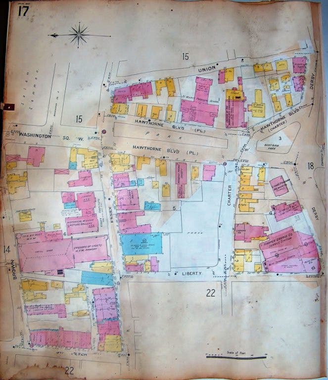
The maps above are pages from Salem Atlas of 1906-1938 found online at Salem Deeds and show these streets. Unfortunately, two maps are necessary to see both sides of St. Peter Street.
Looking at them, however, gives one a good sense of how the street was laid out
and where the various businesses were.
Before concluding this column, I want to thank the for permission to use these photos and to encourage people to take a look at the old photos section on their website. There are a number of very interesting photographs that give good views of bygone days.
If you have old photographs of Salem you’d like to share please consider offering them to the Salem Police for inclusion on their website. For more information, you can contact Police Detective Sgt. Jim Page through the SPD website.