Weather
Weather Watches Issued In North Jersey As Another Round Of Severe Weather Moves In
Flash flooding and locally damaging winds are possible Saturday as severe storms are set to lash the state.


Another severe thunderstorm watch has been issued for North Jersey, including Sussex, Morris, and Warren Counties, the National Weather Service said Saturday afternoon.
”If you are affected by severe storms this afternoon, please first take shelter and stay safe. Once the storm has passed, if you have any reports of wind damage, hail, or flooding, please feel free to report it here when it is safe to do so,” forecasters said.
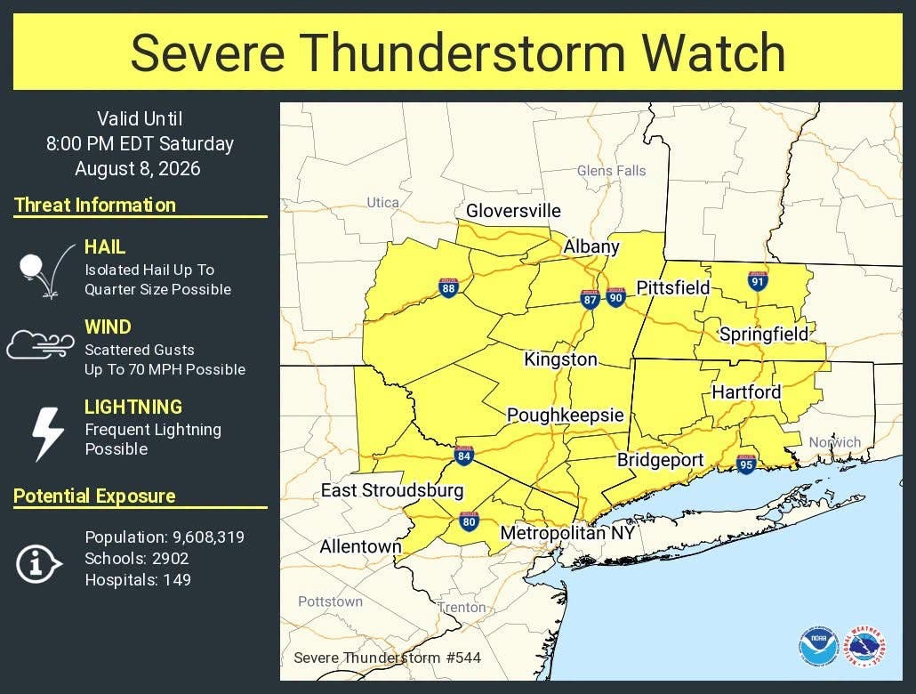
After severe storms that brought heavy flooding, high winds and lightning across the Garden State on Friday, Mother Nature has reloaded and is prepping another tantrum for Saturday, according to the National Weather Service.
Find out what's happening in Across New Jerseyfor free with the latest updates from Patch.
"The severe thunderstorm potential increased for this afternoon and evening with the greatest risk near and NW of the I-95 corridor and most of Delmarva," forecasters said. "The primary risk is locally damaging winds. Locally heavy rain leading to flash flooding is also possible."
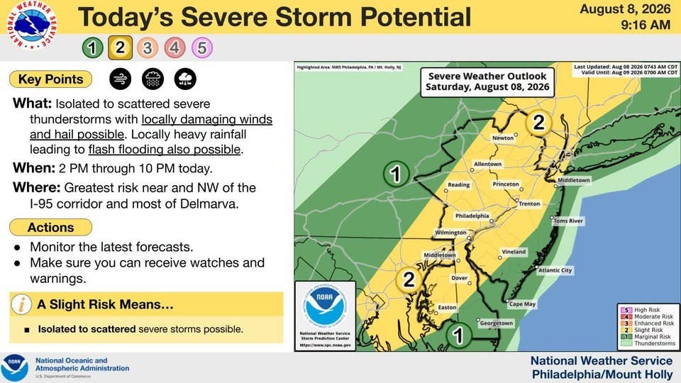
Friday's storm featured a watch, covering all 21 NJ counties, after a very hot and humid day. A Heat Advisory remains in place for most of the state through Saturday. The exception is the far southern counties.
Find out what's happening in Across New Jerseyfor free with the latest updates from Patch.
The window for the storms is between 2 p.m. and 10 p.m. forecasters said.
Heat index values could reach 104 degrees, according to the National Weather Service.
Heading into next week, Monday and Tuesday also look to be hot, humid and stormy.
A cold front late Tuesday or Wednesday should break the excessive heat and humidity, forecasters said. But it could also continue the stormy pattern.
Get more local news delivered straight to your inbox. Sign up for free Patch newsletters and alerts.