Weather
Severe Storm Warnings Issued In Parts Of NJ, Watches Blanket State
New Jersey is set for a "wild weather ride" Friday with a warm afternoon, stormy evening, windy night and frosty weekend ahead.


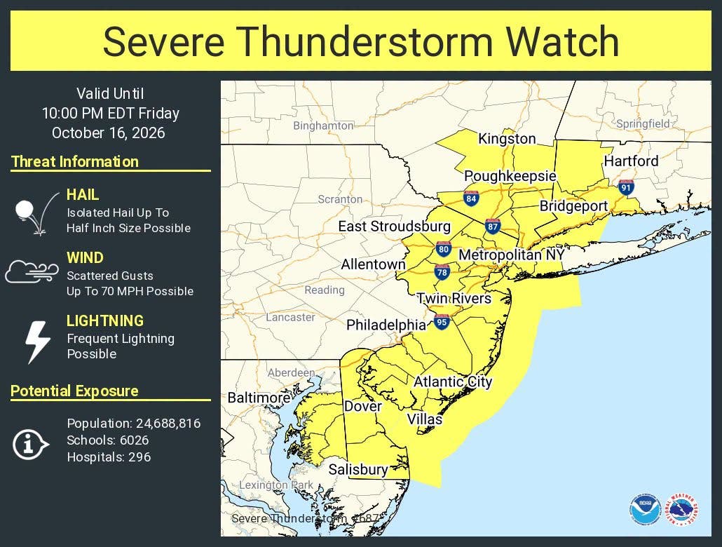
Severe thunderstorm watches have been issued across New Jersey and warnings blanket parts of the Garden State as residents prepares to get slammed by rain, hail and strong winds.
All of New Jersey is under a watch until 10 p.m. Morris, Hunterdon, Warren and Somerset County until approximately 6:30 p.m., according to the National Weather Service.
These storms will bring up to 70 mph wind gusts, lightning and half-inch sized hail.
Find out what's happening in Across New Jerseyfor free with the latest updates from Patch.
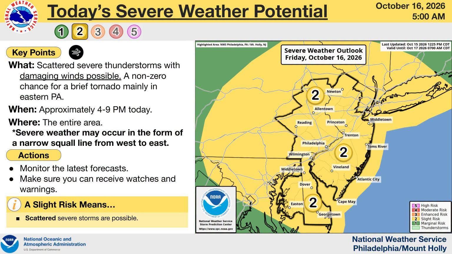
Severe weather moves in during the late afternoon into evening. Northwestern Jersey will see storms around 4 p.m. to 6 p.m., Central Jersey around 5 p.m. to 7 p.m. and South Jersey from 6 p.m. to 8 p.m.
The entire state is under a marginal risk for severe weather, level 2 out of 5. This severe weather may appear in the form of a squall line heading west to east.
Find out what's happening in Across New Jerseyfor free with the latest updates from Patch.
The risk of severe weather will drop after sunset.
Gusty winds will develop overnight, ranging from 15 mph to 25 mph with 30 mph to 40 mph gusts, according to the National Weather Service.
Saturday will be much cooler and drier. Winds will diminish Saturday night.
Temperatures will further drop overnight Saturday, reaching at or below freezing in the northwestern corner of the state, National Weather Service forecasters said. In Central and South Jersey, lows will hit the mid-30s. At the coast, it will be in the upper-30s to mid-40s.
Widespread frost will likely be limited to the far northern reaches, though patchy frost is possible across inland New Jersey, especially in the Pine Barrens.
Temperatures will moderate back to near normal Sunday.
Get more local news delivered straight to your inbox. Sign up for free Patch newsletters and alerts.