Weather
Snow, Ice 'Likely:' N.J.'s Winter Weather Weekend, Monday
Winter weather is likely in N.J. this weekend as the region's worst snow, ice storm so far is expected to hit, impacting Monday's commute.

Winter weather is likely in N.J. this weekend as the region's worst snow and ice storm so far is expected to hit, impacting Monday's commute.
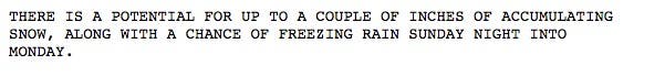
A wintry mix of snow, freezing rain and sleet is possible Sunday through Monday morning, according to the National Weather Service.
Read update: Hazardous Weather Outlook For New Jersey Weekend, Monday Commute
Find out what's happening in Toms Riverfor free with the latest updates from Patch.
Here are the hazards and impacts, according to the NWS briefing package:
- Snow: Locations along and north of Interstate 78 could see highest amounts, but accumulating snow is possible as far south and east as the Interstate 95 corridor.
- Ice: There is a chance for freezing rain and sleet generally along and north of Interstate 78 late Sunday night into Monday morning. If it occurs, this could result in a light coating of ice especially on elevated surfaces.
- Impacts: Hazardous travel conditions are possible for the Monday morning commute especially along an north of Interstate 78, though impacts to the morning commute are possible as far south as Interstate 76.
- Timing: Snow could begin across the Poconos as early as Sunday morning. Precipitation is expected to spread across the region by Sunday evening. By mid day Monday, precipitation should be all rain.
- Confidence: Precipitation occurring is high
If warm air moves in faster, it could result in a faster changeover and lower snow and ice amounts. A slower arrival could mean higher snow and ice amounts and impacts further south.
Find out what's happening in Toms Riverfor free with the latest updates from Patch.
For now, a hazardous weather outlook has been issued for Sussex, Morris, Union, Hunterdon and Warren counties. But that could get larger.
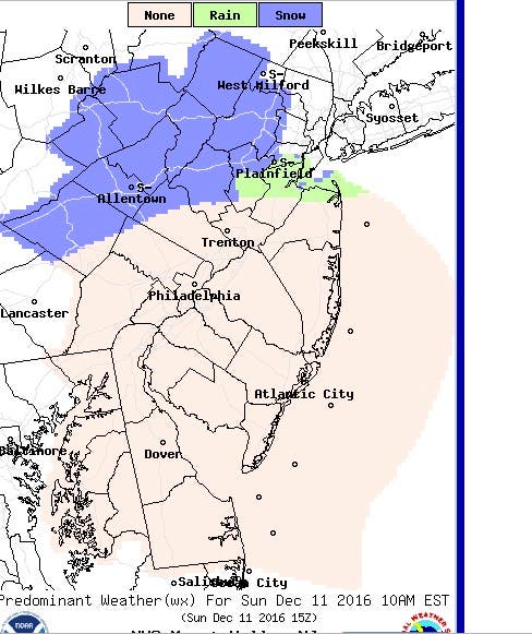
Some of the first snow will come early Sunday:
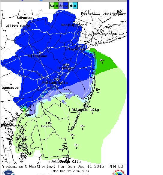
For some areas, the worst of it will come Sunday night:
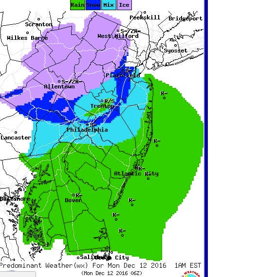
Ice and snow will mix on Monday morning, creating the potential for a bad Monday commute:
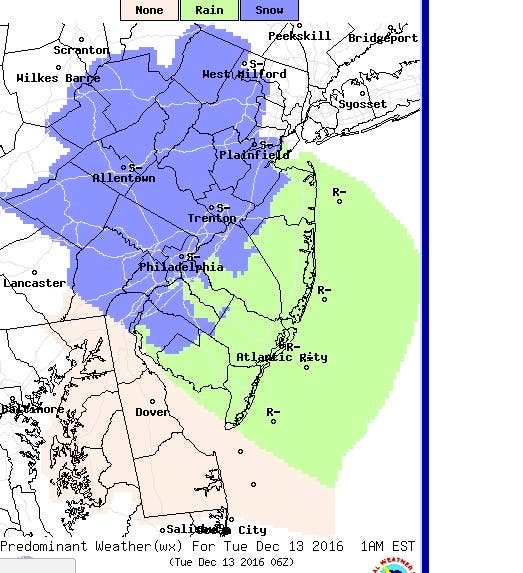
Some of it will return on Tuesday morning:
Here is the weather forecast for the area:
- Friday: Mostly sunny, with a high near 40. West wind 13 to 15 mph.
- Friday night: Partly cloudy, with a low around 22. West wind 6 to 9 mph.
- Saturday: Mostly sunny, with a high near 37. West wind 5 to 11 mph.
- Saturday night: Increasing clouds, with a low around 21. West wind around 6 mph becoming calm after midnight.
- Sunday: A chance of rain or snow before 3 p.m, then a slight chance of rain between 3 p.m. and 5pm, then a slight chance of rain, ice and snow after 5 p.m. (except in Cape May and Atlantic counties) Mostly cloudy, with a high near 38. Calm wind becoming south 5 to 8 mph in the afternoon. Chance of precipitation is 20 percent.
- Sunday night: Rain or snow likely (except in Cape May and Atlantic counties), becoming all rain after 2 a.m. Cloudy, with a low around 33. Chance of precipitation is 70 percent. New precipitation amounts between a tenth and quarter of an inch possible.
- Monday: Snow, sleet or rain, possibly mixed with freezing rain before 9 a.m., then rain and snow between 9 a.m. and 10 a.m., then rain after 10am. High near 40. Chance of precipitation is 80 percent.
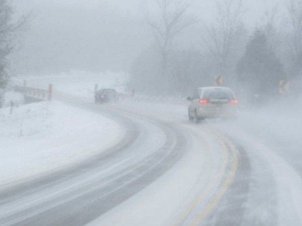
Patch file photo
Get more local news delivered straight to your inbox. Sign up for free Patch newsletters and alerts.