Crime & Safety
CA Fires 2020: 31 Dead; 4M Acres Burn
The latest on California's largest wildfire season on record. Plus, see a map of all fires burning across the state, Oct. 7.


CALIFORNIA — More than 16,500 firefighters continued the fight Wednesday against 22 major wildfires across the Golden State. As temperatures remained unseasonably warm, crews faced 25 new wildfires Tuesday but extinguished them all.
A gripping warm and dry weather pattern statewide was expected to finally ease into more-seasonal temperatures Wednesday, with even a chance of rain in some areas this weekend. Possible precipitation and increasing humidity levels could aid firefighters in suppression efforts through the weekend, Cal Fire said.
But Cal Fire warned "the large fire threat will start to increase once again early next week as warm and dry conditions commence."
Find out what's happening in Across Californiafor free with the latest updates from Patch.
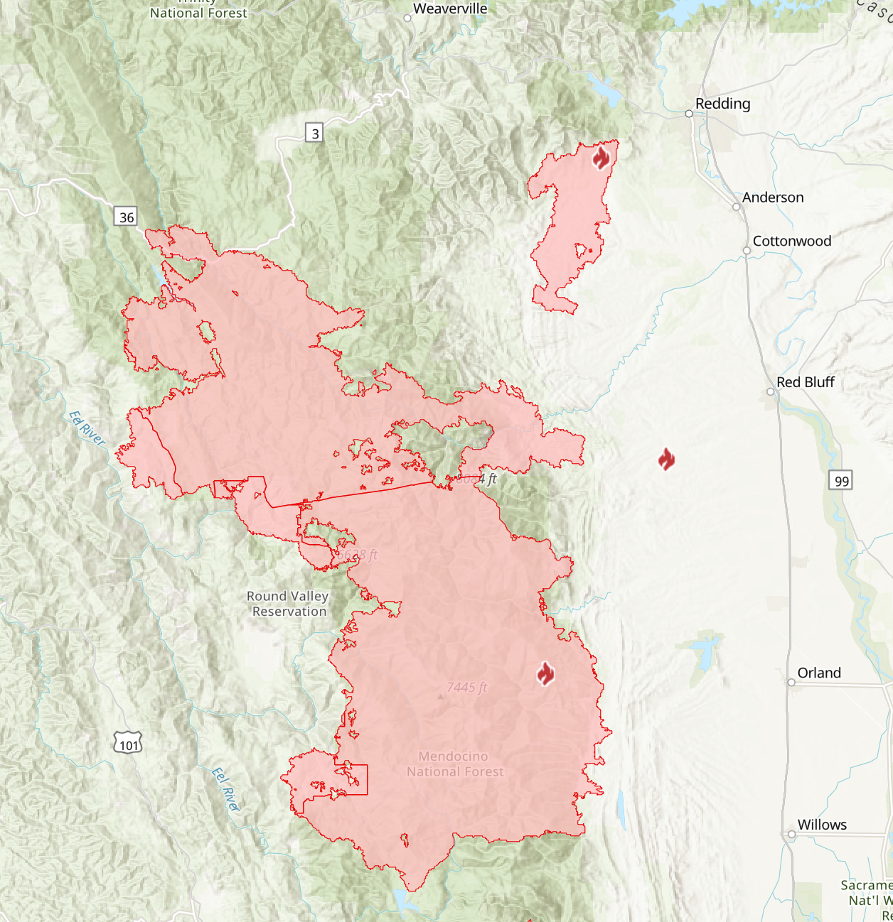
The August Complex Fire was already California's largest wildfire in state history, but it smashed another record as it grew to 1,002,097 acres over the weekend. The massive blaze has been smoldering since Aug. 17 from the Mendocino National Forest all the way up to the Shasta Trinity National Forest, threatening a mega merger with the Zogg Fire, burning less than 10 miles away.
The Zogg Fire, burning near Redding, has scorched 56,305 acres, but fire crews made good progress on containment this week, holding the blaze at 86 percent.
Find out what's happening in Across Californiafor free with the latest updates from Patch.
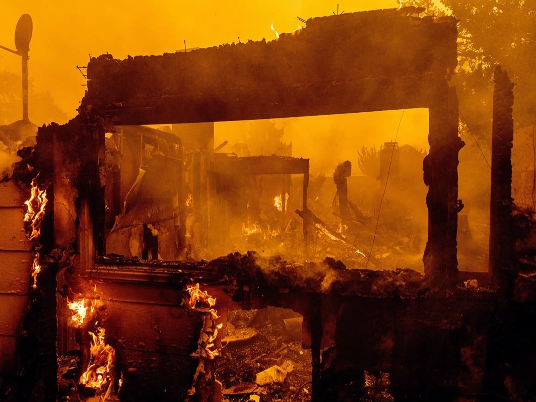
During this catastrophic fire year, more than 8,891 known structures have been lost across the state, and 31 people have died.
A dry landscape, combined with persistent and historically high temperatures this year, have kept the state in an extended fire season. California may be in for a dry winter as La Nina conditions have been forecast, which could keep the state in a relatively warm and arid weather pattern.
California's largest-ever fire season may not be over until November.
The devastating Glass Fire, burning in Napa and Sonoma counties, has consumed more than 1,517 structures.
Aided by dry and warm air, the Glass Fire burned actively overnight and has scorched 67,200 acres with 58 percent containment.
The fire has also destroyed historic landmarks and famed wineries along Silverado Trail, nestled within Napa Valley.
A 120-year-old home at Tofaneli Vineyard and the 41-year-old Chateau Boswell Winery were lost to the flames last week.
The Glass Fire has consumed countless homes, sending tens of thousands fleeing from their communities in Napa and Sonoma counties throughout the week. Fortunately, no new evacuation orders have been issued since Thursday, with some evacuation orders reduced to warnings in areas of Sonoma County and parts of Santa Rosa.
The entire city of Calistoga was evacuated a week ago as incoming flames threatened to engulf the city. More than 5,000 people in Calistoga were forced to flee.
Although no cause has been determined for the Zogg and Glass fires, last weekend's dry heat wave is largely to blame.
SEE ALSO: Oakland Zoo Treats Mountain Lion Cub Badly Burned In Zogg Fire
This historic fire year points to what Cal Fire, environmental scientists and some politicians have been warning all along: climate change.
Gov. Gavin Newsom has repeatedly urged constituents and fellow politicians in his daily news briefings to look at the data behind rising temperatures in California and how temperatures have contributed to the growth of fire seasons over the years.
"Data and science are not beliefs," Newsom said during a mid-September news conference. "You have to acknowledge facts."
In 2020 alone, some 8,300 fires have incinerated 4 million acres.
And since Aug. 15, when a series of unseasonal dry lightning storms ignited dozens of major fires, the state has been breaking records for acres burned at a rapid pace.
SEE ALSO: Historic Chateau Boswell Winery Burns Down; More Landmarks Lost
Thirty-three members of California's congressional delegation, including Rep. Judy Chu, House Speaker Nancy Pelosi and House Minority Leader Kevin McCarthy, wrote a letter to President Donald Trump last week urging him to support Newsom's request for a Major Disaster Declaration to respond to the wildfires raging in California, including the Bobcat Fire, which is burning in Chu's district.
Cal Fire offers a website to help people prepare for and prevent wildfires. Ready For Wildfires can be accessed here.
READ MORE: SEE ALSO: Wildfire Smoke Could Affect Pregnant Women Disproportionately
As fire season rages on, new records continue to be set.
Cal Fire says these new records have been recorded this season:
- 5 of the Top 20 largest wildfires in California History have occurred in 2020.
- Largest Wildfires - #1 August Complex, #3 SCU Lightning Complex, #4 LNU Lightning Complex, #5 North Complex, and #6 Creek Fire.
- Most Destructive - #5 North Complex, #10 LNU Lightning Complex, #11 CZU Lightning Complex, and #17 Creek Fire.
- Deadliest Wildfires - #5 North Complex and #20 LNU Lightning Complex.
SEE ALSO: Discovery Channel Partners With Cal Fire In New Series

Here's more on some of the major fires burning as of Wednesday, via Cal Fire:
**CALFIRE Incidents**
Zogg Fire, Shasta County (more info…)
Southwest of Redding
*56,305 acres, 86% contained
*4 Fatalities
*Evacuation orders in place
*CAL FIRE Team 2 in command.
Butte/Tehama/Glenn (BTU/TGU) Lightning Complex, multiple Counties (more info…)
Butte, Tehama and Glenn Counties
*19,609 acres, 97% contained
*14 structures destroyed
*While no growth is expected, fire suppression repair work is ongoing.
**Unified Command Incidents**
Glass Fire, Napa and Sonoma County (more info…)
4 miles east of Calistoga
*67,200 acres, 58% contained
*Evacuation orders and warnings in place
*CAL FIRE Team 3 in command.
Creek Fire, Fresno County (more info…)
Northeast of Shaver Lake (Sierra National Forest)
*328,595 acres, 49% contained
*Evacuations in place
*Heavy tree mortality in the area
*852 structures destroyed
*Northern Rockies Team 4 is in command of the North Zone and California Interagency Incident Command Team 5 is in command of the South Zone.
SQF Complex, Tulare County (more info…)
3 miles east of Giant Sequoia National Monument
*160,908 acres, 65% contained
*Evacuation order and warnings remain in place
*232 structures destroyed
*California Interagency Incident Management Team 13 in unified command with CAL FIRE.
**Coordinated Command Incidents**
August Complex, Tehama County (more info…)
Colusa, Glenn, Lake, Mendocino, Tehama and Trinity Counties
Elk Creek and Stonyford area (Mendocino National Forest)
*1,011,493 acres, 60% contained
*South Zone 545,241 acres
*North East Zone 264,775 acres
*North West Zone 65,611 acres
*West Zone 135,866 acres
*1 fatality
*210 structures destroyed
*Includes multiple fires including the Elkhorn, Hopkins, Willow, Vinegar, and Doe fires
*Southwest Incident Management Team 1 will in brief to assume command of the South Zone today
*Pacific North West Incident Management Team 2 in command of the Northwest and South Zones
*Great Basin Incident Management Team 2 is in command of the North East Zone
*CAL FIRE Incident Management Team 5 in unified command of the West Zone with Mendocino County Sherriff’s Office.
**Federal Incidents**
North Complex, Plumas County (more info…)
Northeast of Oroville to southwest of Quincy (Plumas National Forest)
*318,928 acres, 87% contained
*15 fatalities
*2,342 structures destroyed
*Evacuation orders and warnings remain in place
*Includes the Bear and Claremont Fire.
Snow Fire, Riverside County (more info…)
Snow Creek Rd, west of Palm Springs
*6,254 acres, 95% contained.
El Dorado Fire, San Bernardino County (more info…)
West of Oak Glen (San Bernardino National Forest)
*22,744 acres, 95% contained
*1 fatality
*10 structures destroyed
*California Interagency Incident Management Team 13 in command.
Slater Fire, Siskiyou County, (more info…)
5 miles North of Happy Camp (Klamath National Forest)
*155,510 acres, 67% contained
*2 fatalities
*Evacuation orders in place.
Devil Fire, Siskiyou County, (more info…)
5 miles north of Upper Devil’s Peak (Klamath National Forest)
*8,693 acres, 32% contained.
Bobcat Fire, Los Angeles County (more info…)
North of Duarte (Angeles National Forest)
*115,796 acres, 89% containment
*Evacuations in place.
Dolan Fire, Monterey County (more info…)
Hwy 1, 10 miles south of Big Sur (Los Padres National Forest)
*124,924 acres, 98% contained
*Structures threatened
*California Interagency Incident Command Team 15 in command.
Bullfrog Fire, Fresno County (more info…)
SE of Bullfrog Lake (Sierra National Forest)
*1,185 acres, 50% contained.
Fork Fire, El Dorado County, (more info…)
15 miles northeast of Pollock Pines (El Dorado National Forest)
*1,667 acres, 70% contained.
Apple Fire, Riverside County (more info…)
Oak Glen/Cherry Valley (San Bernardino National Forest)
*33,424 acres, 95% contained.
Red Salmon Complex – Humboldt County (more info…)
14 miles northeast of Willow Creek (Shasta-Trinity National Forest)
*134,936 acres, 34% contained.
Blue Jay Fire, Mariposa County (more info…)
Yosemite National Park Wilderness
*5,335 acres, 50% contained.
Wolf Fire, Tuolumne County (more info…)
Yosemite National Park Wilderness
*1,092 acres, 60% contained.
Slink Fire, Mono County (more info…)
2 miles west of Coleville (Humboldt-Toiyabe National Forest)
*26,759 acres, 86% contained.
Moraine, Tulare County (more info…)
Sequoia and Kings Canyon National Parks Wilderness
*694 acres, 70% contained.
Rattlesnake, Tulare County (more info…)
Sequoia and Kings Canyon National Parks Wilderness
*4,471 acres, 30% contained.
Get more local news delivered straight to your inbox. Sign up for free Patch newsletters and alerts.