Weather
CA Storm Aftermath: Here's What 17 Feet Of Snow Looks Like
See photos of snowfall in California as locals bundle up to ring in the new year!

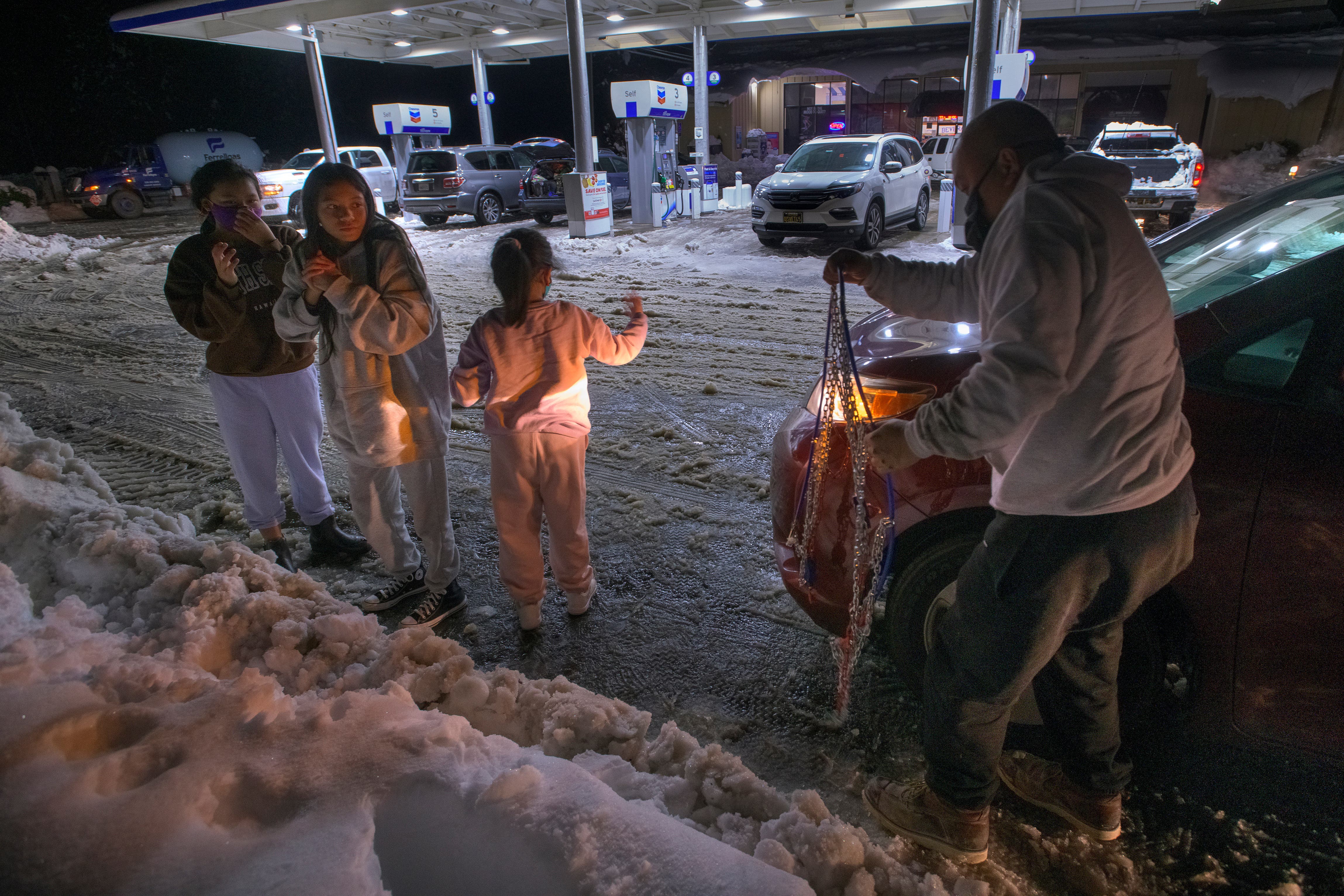
ACROSS CALIFORNIA — From avalanches to record snowfall, a series of winter storms this week pummeled the Golden State with road closures, mudslides, and rapid water rescues. When the storm clouds clear, ski conditions will be epic, but, in the meantime, residents up and down the state are dealing with hazardous conditions.
A series of back-to-back storms dropped several feet of snow in the California mountains from Big Bear to Tahoe. Low snow levels forced authorities to close several highways from the I-80 in Placer County to the full closure of the Golden State (5) Freeway at the Grapevine Thursday afternoon, the California Highway Patrol said. The 5, is a major artery for travel between Los Angeles County and Northern California, and authorities did not have an immediate estimate for when it would reopen Thursday. Drivers were advised to avoid the area or expect significant delays.
The I-80 remained closed due to poor visibility and heavy snow from the Nevada state line to Placer County, California, According to the Associated Press.
Find out what's happening in Across Californiafor free with the latest updates from Patch.
Further south, at least 27 people were rescued from a campground in Malibu, where downpours triggered flooding and mudslides.
This is Leo Carrillo camp grounds in Malibu. Heavy presence of fire equipment. Multiple stranded families rescued #Muddy #LARain #swiftwater @MPrepardness @LHSLASD @Cal_OES @LACoFDPIO pic.twitter.com/9pEklKlTVH
— Malibu Emergency Preparedness Solutions🚑🚓🚒🚔🚁 (@MPrepardness) December 30, 2021
Due to the severe flooding at Leo Carrillo campground in Malibu along PCH, LA County Fire Department’s Search & Rescue Team is rescuing stranded campers with their boat! CHP is on scene for traffic control. @LACoFDPIO pic.twitter.com/CqFdstphkH
— CHP - West Valley (@CHPWestValley) December 30, 2021
Here is how California is dealing with the snow:
Find out what's happening in Across Californiafor free with the latest updates from Patch.
LA skyline, the morning after Christmas storm, 2021 (Photo by Gary Blasi) pic.twitter.com/K3ZjNStJy0
— Victor Narro (@NarroVictor) December 29, 2021
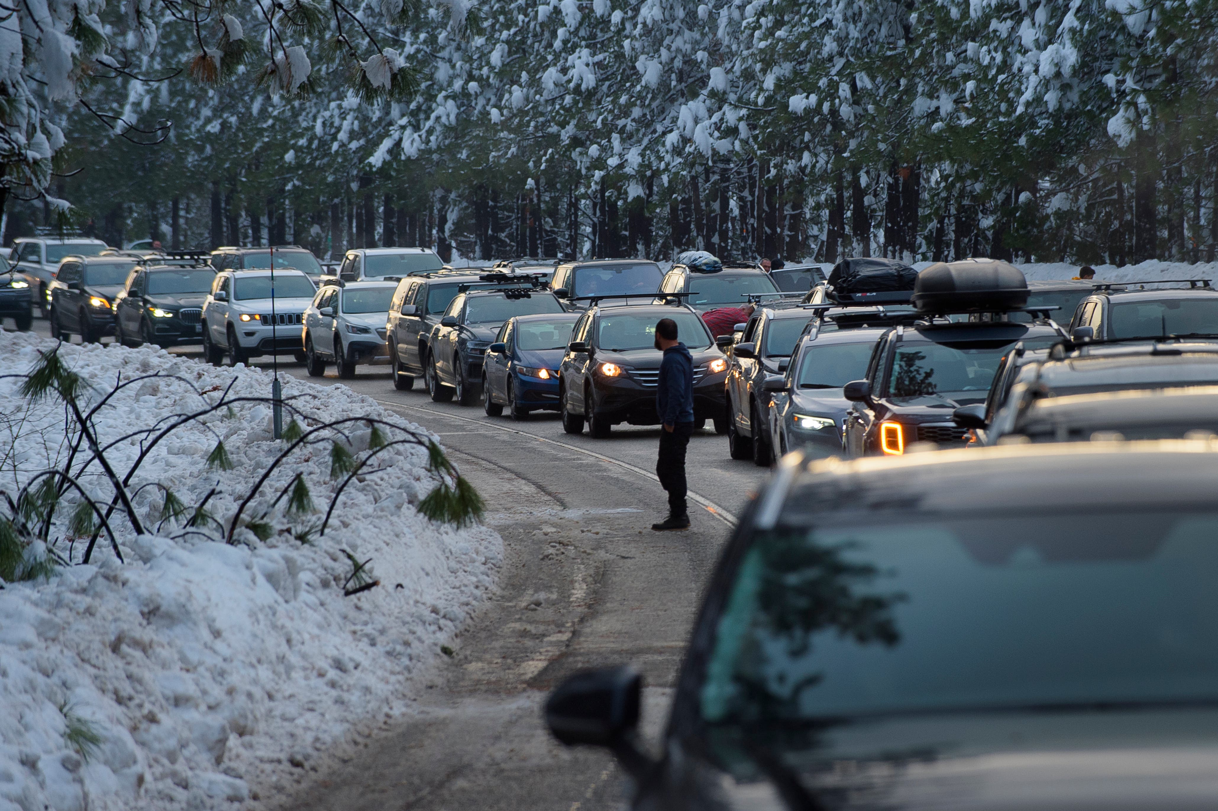
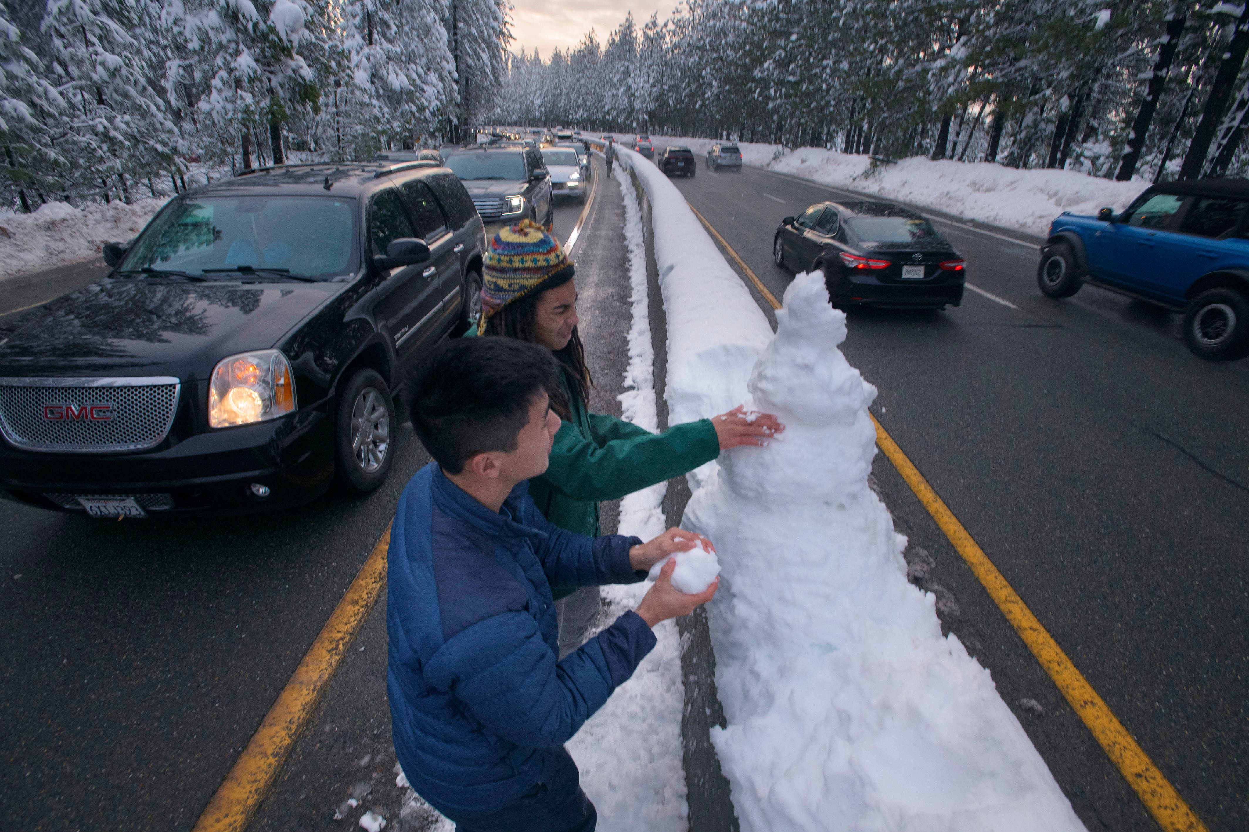
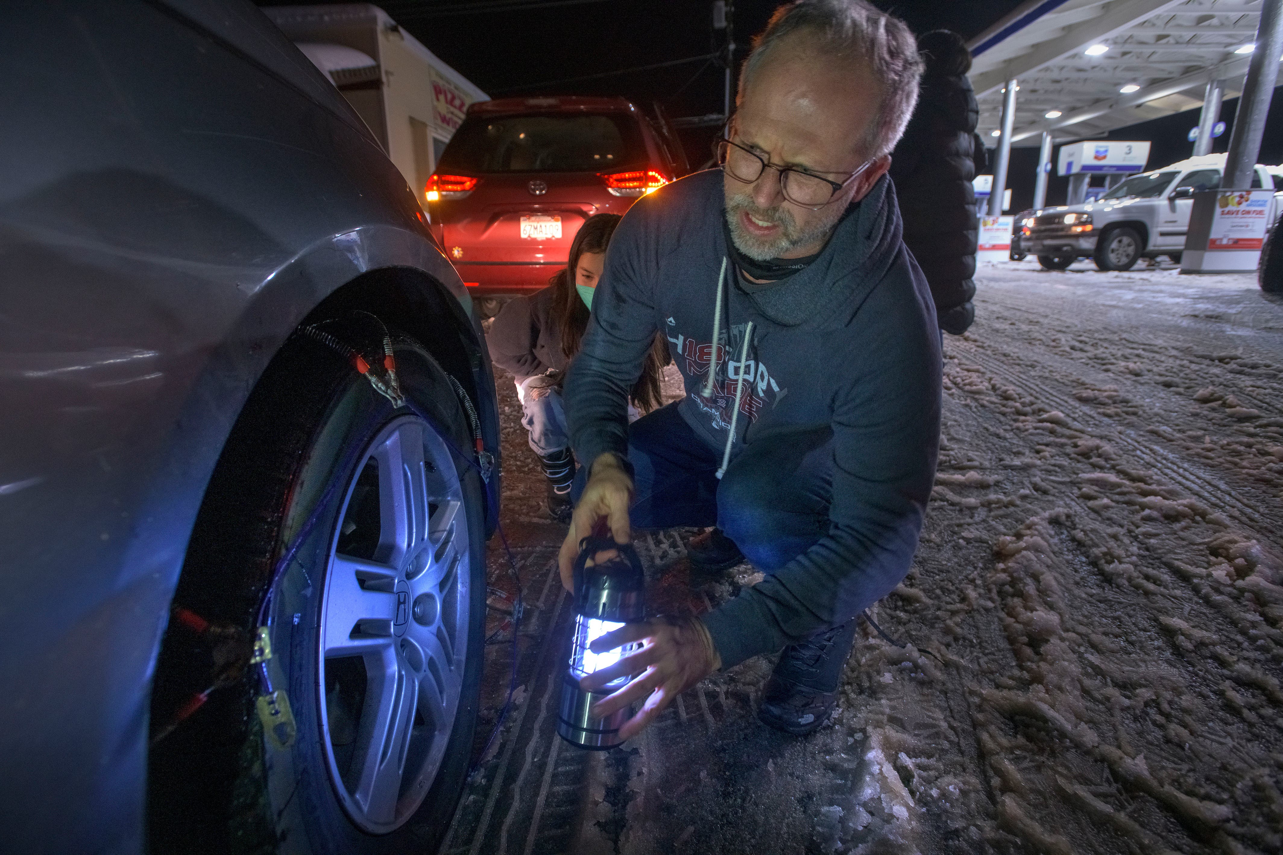
An avalanche blocked a state route that connects Tahoe City to some ski resorts in Olympic Valley and authorities urged motorists to avoid nonessential travel, the AP reported.
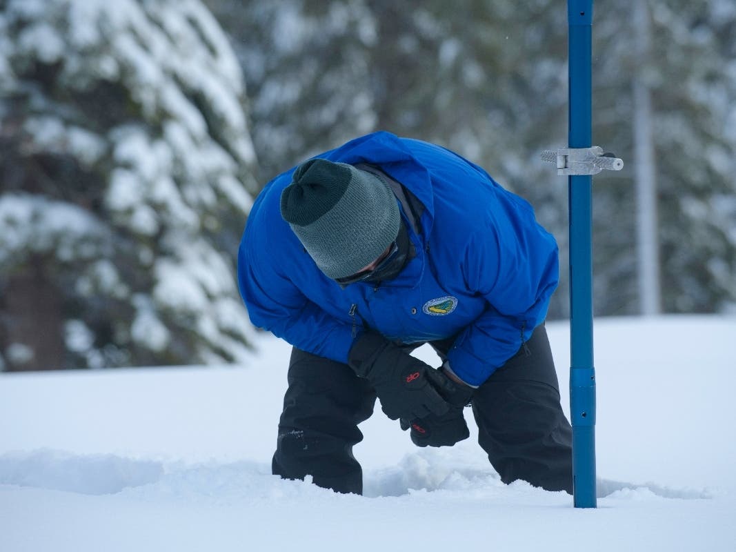
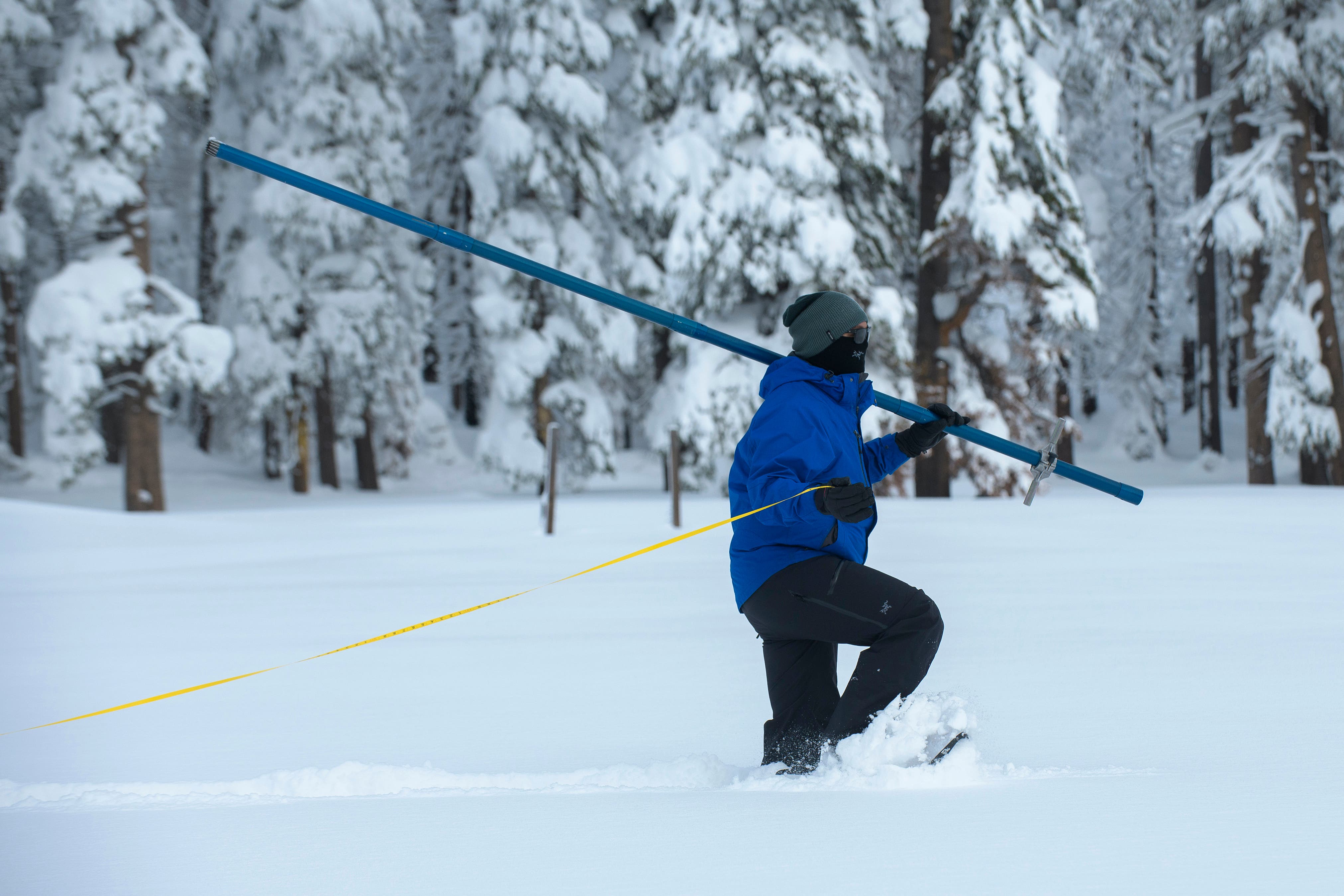
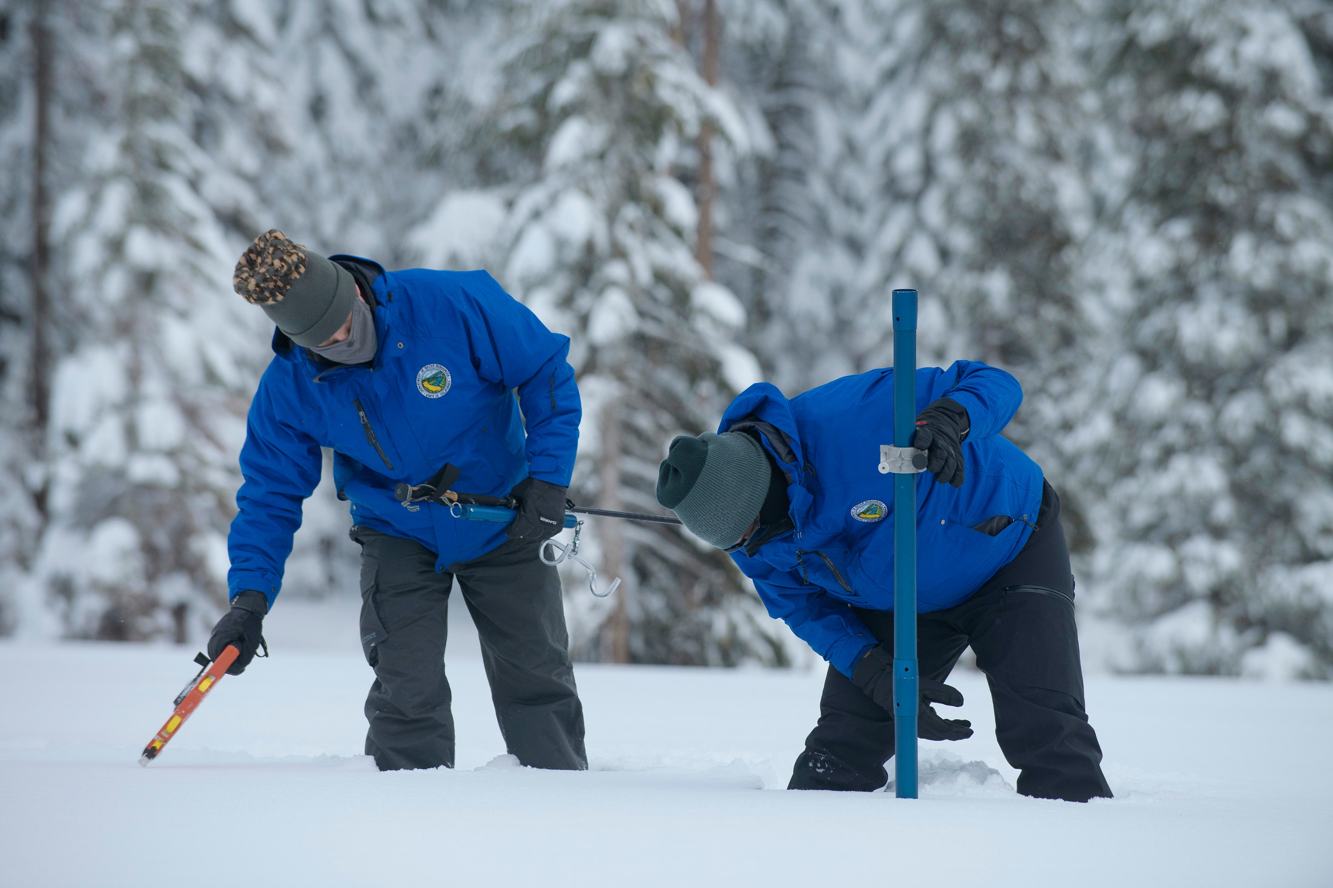
According to an Associated Press report, officials with the University of California, Berkeley’s Central Sierra Snow Laboratory said recent snowfall eclipsed the snowiest December ever.
Weather observers say the previous record of 179 inches set in 1970 fell and is now 193.7 inches.
More snow is expected.
Further south, torrential rain caused roadway havoc and evacuations.
In Orange County, evacuations were mandatory for residents in the Silverado, Williams and Modjeska canyon areas in the Bond Fire burn areas faced mudslides amid torrential downpours.
Forecasters were also warning residents that travel in the Sierra Nevada might be difficult for the foreseeable future.
SEE ALSO:
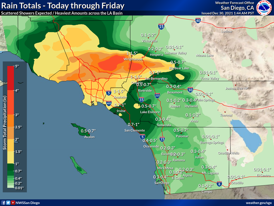
More wet and cold weather was expected in Southland communities through Friday.
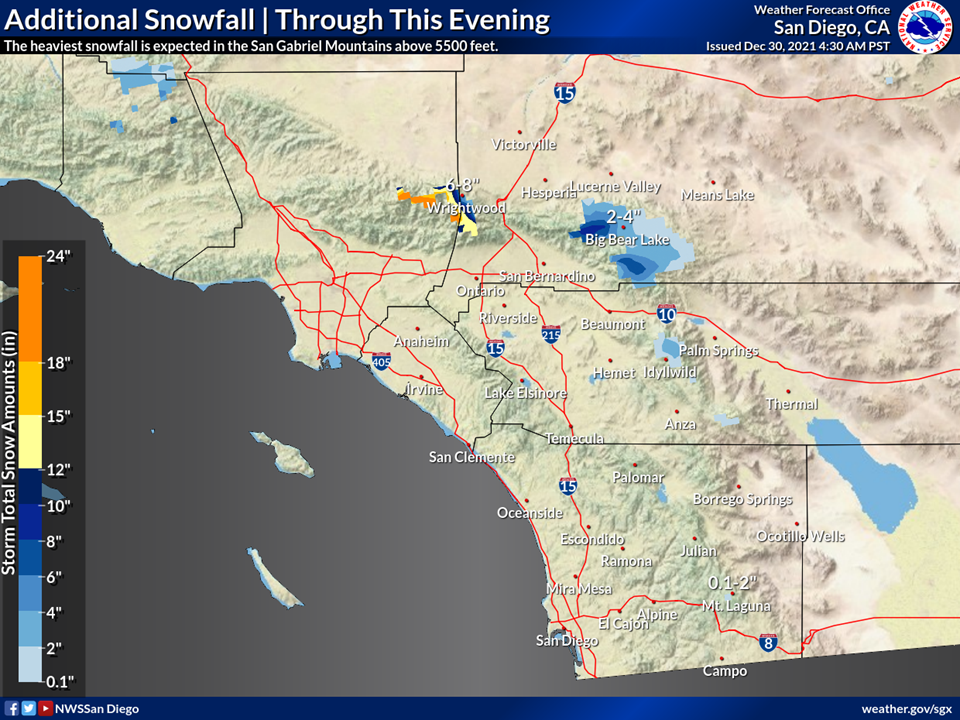
Snow was expected to continue through Thursday evening.
In the Bay Area, the storm appears to have done the bulk of its work, but now residents can expect to see some king tides in the days ahead.
The new year will usher in a return of the King Tides to the #BayArea The astronomically driven event will make for higher high tides (morning) and lower low tides (afternoon). Localized flooding will be possible for low lying areas.#CAwx #kingTides pic.twitter.com/LBCV3YJDZV
— NWS Bay Area (@NWSBayArea) December 30, 2021
The Associated Press contributed to this post.
Get more local news delivered straight to your inbox. Sign up for free Patch newsletters and alerts.