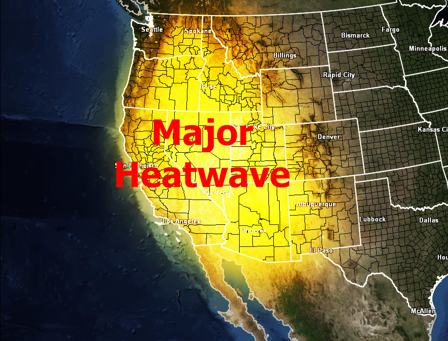
A major heatwave is going to strike Southern California at the end of this week, into early July, which will bring temperatures will over 100F in the pass zones and over 115-120 in the desert zones, with records being challenged region-wide.
A tropical system in Mexico will eject westward, which should setup the stage for the four corners ridge to finally develop. As it does so, the ridge will shove west directly over Southern California, which will heat up there area very quickly starting Thursday of this next week and lasting a week there-after.
There are indications that this could be accompanies by monsoonal moisture, which may spark a chance of showers and thunderstorms across the region, depending on how deep the moisture profiles are going to be.
Find out what's happening in Banning-Beaumontfor free with the latest updates from Patch.
At current studies, monsoonal moisture will not be too thick, mainly staying above 14,000 feet. So high-based activity looks to be it right now unless the developing tropical system south of here ejects more moisture into play.
This is still very far away … however this is the first major heatwave of Summer 2013 and residents who are sensitive to the heat must be aware of the coming event.
Find out what's happening in Banning-Beaumontfor free with the latest updates from Patch.
SCWXA will be issuing weather alerts as this event comes closer. Due to the dry lightning potential, dry atmosphere in the low levels, and heat, a high fire danger will accompany this event.
The SCWXA Forecast Product is a specialty product issued by Southern California Weather Authority.com - Southern California's Public Choice for Weather Alerts.
For SCWXA Facebook Visit - https://www.facebook.com/SouthernCaliforniaWeatherAuthority
Get SCWXA Weather alerts via email for FREE - http://www.southerncaliforniaweatherauthority.com/e-mailed-alerts/