Weather
More Thunderstorms May Hit Pass Area As Heat (Slightly) Fades
Plus, see what heat records were recently broken around the region.

RIVERSIDE COUNTY, CA — A heat wave that began last week is expected to gradually break starting Monday and return high temperatures to under triple digits by Wednesday, according to the National Weather Service.
In the meantime, a blowing dust advisory was in effect until 5 this morning in the Coachella Valley and the San Gorgonio Pass near Banning amid winds of up to between 20 and 30 miles per hour and gusts of 35 miles per hour.
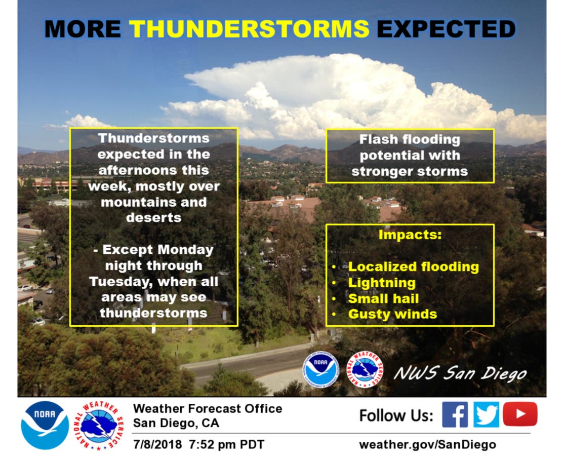
The chance of measurable precipitation Monday was 20 percent both in the Coachella Valley and the San Gorgonio Pass.
Find out what's happening in Banning-Beaumontfor free with the latest updates from Patch.
High temperatures for the metropolitan Riverside area are expected to remain in the low 100s until Wednesday with a slight chance of thunderstorms Tuesday and Wednesday, forecasters said. Monday's high in the Coachella Valley is forcast to be 105.
As for Beaumont in particular, here's what you can expect this week:
Monday Afternoon
Mostly sunny, with a high near 96. West wind 5 to 10 mph.
Find out what's happening in Banning-Beaumontfor free with the latest updates from Patch.
Monday Night
Mostly cloudy, with a low around 73. Light and variable wind becoming east 15 to 20 mph after midnight. Winds could gust as high as 30 mph.
Tuesday
A chance of showers and thunderstorms after 11am. Partly sunny, with a high near 90. East wind 5 to 10 mph becoming light and variable in the afternoon. Chance of precipitation is 30%. New rainfall amounts of less than a tenth of an inch, except higher amounts possible in thunderstorms.
Tuesday Night
A slight chance of showers and thunderstorms before 11pm. Mostly cloudy, with a low around 69. Northwest wind around 5 mph becoming calm in the evening. Chance of precipitation is 20%.
Wednesday
A slight chance of showers and thunderstorms after 11am. Mostly sunny, with a high near 92. Light and variable wind becoming south 5 to 10 mph. Chance of precipitation is 20%.
Wednesday Night
A slight chance of showers and thunderstorms before 11pm. Partly cloudy, with a low around 69. Chance of precipitation is 20%.
Thursday
A slight chance of showers and thunderstorms after 11am. Mostly sunny, with a high near 92. Chance of precipitation is 20%.
Thursday Night
A slight chance of showers and thunderstorms before 11pm. Partly cloudy, with a low around 69.
Friday
Mostly sunny, with a high near 93.
Friday Night
Partly cloudy, with a low around 68.

RECORD-BREAKING HEAT
Riverside broke its record for warmest low temperature Saturday with 82 degrees, two degrees higher than the previous record set in 2007.
The highest low temperature Sunday in Riverside was 75 degrees, also a record for that date.
The NWS issued a heat advisory for the metropolitan Riverside area for the past three days, with the last warning ending at 9 p.m. Sunday.
Riverside also set record high temperatures Friday and Saturday with the mercury topping out at 113 over the weekend.
The heat wave resulted in various blackouts throughout Los Angeles, which crews are still working to restore.
Southern California Edison Monday reported that 327 customers in Riverside County were without power.
Increased moisture and clouds could result in a slight chance for thunderstorms Monday, Tuesday and Wednesday.
Live Oak Canyon and Pinyon Pines each received more than .15 inches of rain as of 8 p.m. Sunday, according to the NWS.
High winds in Thermal and Palm Springs are expected to result in reduced visibility and poor air quality Monday morning.
— City News Service contributed to this report / Image via Shutterstock
Get more local news delivered straight to your inbox. Sign up for free Patch newsletters and alerts.