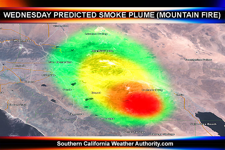
For a couple days the smoke plume of the Mountain Fire has been east of the area, over areas of Palm Springs to the Morongo Basin. However, this plume is set to change direction.
The upper level atmosphere suggests the winds will switch from south to north to southeast to northwest over the Banning Pass today. This will bring the ash cloud over the area.
The Mountain Fire is expected to maintain this general upper level pattern for the next several days as the flow becomes monsoonal and moisture + showers and thunderstorms come into play toward end week into the weekend.
SCWXA Air Quality Alerts remain in effect for the pass area
The SCWXA Forecast Product is a specialty product issued by Southern California Weather Authority.com - Southern California's Public Choice for Weather Alerts.
For SCWXA Facebook Visit - https://www.facebook.com/SouthernCaliforniaWeatherAuthority
Find out what's happening in Banning-Beaumontfor free with the latest updates from Patch.
Get SCWXA Weather alerts via email for FREE - http://www.southerncaliforniaweatherauthority.com/e-mailed-alerts/