Weather
Before & After Photos Show CA's Snowpack, Reservoirs After Storms
Satellite images show the impact winter storms had on California's snowpack and reservoirs. Is it enough to keep drought conditions at bay?


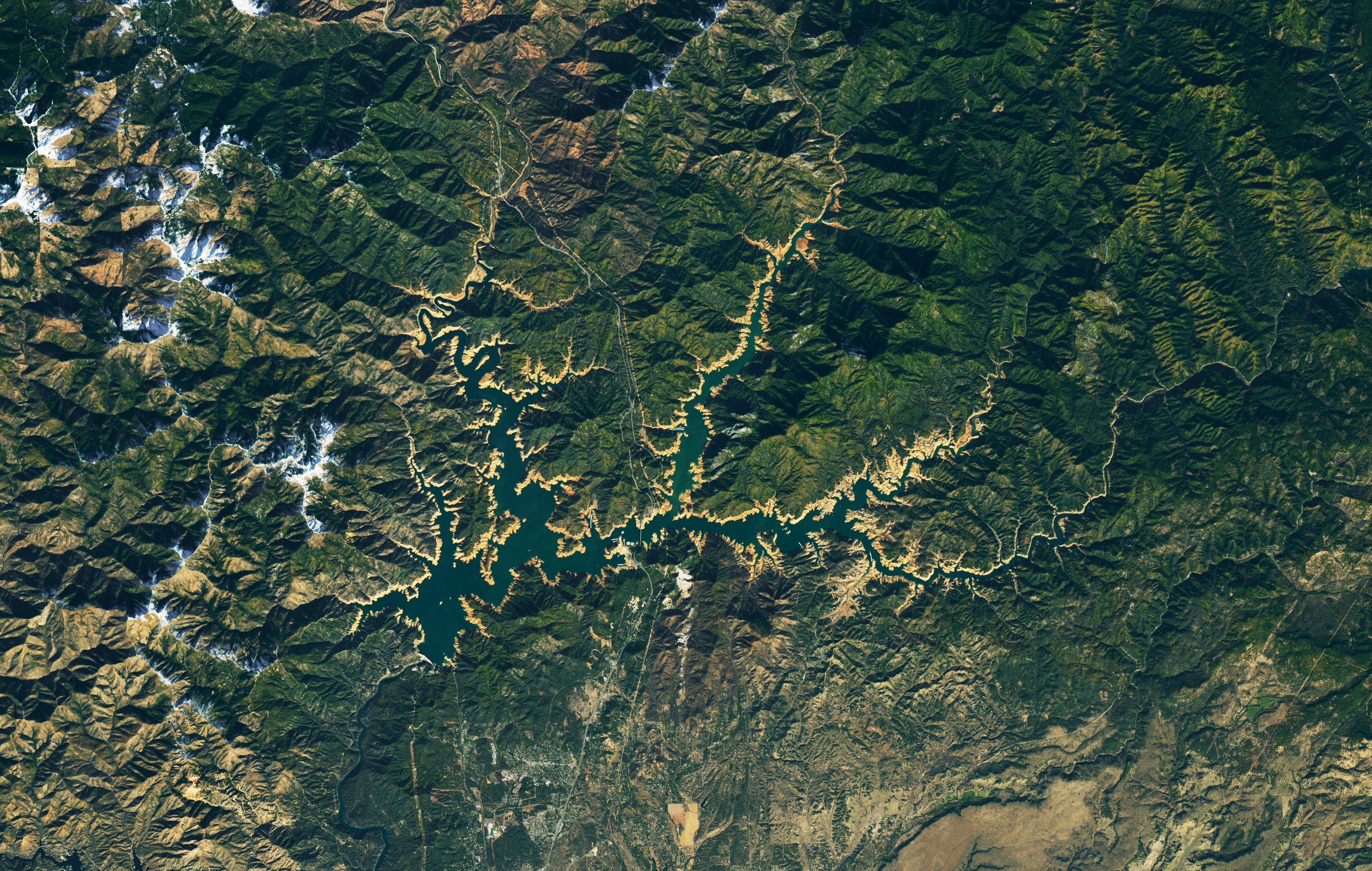
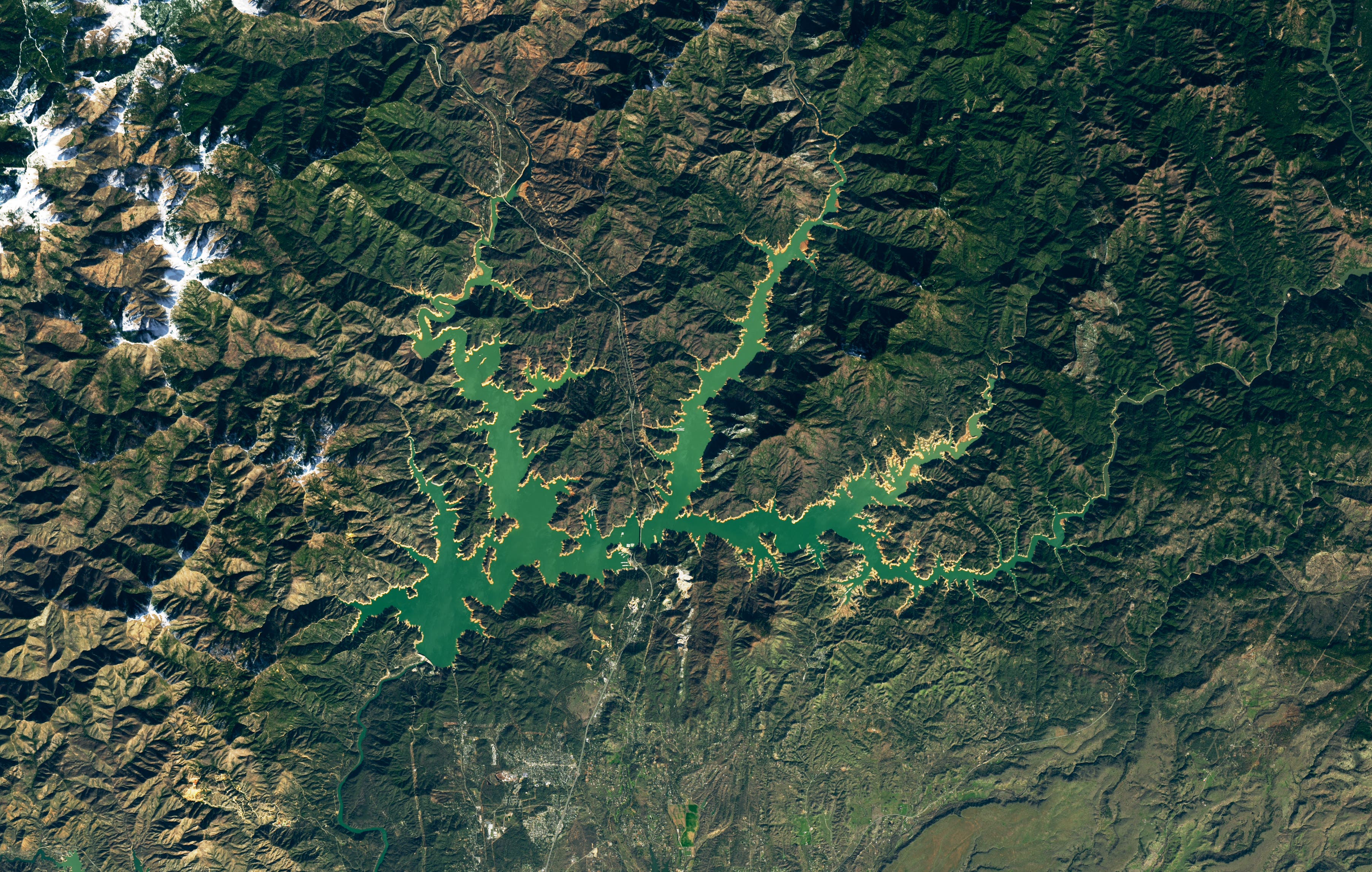
CALIFORNIA — California's reservoir and snowpack levels have transformed over one of the wettest winters in recent history, as photos from NASA's Earth Observatory satellite photographs show.
These comparative pictures say a thousand words about the rising water levels in the reservoirs, but the water table beneath the ground remains depleted after a decades-long groundwater decline, experts from the Earth Observatory said.
Lake Oroville and Lake Shasta, both in northern California, are two of the largest reservoirs in California and both have received nearly enough rain to fill them. Still, a telltale 'bathtub ring' painted over the sandstone edges show there is more room remaining even after record rains.
Find out what's happening in Banning-Beaumontfor free with the latest updates from Patch.
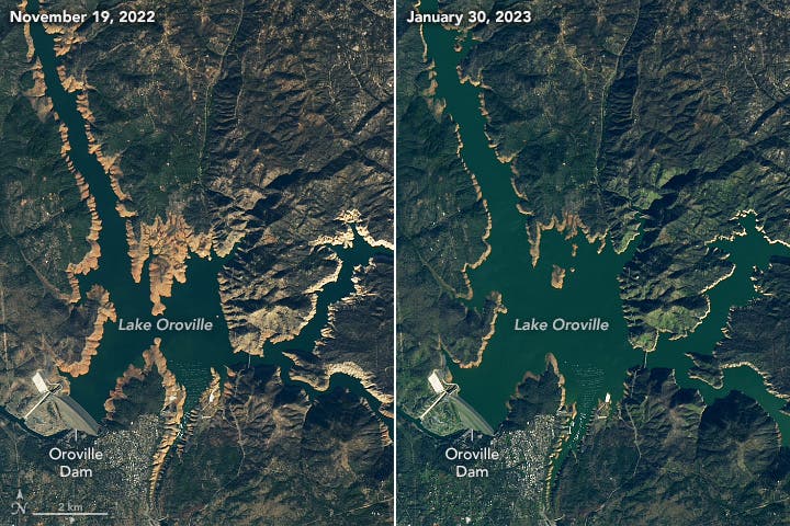
Lake Oroville has filled significantly since November, the satellite pictures show. Side-by-side photographs of lakes and mountains show vast differences in the waterline.

Though the photos from space show Lake Shasta looking near-to brimming, the lake remains about 70 feet shy of total capacity.
Find out what's happening in Banning-Beaumontfor free with the latest updates from Patch.
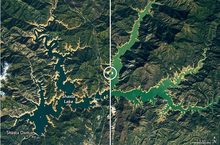
Lake Shasta is also still registering as "under-full," with a current lake level of 996.71 feet.
"The abundant water is expected to recharge the groundwater in the next few months, as we have seen during similar events in 2011 and 2017," Liu said. "However, if the climate pattern is the same as before—dry and hot in summer followed by low precipitation—and the water demands are still high, then we expect the groundwater drawdown will continue."
As of Friday, California's reservoirs were at 96 percent of average levels, according to reports from California Water Watch. Though close, they are still not at capacity after a prolonged drought.
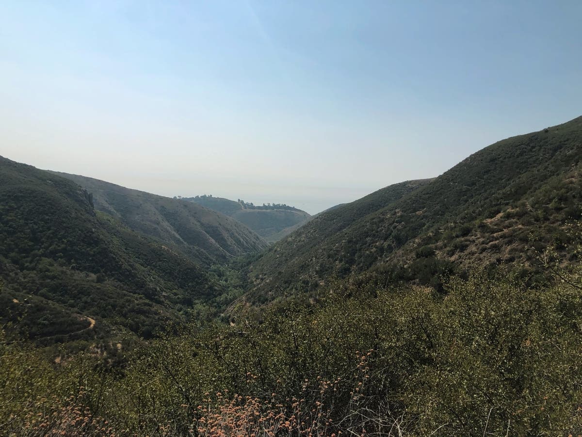
The NASA Earth Observatory satellite also captured photographs of southern California mountains before and after the late February storms smothered the mountains in snow.

The late February and early March storms that included blizzard conditions for some added even more snow to the beleaguered mountain communities but have been a boon for building the state's snowpack.
As residents dig themselves out of record snow, March rains were expected to tap into the atmospheric river system, fed by tropical moisture, according to the National Weather Service. Warmer storms could cause rapid snowmelt and create further problems, according to the National Weather Service, Oxnard branch.

Though it is too soon to tell how stormy the remainder of winter will be, the National Oceanic and Atmospheric Administration's Climate Prediction Center said there will be above-normal rain across California into March.
"If we were to get heavy rain with a warm system and a lot of tropical moisture feeding into it, that would melt all of the snow that just fell in the mountains," said David Sweet, a meteorologist with the National Weather Service in Oxnard told the LA Times in a recent report.
California is more accustomed to warmth and sun, with residents that boast of being able to surf and ski on the same day.
Even with the record snowfall, "flatlanders" are having more trouble getting up to the snow. Caltrans and California Highway Patrol closed roads due to treacherous travel conditions.
Three separate avalanches covered roads, leading California Highway Patrol to close access to Mount Baldy.
"I'm standing on about 15 feet of avalanche debris," said Mt. Baldy Resort General Manager Robby Ellingson on a walk around the property over Facebook this week. He said the staff was working hard to clear up the debris for skiers this weekend. However, as of Friday, the route to Mt. Baldy was closed with authorities saying that it will likely remain closed through the weekend.
Big Bear Mountain and Snow Summit were open for business after 10:30 a.m. and have continued to put the safety of their employees, guests, and community first. With most roads closed through Friday, the slopes were reserved for locals only.
The San Bernardino County Office of Emergency Services is coordinating efforts to get food, fuel, supplies and services up to mountain residents as crews continue work to remove snow and debris from roadways stretching from Mt. Baldy to the eastern edge of the Big Bear Valley. pic.twitter.com/uZ9Kf5Hcsw
— SBCounty (@SBCounty) March 3, 2023
The route from the Bay Area and Sacramento to Sierra ski resorts is still iffy. Highway 88 was still closed Friday afternoon. Highway 50 was open but a high wind advisory cautioned against travel for campers and trailers. Interstate 80 is open to Reno. With an epic snowpack, expect some company on the roads.
Get more local news delivered straight to your inbox. Sign up for free Patch newsletters and alerts.