Weather
Storms to Slam Banning, Beaumont Ahead of Christmas Day: NWS
Also on tap? Snow in the nearby mountains.

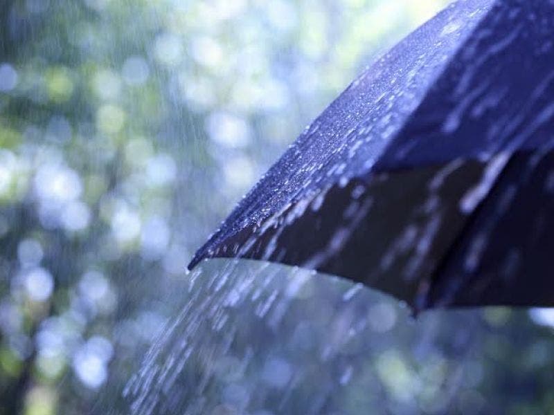
BANNING, CA – Rain is expected to return to Banning and Beaumont this week as two separate storm systems roll in off the Pacific, forecasters said Tuesday.
According to the National Weather Service, the first trough of low pressure is expected to reach the Inland Empire area Wednesday night or Thursday, producing sporadic light rain, with the heaviest showers at the higher elevations. The snow level will be above 8,000 feet.
Forecasters said the subtropical system is lacking intensity but will be followed by a stronger front originating from the northwest Friday.
Find out what's happening in Banning-Beaumontfor free with the latest updates from Patch.
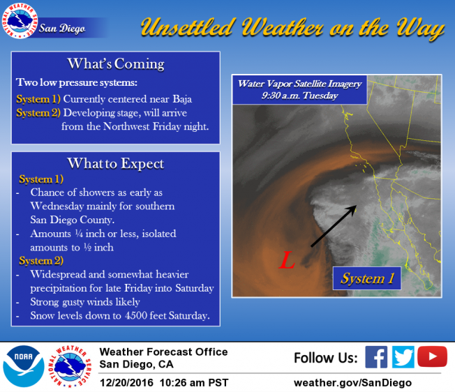
"(This) colder low pressure system ... is expected to bring more widespread and somewhat heavier precipitation for late Friday into Saturday, with the main period of significant precipitation (Saturday morning)," according to an NWS statement. "Overall, this looks like it could be a decent rain and snow producer, but fast-moving enough to minimize any flooding threat."
Here's what Banning residents can expect in the coming days, according to the National Weather Service:
Find out what's happening in Banning-Beaumontfor free with the latest updates from Patch.
Tonight
Mostly clear, with a low around 51. East wind 10 to 15 mph, with gusts as high as 20 mph.
Wednesday
A 20 percent chance of showers. Mostly sunny, with a high near 63. East wind 10 to 15 mph, with gusts as high as 30 mph.
Wednesday Night
A 20 percent chance of showers. Partly cloudy, with a low around 50. East wind around 15 mph, with gusts as high as 30 mph.
Thursday
A 40 percent chance of showers. Mostly sunny, with a high near 63. East wind 15 to 20 mph, with gusts as high as 30 mph.
Thursday Night
A 20 percent chance of showers. Partly cloudy, with a low around 50. East wind 10 to 15 mph, with gusts as high as 25 mph.
Friday
A 20 percent chance of showers. Mostly sunny, with a high near 61.
Friday Night
Showers, mainly after 10pm. Low around 45. Chance of precipitation is 80%.
Saturday
Showers, mainly before 10am. Partly sunny, with a high near 51.
Saturday Night
A chance of showers before 10pm. Partly cloudy, with a low around 40.
Christmas Day
Mostly sunny, with a high near 52.
The wet weather is predicted to dissipate by Saturday night, leaving partly cloudy skies and below normal temperatures for Christmas throughout the Inland Empire.
Temperatures in the Riverside metropolitan area on Friday will top out in the mid-60s, with lows in the upper 40s. On Saturday, the mercury will only reach about 55 degrees, with a low around 40 Saturday night, according to the Weather Service.
The agency predicted highs in the upper 60s for Palm Springs on Friday, with a low around 50. On Saturday, temps will peak in the low 60s, with lows in the upper 40s.
– City News Service contributed to this report / Image via Shutterstock
Get more local news delivered straight to your inbox. Sign up for free Patch newsletters and alerts.