Community Corner
Dixon Then and Now: The City's Ghost Creeks
Man-made waterways and pipes replaced them


Before white men came in the 1800s and began to farm and raise cattle in this area, the terrain looked quite different than it does now. Wild grass and oats, nourished by the fertile soil, grew six feet high or more. The land wasn’t flat like it is now, but undulating, and creeks ran through it like the veins in our hands. Some of them ran a long distance, from the western low mountains to the Delta, and carried water most of the year, while other streams were much shorter and more intermittent, beginning and ending out here in the plains.
These short-run streams carried water during the wet season and were dried-up gullies in the summer. In years of heavy rain and snowfall, this whole area might be under water for long periods of time since we didn’t have large reservoirs and levees to hold the water back.
Playing a hunch that one or more of these short streams passed through what is now Dixon, I researched old maps and talked to City Engineer Royce Cunningham and John Currey, head of the Dixon Resource Conservation District. I learned that, yes, the land that Dixon sits on was once bisected by two streams that have become ghost creeks, having pretty much disappeared from view.
Find out what's happening in Dixonfor free with the latest updates from Patch.
First off, let me say that due to the lay of the land, streams in this area came out of the northwest and flowed down toward the southeast and the Delta. One of the creeks running through what is now Dixon was called Dickson Creek, after the man who founded our town. It’s hard to tell exactly where its streambed began, or perhaps several streambeds combined to form it. Anyway, it crossed what is now the freeway and came into this area approximately where Starbucks is located along Ary Lane today. It then pretty much proceeded east along the path that H Street takes, taking a dip toward the southeast as it crossed what is now Adams and First streets, through where Affordable Auto Care and Jed’s Towing are now located, and then across the present-day location of the railroad tracks. Then the stream continued down through the area where Hall Park is now, and continued on toward the Delta.
A more prominent stream that mimicked the path of Dickson Creek (but to the north) was Dudley Creek. It crossed into our area near where a cattle undercrossing now goes under the freeway, near the corner of present-day North Lincoln Street and Little Lane. It headed southeast, crossing First Street at the point where Ace Hardware is now located. It eventually angled to the southeast, passing close to the end of Doyle Lane and then through the area now occupied by Dr. Timm’s veterinarian office along Pedrick Road, and beyond.
Find out what's happening in Dixonfor free with the latest updates from Patch.
Another shorter stream passed just to the southwest of present-day Dixon, crossing the present freeway near the Dixon fruit stand and the Indian restaurant. It was never given a name, but because it headed south along what is now Batavia Road, I’ll take the liberty of calling it Batavia Creek.
I’ve provided a Google map with this column on which I drew in heavy dotted lines the paths these three streams took before Dixon was founded.
You might ask what’s become of these intermittent streams. Generally, outside of town, farmers leveled the land, filling in creekbeds in the process. Later, they came to realize that in heavy rainfall years, without the drainage provided by the creeks, their fields would flood. For that reason, in our area around 1952, the Dixon Resource Conservation District was formed to arrange for straight ditches and waterways to drain water toward the Delta.
Within Dixon also, little thought was given to drainage at first, and the streambeds within the city were filled in. Still, you can see a few remnants of them. Across First Street from Ace Hardware is a long, tree-lined driveway heading east, back to a solitary home. Alongside most of its length is the old Dudley Creek streambed as a gully. Maybe it should be put on the Dixon’s list of historical preservation sites!
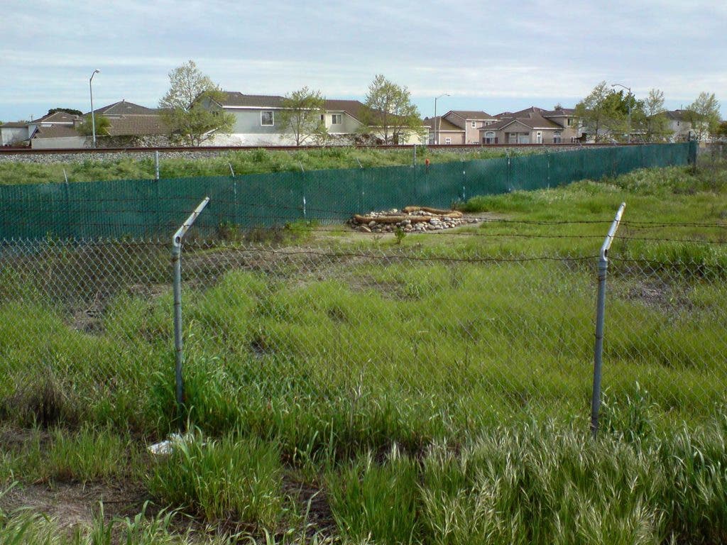
To the south, a bit of the Dickson Creek streambed is preserved east of the railroad tracks along North Second Street, between La Esperanza Drive and West Creekside Circle. If you look over a fence from a gravelly area there, you’ll see what the city calls Esperanza pond – a water retention pond designed to help contain floodwaters.
As for my newly named Batavia Creek, if you drive west on A Street to the west side of the freeway where A St. becomes Dixon Ave. West, where an orchard transitions to an open field, you can spot a low section on the north side of the road where the creek passed through. If you look at a Google satellite map image of that spot in close-up, you can easily see a faint trace of the old stream in the open field.
Today in Dixon, a network of underground pipes has replaced the drainage capabilities of the old streams. Back when environmental laws weren’t so strict, say before the 1970s, city property owners would fill in streambeds and install their own pipes to underground the streams, and many of those pipes continue being used today, in various states of repair (or they may be too small). But most of the storm water drainage is accomplished by a city-owned, piped, water-drainage system.
The city (and developers and businesses) have also built a series of large water-retention ponds to store rainwater for gradual release. Some are used every year, such as the city’s large pond near the corner of Porter and Pitt School roads (and southwest of Parkway Blvd.). Others, such as most of Dixon’s largest park, Northwest Park, are for use during water emergencies when the amount of rainfall can’t be handled by the underground pipes. Northwest Park is located adjacent to the now-filled-in Dickson Creek streambed. Also, city streets themselves can serve as waterways during flooding conditions. It should be recognized that cities create water runoff problems because the area within them is prevented from soaking up rainfall by paved streets and parking lots, roofs, sidewalks and driveways. This results in more and faster water runoff and higher peak rainwater surges.
Because Dixon lies in the path of water runoff from fields across the freeway, the city’s rainwater drainage system has to be able to pass through this water as well. For that reason, the Dixon Resource Conservation System (which handles rural drainage) works closely with the city.
Areas of Dixon prone to flooding during extreme “events” (so-called 10- and 100-year events) are the extreme southern end of Almond St. and some homes along the eastern end of H St., where lawns and homes are actually lower than the adjoining street. Newer homes in Dixon, if you’ll notice, are built on land graded to be higher up than the street. Also, a photo accompanying this column shows flooding near B Street and Diane Place in 1978.
As a final note, I did a lot of walking and exploring around Dixon to research this column (see the photos accompanying this column). One of my big finds was locating the point where two large underground pipes exit the ground just to the southeast of the new high school. I’m told that these carry water generally from the old Dickson and Dudley creeks areas and that Dickson Creek once passed through nearby. Water was coming out of the pipes, and was headed down a straight man-made stream to water retention basin ‘C,’ nearby, with ducks and geese enjoying its lake.
Just minutes before, I had met a woman walking in Hall Park who said she had lived nearby since 1968, when Dickson Creek still ran through the area (at least during the wet season). She said her sons used to cross a plank across the stream to get to little league practice, and would catch pollywogs there for fun. I’m afraid, though, that Dixon’s Tom Sawyer days are over.