Weather
As We Head Into Fall, East Palo Alto Temperatures To Rise
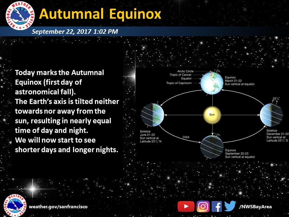
It's officially the first day of Fall, but the weather might not know that yet.

EAST PALO ALTO, CA — Though Friday may be the first day of the Fall season, the local temperatures are expected to rise for the next few days around the Bay Area. We'll also start seeing longer nights and shorter days.
"A gradual warming trend will begin today as the upper level trough shifts east and high pressure builds over the Eastern Pacific," the National Weather Service said Friday in their forecast discussion for the region. "As the region transitions to a warmer pattern temperatures will approach seasonal norms still maintaining moderately breezy conditions.
"Significantly warmer temperatures are forecast for the weekend and into early next week," the agency said.
Find out what's happening in East Palo Altofor free with the latest updates from Patch.
Here's the NWS forecast for East Palo Alto for the coming days:
Friday
Sunny, with a high near 72. North northwest wind 6 to 11 mph.
Find out what's happening in East Palo Altofor free with the latest updates from Patch.
Friday Night
Mostly clear, with a low around 53. Northwest wind 8 to 13 mph becoming light west in the evening.
Saturday
Sunny, with a high near 77. Light west wind becoming north northwest 9 to 14 mph in the morning. Winds could gust as high as 18 mph.
Saturday Night
Clear, with a low around 53. West northwest wind 5 to 14 mph becoming northeast in the evening. Winds could gust as high as 18 mph.
Sunday
Sunny, with a high near 81. Light north wind becoming northwest 10 to 15 mph in the afternoon. Winds could gust as high as 20 mph.
Sunday Night
Mostly clear, with a low around 56.
Monday
Sunny, with a high near 84.
Monday Night
Mostly clear, with a low around 59.
Image via Pixabay
Get more local news delivered straight to your inbox. Sign up for free Patch newsletters and alerts.