Community Corner
Doheny Ocean Desalination: Did SCWD Hit A Wall Drilling Test Wells?
California State Parks & South Coast Water District Both Rebuff A Recent Public Record Act Request, Refuse To Divulge Critical Project Info


Clean Water Now's CPRA Request For The Doheny Ocean Desalination Project (DODP) Hits A Wall
My NGO received recon information early this year that made us suspicious, thus we became the "seekers": Get confirmed, denied or acquire some inkling, an explanation of what went amiss at the 2 test wells drilled by SCWD in January and February on the proposed permanent site, within the campgrounds near the creek mouth.
SCWD and the California State Parks (CSP) attorney invoked statues and whatnot, rejecting our request for communications, work logs, reports, etc. Hiding behind in-progress negotiation barriers, attorney-client, attorney product and/or proprietary rights is ridiculous, that's their common excuse right now.
Find out what's happening in Laguna Niguel-Dana Pointfor free with the latest updates from Patch.
Some of the word-smithing by SCWD is laughably convoluted and contradictory: "Therefore, at this stage of the negotiations, the public's interest in non-disclosure of the records exceed the public's interest in disclosure." (See SCWD & CDSP letters in slideshow)
In one fell swoop SCWD and CSP have violated the spirit, the intent of both the Brown Act and Public Records Acts respectively but not respectfully:
Find out what's happening in Laguna Niguel-Dana Pointfor free with the latest updates from Patch.
“The people of this State do not yield their sovereignty to the agencies which serve them. The people, in delegating authority, do not give their public servants the right to decide what is good for the people to know and what is not good for them to know. The people insist on remaining informed so that they may retain control over the instruments they have created.” The Brown Act (1953)
Rumor was that SCWD had to pull the plug before they'd proven the locations and sub-surface conditions workable. They must have hit a wall, at least some kind of obstructing barrier, surprise impediment or inhibiting anomaly? [1]
Literally, something blocking their ability to drill as far out and as deeply as they originally proposed without a great deal of effort. Something their hydrogeological assessments hadn't predicted, but a significant hurdle if they want to proceed with campground installations for the full scale, multi-snouted well arrays. (See slideshow)
One well was to be for monitoring groundwater, the other a fully operational slant well out about 2-3 times the length and quite deeper than the pilot/demo project over 15 years ago. That well, on the day use side of DoHo, only extended a few hundred feet, to about the low tide mark. (See slideshow above)
And like SCWD, we can only assume that in cooperation/coordination to get their alibis straight with CSP, CWN has also hit a veritable investigation wall. Both agencies are locked in negotiations over campground dislocation compensation/mitigations and are refusing to divulge what's gone awry.
Most likely, SCWD bumped into a segment of the alluvial fan at the creek mouth. Basically deltas, they are a result of the deposition of sediment (sand, gravel, clay, heavy metals, etc.) which over many millennia compact themselves, layer-by-layer, a lot due to the stress of sheer weight.
Sandstone bluff erosion adds to the depositional sum. Water (a compaction accelerator) coupled with the area's historical seismic activity amplify the compaction rate and have created the present density, tamp the sediment down.
The weight of subsequent peak rainy event, heavy, slurry-like sediment deposition over tens of thousands of years eventually created a membrane more dense than just common beach sand. And nearly impervious.
There's a plentitude of historical, geological evidence regarding major seismic events, one recorded by the missionaries in what is now San Juan Capistrano. So the vibrations literally amplified compaction, modern construction machines you see every day mime that tamping down.
Triangular or pyramid-shaped, the discharge in the lagoon being the apex, the depositions would have spread out accordingly. Which SCWD, their consultants and vendors should have known was probable, shouldn't they?
Whether they hit self-compacted alluvium, rubble (loosely compacted fields of rocks and debris), a "paleo fan" or a distinct pocket much more dense than they anticipated which might even be solid rock, apparently the public has no right or need to know.
Once Doheny State Park & Beach was built (including the jetties), the depositions after ≈ 1968 when dredging began after said jetties and the breakwater were completed, peak flood events would have started the basic discharge composition shifting downcoast towards San Clemente.
And were these desalination people blind? Hey dude, ever see or hear of "Boneyard" right there under your academic noses? It's Doheny State Beach’s famous northernmost reef section in front of the day use side of the creek mouth.
It earned its nickname because of its shallow, rocky ledges where waves can surge and break sharply. Go look yourselves at extreme low tides, something that perhaps eluded these proponents.....makes you wonder what else they overlooked.
Review the graphics in my slide show and/or the Pollyanna propaganda in studies, reports and updates attendant to this crapshoot, and a picture emerges in spite of Municipal Water District of Orange County (MWDOC), Metropolitan Water District of Southern California (MET) and SCWD kool-aid pouring contest.
By the graphics and hydrogeological analyses submitted by SCWD, the various jurisdictional agencies like the San Diego Regional Water Quality Control Board (SDRWQCB), California Coastal Commission (CCC), California State Lands Commission (CSLC), fiduciary ones that had regulatory oversight powers, were led to believe they'd be drilling through a little surface silt but dominantly sand.
It should be noted that none, exactly none of these agencies had staff that could analyze these Pollyanna site conditions or the technology itself. Staff report documents admitted it, reflect that inability, lack of peer review/institutional capacity but it seemed slant wells being sub-surface, out of view, created some kind of new platinum standard.
Solely focused on below-surface and minor intrusion, less visibility, supposedly less invasive, everyone, including NGOs besides CWN, praised it because compared to open intake systems like The Poseidon Adventure (a disaster) in Huntington Beach, little if any threat, any damage to marine life biota was anticipated.
CWN was leery, skeptical from the start over 15 years ago when after a few years of conceptual gatherings and minimal permits, MWDOC set up shop for the test slant well on the day use side of DoHo. (See slideshow above).
SCWD and its cohorts have had no trouble with bragging about their acquisition of millions in public/taxpayer funds, not to mention the millions scarfed from their ratepayers.
Yet those who've paid for it thus far (taxpayers), including ratepayers who are the SCWD Board's bosses, have no right to see what's going on behind the blue curtain?
If you believed "The Final Summary Report: Doheny Ocean Desalination Project Phase 3 Investigation" published by MWDOC in January 2014, it included a prospectus regarding "Full Scale Project Conceptual Assessment." [2]
This is what they mean in clichés like "the Devil's in the details," in this case rife with confirmation biases. MWDOC launched this project conceptually over 20 years ago at a meeting several CWN Board members attended.
MWDOC refuses to admit that it might have been wrong, their recent return to the fold (they dropped out 10 years ago) and support a function of PR optics.
SCWD took sole control of the wheel said 10 years ago and refuses to turn this Krazy Klown Kar around (reconsider conventional, tried and true vertical instead of experimental slant wells) or at least be more forthcoming that its original schedule is sooooo out the window of "we'll be online by...." projections made publicly.
Costs have skyrocketed by tens of millions, it's slowed down to a crawl post-Final EIR (5 years ago), and SCWD keeps moving the goal posts and goal line (deadline deliverables). In fact the benchmarks proffered 5 years ago are in such disarray, no longer viable/obtainable, as to have become extinct (paleo) themselves.
Perhaps more important for all of those affected financially in some way, their money used, this thing was penciled out in 2014 to be about a 14 million gallon a day (mgd) production plant. It needed to draft ≈ 30 mid to produce that amount of drinking water as most desalination doesn't quite make the 50% recovery rate as advertised.
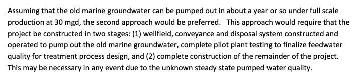
Terming the historical remnants "old marine groundwater," or the fan-tabulous "paleo-channel" eventually coined by SCWD vendors, another fabrication emerges: SCWD alleged that pumping the paleo (and surrounding future well-field) clear of residual contaminants before going into full production (most notably iron and manganese in high concentrations) wasn't a big deal.
But hold the phone Mabel: SCWD has lowered it sights, its goals: The DODP was downsized to a 5 mgd production (around a 11-12 mgd pumping schedule) and yet refuses to admit that (do the math) it might take 2 1/2-3 years to clear the proposed well-field.
SCWD claims 1 year to 18 months duration in its documents for the downsized 5 mgd, and to repeat its importance, ALL of the oversight regulatory and public trust agencies accepted the MWDOC/SCWD science without challenge.
By reducing the production so much (1/3 of the original), they loose economy of scale, i.e., the delivered product cost would rise. Ever see SCWD mention that?
Ocean slant wells being a bright shiny new toy, nowhere is there a cluster or array of them along the Pacific coast online and producing in quantity. The usual complainers, desalination's myopic critics, were mostly hardened veterans from The Poseidon Adventure.
They felt that as long as the drafting device wasn't an open ocean intake, why worry, what could go wrong? Yet here it is, stalled again.
And to remind stakeholders, if the hydrogeological projections and the technical modeling validity are in jeopardy, keep in mind that the owner of the slant well patents was and still is SCWD's #1 consultant regarding San Juan Creek groundwater, upstream sea water intrusion challenges and the DODP too.
Despite CWN objections due to obvious conflict of interest, SCWD ignores that justifiable suspicion, that allegation
"In early September of 2021, then President of SCWD, Rick Erkeneff, drew a line in the sand, categorically, emphatically stated that by its first BOD meeting in May of 2022: The public could rely upon them. The District would announce whether it would have partners or go it alone.
Well, Mr. President, we're waiting, you're 3 months past that binary "Go/No Go" declaration." [3]
Two years post May 2022 and WTF are we? Where are the partners, huh? SCWD drops names but has yet to get a signed, purchase agreement contract with discrete delivered supply costs.
I'm guessing they can't now because a significant glitch, an element of uncertainty due to the campground expedition has literally and figuratively gone south. Time out. Again.
Has it occurred to the people funding or acting as cheerleaders for the DODP that those who dropped out 10 years ago, or those hesitant to commit now, have "grokked" (figured out) that SCWD's strategy is not what it purports to be, nor is the project itself?
That all of that financial stewardship and transparency braggadocio is just that: A pile of horse pucky. Perhaps there's no contract with CSP because now the campground site could be a loser, not viable.
“Leadership is not a rank or position to be obtained….it is a service to be given.” (Simon Sinek). The Board of SCWD aren't exactly telegraphing their understanding of this aspect of leadership. They must think that the public serves them, locked back in the dark ages of feudal lords and vassals.
For that matter, maybe having drowned in their own fizzy kool-aid, no Plan B, if the slant well/creek mouth scenario is kaput, SCWD has no clue as to where to go from here. [4]
It was CWN that shut the door on the day use side of the creek during CCC deliberations. We felt that if for no other reason, the years of dislocation for recreational users was abusive, socially unjust.
CWN has several outstanding questions and unresolved issues:
Was it just a coincidence that the original test well and the recent one stopped at ≈ the same distance and depth? Was the poor/unexpected "feedwater quality" part of the reason?
If there is some type of occlusion, a dead end without a workaround, that could trigger a halt/a recalibration, if so when or where are they going to tell us, i.e., what didn’t they know and when didn’t they know it?
Considering the only alternatives in the FEIR were just various (scalable) sizes of the same project, no Plan B involving an optional technology and logistics, if the test results basically kill it, what then?
What about the millions already spent, is SCWD going to return, refund or reimburse contributors to what might be SOC's version of a "train to nowhere?"
OTOH, there is good news: These public agencies definitely know how to keep a secret, so they've got that going for them.
“It is easier to fool people than it is to convince them they have been fooled.” Mark Twain
[1] https://patch.com/california/l...
https://www.lagunabeachindy.com/opinion%e2%80%a8-doheny-ocean-desalination-a-better-plan/