Weather
Rainy, Chilly Fall Weather to Give Way to Hot, Fire Weather by Midweek
More serious weather conditions are expected to begin Tuesday afternoon when a fire weather watch will take effect lasting through Thursday.

LOS ANGELES, CA -- Southland motorists confronted wet roads Monday morning at the start of a week forecast to be marked by fire weather conditions from Tuesday afternoon through Thursday, along with sharply higher temperatures, forecasters said.
There were 142 reported crashes on Los Angeles freeways during the rainy four-hour period beginning at 2 a.m., nearly four times the number that were reported during a comparable period a week ago, when it did not rain, authorities said. On Oct. 10 from 2 to 6 a.m., there were 24 crashes on county freeways, the California Highway Patrol reported.
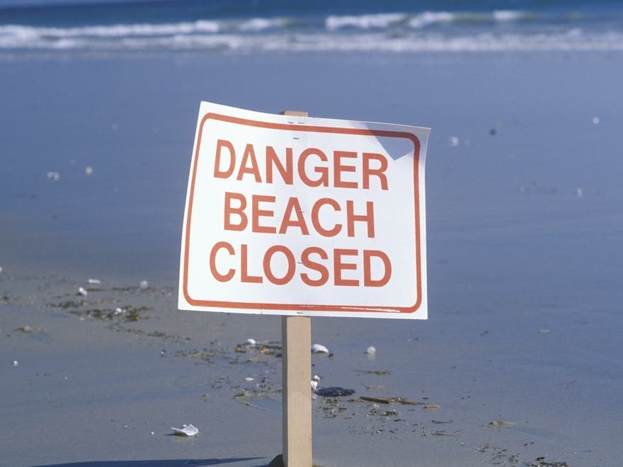
Also in force Monday in L.A. and Orange counties is a beach hazard statement -- a degree less serious than a high surf advisory -- scheduled to last through this afternoon, with surf of 4 to 6 feet battering the coast and sets of 7 feet expected.
Find out what's happening in Malibufor free with the latest updates from Patch.
"Large waves and strong rip currents will increase the risk of ocean drowning. Sneaker waves can suddenly wash people off beaches and rock jetties into the ocean," warned an NWS statement.
More serious weather conditions are expected beginning Tuesday afternoon, when a fire weather watch, which is a notch less severe than a red flag warning, will take effect, lasting through Thursday evening, according to the NWS. During that time, gusty Santa Ana winds will generate higher temperatures and bring considerable drying, with humidity levels dipping to single digits in much of the region, an NWS statement said.
Find out what's happening in Malibufor free with the latest updates from Patch.
In these conditions, "any fire ignitions will have the potential for very rapid fire spread due to the combination of critical fire weather conditions and very dry fuels," it said.
The fire weather watch will cover much of L.A. County, including in the San Gabriel and the Santa Monica mountains, forest areas, the Santa Clarita and San Fernando valleys, and the L.A. coastal zones, which includes beach cities, metropolitan L.A. and the Hollywood Hills.
In the San Gabriels and the forests covering the mountain slopes -- L.A. County's Angeles National Forest and Ventura County's Los Padres National Forest -- north winds of between 20 and 30 mph are expected, along with 50 mph gusts, although gusts of more than 60 mph are expected at Whitaker Peak in Los Angeles County. At the same time, the humidity level will sink to between 3 and 15 percent. The wind will be a little weaker in non-mountain areas.
Also expected this week is another hot spell, with highs in some valley areas reaching the mid 90s Wednesday and around 100 on Thursday, prompting meteorologist Hoxie to predict that residents are in for "quite a shock" after several cooler days.
The NWS forecast showers in L.A. County Monday and highs of 67 on Mount Wilson; 70 at LAX; 71 in Palmdale and Lancaster; 72 in San Gabriel, Burbank and Saugus; 73 in downtown L.A.; 74 in Avalon, Long Beach and Pasadena; and 75 in Woodland Hills.
A sharp rise -- 9 degrees in some communities Tuesday -- is expected Tuesday and again Wednesday and Thursday before a slow cooling trend starts Friday. Highs in Woodland Hills, for instance, are expected to be 75 Monday, 87 Tuesday, 93 Wednesday, 100 Thursday, 98 Friday, 95 Saturday and 90 Sunday. Partly cloudy skies were forecast in Orange County Monday, along with highs of 70 in San Clemente; 71 in Newport Beach; 72 in Laguna Beach and Mission Viejo; 74 in Anaheim and Irvine; and 75 in Yorba Linda and Fullerton.
Orange county temperatures are forecast to rise less sharply this week than in Los Angeles County. The warmest community, Yorba Linda, will be at 75 Monday, 80 Tuesday, 93 Wednesday, 96 Thursday, 95 Friday, 91 Saturday, and 85 Sunday.
-- City News Service, photo via Pixabay