Home & Garden
Rainfall Sets Records with More Showers Ahead
A second round of rain from a cold Alaskan storm is expected to bring snow, thunder and the threat of water spouts off the coast.

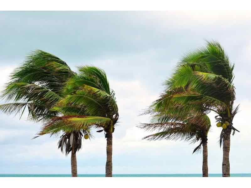
A second band of rain from a cold late-season storm will slide into the Southland this morning amid risks of waterspouts near the coast and minor mud flows over fire-denuded slopes above foothill communities, National Weather Service forecasters said.
Following an overnight lull, “showers should become more numerous from around the Malibu coastline eastward across much of southern Los Angeles County” this morning, said a statement on the website of the NWS monitoring station in Oxnard.
The statement said there is a chance of isolated thunderstorms capable of generating brief and heavy rainfall, lightning, and small hail, and of waterspouts in coastal waters, which would threaten mariners.
Find out what's happening in Manhattan Beachfor free with the latest updates from Patch.
Any heavy rainfall will create a risk of minor mud and debris flows near the sites of the Colby and Williams fires, according to the NWS.
Strong winds will once again lash the Antelope Valley today, blowing at sustained speeds of between 20 and 30 miles per hour, gusting to 45 mph and, possibly, even to 55 mph. it said. A wind advisory will be in effect in the Antelope Valley from 2 p.m. until 9 p.m.
Find out what's happening in Manhattan Beachfor free with the latest updates from Patch.
In the San Gabriel Mountains, the snow level will be between 5,000 and 6,000 feet today, creating winter-type driving conditions on higher mountain roadways, the NWS statement said.
A winter weather advisory will remain in force in the San Gabriels above 6,000 feet through early this evening.
The most rain yesterday fell on Opids Camp, traditionally the wettest place in Los Angeles County, according to the NWS. Through 6 p.m. Thursday, 1.25 inches had fallen in the previous 24 hours on the school camp in the Angeles National Forest, 3,600 feet above Pasadena in the San Gabriels.
Other rainfall leaders included the West Fork Heliport (.83 of a inch), Mount Baldy (.70), Crystal Lake (.66), Santa Anita Dam (.63), Pasadena (.57), and San Gabriel Dam and Inspiration Point (.55 each).
Rainfall records for this date were set Thursday at downtown Los Angeles (.16 of an inch, breaking the previous record of .03 set in 1902) and Los Angeles International Airport (.17, breaking the previous record of .06 set in 1962).
Today’s temperatures are expected to be in the 60s.
The storm, which originated in the Gulf of Alaska, reached the region Thursday. No rain is forecast for Saturday.
The NWS forecast highs today of 50 on Mount Wilson; 62 in Palmdale and Lancaster; 63 in San Clemente, Pasadena, Saugus and San Gabriel; 64 in Newport Beach, Laguna Beach, Mission Viejo, Avalon, Burbank and at LAX; 66 in Woodland Hills, Anaheim, Irvine and Yorba Linda; and 67 Fullerton, in Long Beach and downtown L.A.
OTHER PATCH HEADLINES
- Jury Convicts Father of Murdering Daughter, 4, by Throwing Her from Cliff
- Namaste, Batter, Batter, Batter! Sunday is Yoga Day at Dodgers Stadium
- Local Firefighters in Nepal Survive Magnitude 7.3 Quake
- LB Cop Who Killed Unarmed Teen Has History of Shooting and Heroics
- Chief Takes Fall for Mayor’s Absence at Venice Townhall
- Southbound 405 Freeway to Close Overnight in the Valley Area
- ACLU Calls for Investigation of Sexism in Hiring Movie and TV Directors
- City Delays Historic Status Vote Aimed at Protecting LA’S Oldest Norms Diner from Demolition
City News Service
Get more local news delivered straight to your inbox. Sign up for free Patch newsletters and alerts.