Politics & Government
Ballona Wetlands Project: What Will I See, and Will I Like It?
Before/After Simulations Show Extraordinary Improvement in Public Recreational Views with the State's Ballona Wetlands Restoration Project

Do you like what you see in the photos above? If so, tell our Councilman! Send an e-mail TODAY, including your name and city, to mike.bonin@lacity.org and simply state you "support approval of the State's proposed plan to restore Ballona to a full tidal wetland with improved public access." Good citizenship is easy. Just speak up and be heard.
Chapter 3.2 of the 1242-page Ballona Wetlands Restoration Project Draft EIR satisfies the state requirement to study the visual impacts of a proposed project. Even though the Ballona Wetlands Ecological Reserve Project would solely create fish and wildlife habitat, and public access trails for its enjoyment, the state must still evaluate the project’s impact to your eyes.
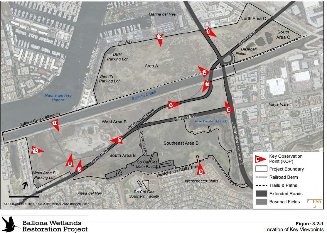
A visual impacts analysis is performed by experts in that field (indeed, it is a field of study). These experts identify viewpoints around the project area where the public will most often see the finished project. These viewpoints are called Key Observation Points, or KOPs. Twelve (12) such KOPs were studied for Ballona, and are shown on the map below from the EIR chapter entitled, Aesthetics.
Find out what's happening in Marina Del Reyfor free with the latest updates from Patch.
One of the neat things visual resources experts do is take a photograph from each KOP, and then create a simulation of what the view will look like when the project is finished. They do this by taking the grading plan, which shows precise elevations every six inches, and run the plan through a computer program. The program makes a 3-D picture of the finished landscape. The expert then rotates the 3-D picture to match the view from a KOP, and then “paints” the view with photographed existing elements that won't change (like a building), and then adds simulated surface treatments, such as concrete, blue water, or green vegetation. These experts have catalogs of very specific surface treatments. In the Ballona EIR, for example, two common surface treatments are “pickleweed saltmarsh” and “coastal shrubs”, vegetation types which will dominate the new wetlands and uplands at Ballona, respectively.
Below is a “before photo” and “after simulation” pair for KOP No. 1, which looks southeast from Lincoln Blvd. at the edge of the existing fence. In the photo you can see the Via Marina condominiums adjacent to this area, the Ballona Reserve’s “North Area C”. The simulation shows a shrub-covered knoll, which will be built from old fill dirt dug from “Area A” west of Lincoln. There will be two such knolls in this area, joined by trails that cross a blue water tidal creek extending from the Marina's existing “Fiji Ditch”.
Find out what's happening in Marina Del Reyfor free with the latest updates from Patch.
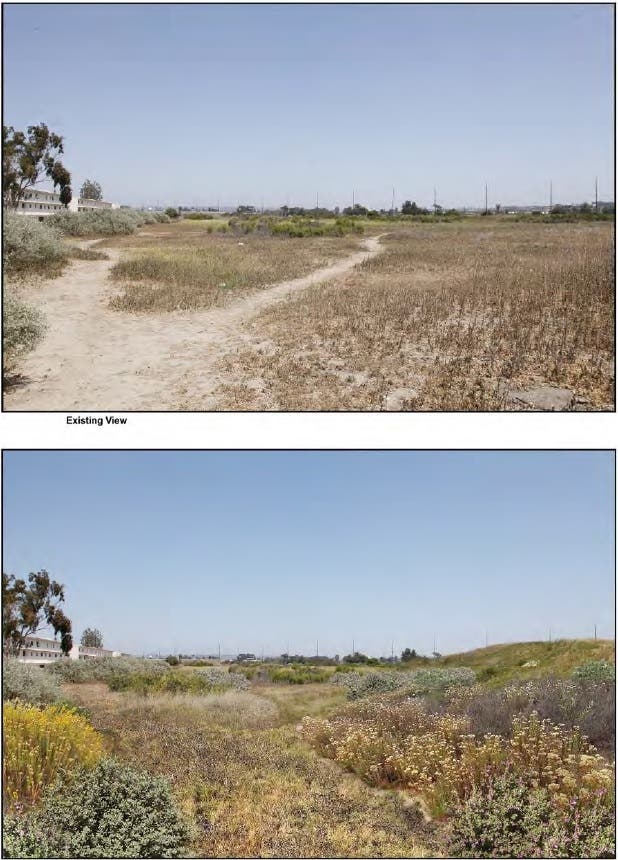
Note that the “social trails” in the first photograph are gone in the second photo-simulation. These social trails will be replaced by the network of public trails discussed in my last Patch article on Public Access. Rangers will patrol the new park land once opened to the public, to prevent social trails from reforming, remove trash, maintain fencing and benches, and ensure planted or seeded native vegetation grows quickly over the new upland areas.
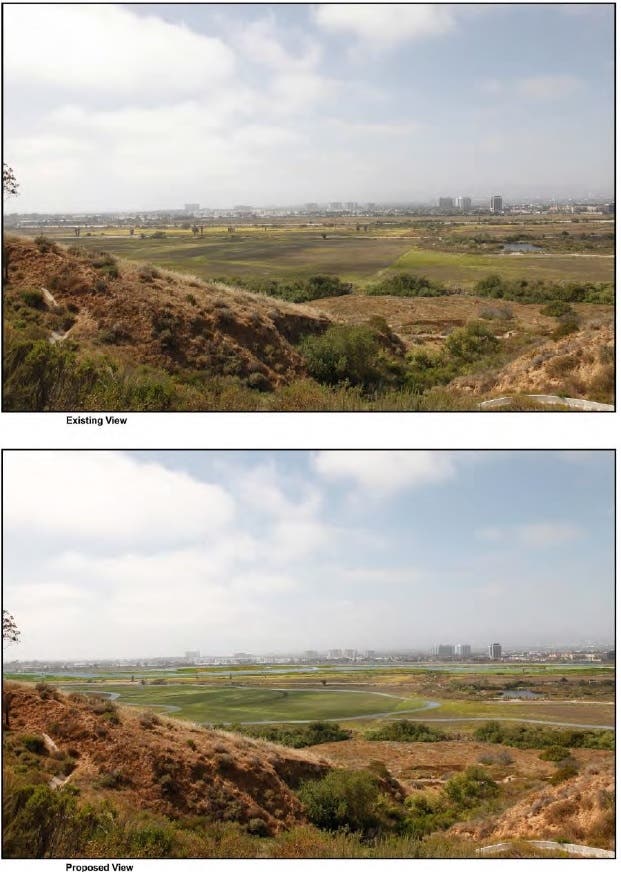
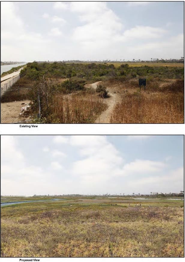
Another nice photo/simulation pair shown below is from KOP No. 2, which looks west from the existing Ballona Creek bike path, just west of Lincoln Blvd. If you’re a fan of wetlands, this simulation will make you smile. The existing trashy social trails and mostly weedy vegetation of Area A (where Marina construction dumped two million tons of dirt in the 1950s) is replaced by a new elevated boardwalk path above pickleweed saltmarsh in the mid-picture (look closely). Deeper, lush tidal wetlands are seen in the distance, replacing old fill dirt, gas wells and weeds. The old, straight concrete Ballona Creek channel is replaced by a meander (curve) and the creek banks are vegetated instead of concrete.
Browse through the Aesthetics chapter of the EIR to see ten more before/after photo and visual simulation pairs, and the expert analyses that describe them. It will give you a keen sense of “What You Will See.” Only you can decide if you “Will Like It.”
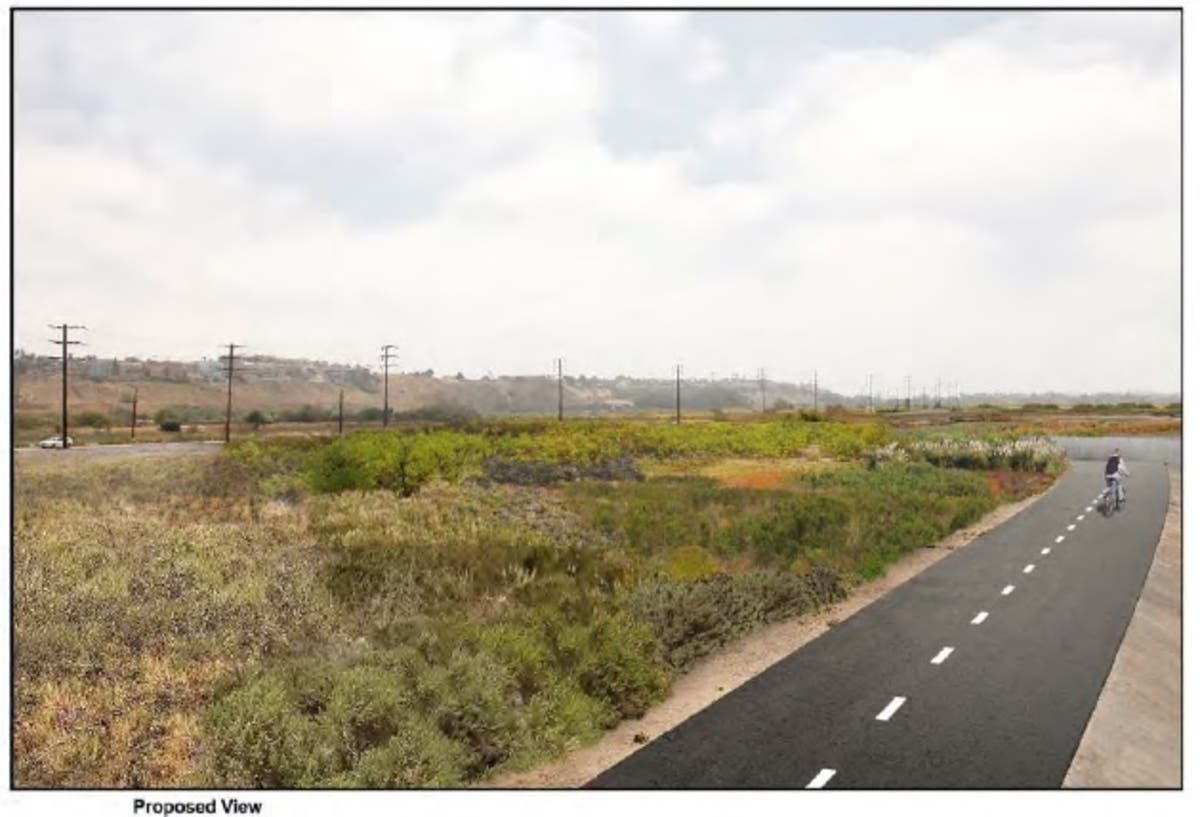
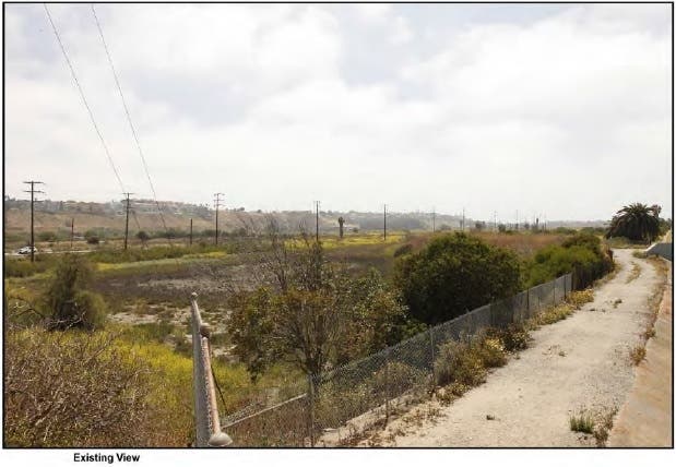
Here’s another photo/simulation pair from KOP No. 3 near Culver Blvd. Fences, concrete and weeds: Gone! New bike path and lush native coastal shrubs: Yes!
Remember, if you like this plan, you need to tell Councilman Bonin! Send an e-mail today, including your name and city, to mike.bonin@lacity.org and simply state you "support approval of the State's proposed plan to restore Ballona to a full tidal wetland with improved public access."
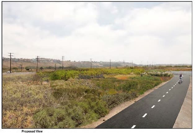
Here’s one more photo/simulation pair below, from the Playa Del Rey Bluffs. My thanks to my neighbor from the Marina, Mr. “JK”, for prompting this article. Enjoy your Ballona Wetlands!