Schools
Stanford Scientists Use Satellites To Measure Groundwater Levels
Stanford scientists have found a new way to measure water levels in underground aquifers, a significant discovery with a water crisis at hand.
Stanford scientists have found a way to "see" under the surface of agricultural regions, using satellites orbiting the Earth to monitor aquifer water levels.
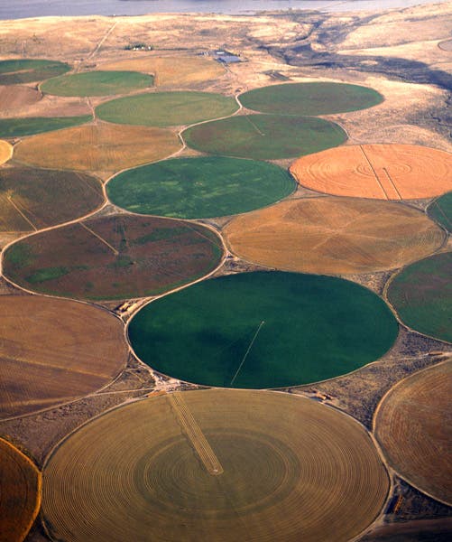
Groundwater aquifers in the American West supply agricultural irrigation systems with water. With an impending water crisis on our hands, it is now more important than ever to monitor the amount of water in these aquifers.
"Groundwater regulators are working with very little data and they are trying to manage these huge water systems based on that," said Jessica Reeves, a geophysics doctoral student. Thanks to Reeves and her colleagues' satellite-based studies, regulators now have more data with which to work.
Find out what's happening in Menlo Park-Athertonfor free with the latest updates from Patch.
Reeves presented her data last Monday at the American Geophysical Union meeting in San Francisco.
The scientists have discovered how to use existing specialized satellites to detect movements of the land as the aquifer levels rise and fall. Hydrologists can then use this information to determine how much water lies below.
Find out what's happening in Menlo Park-Athertonfor free with the latest updates from Patch.
Groundwater levels in aquifers rise and fall seasonally, depending on rainfall and melted snow. Until now, regulators had to use direct measurements from wells drilled into the aquifers, but these measurements did not represent the vast groundwater systems, as wells are few and far between.
Though satellites have been used before, they could only detect groundwater levels in barren lands like deserts. Crops, which are constantly growing, create "noise," reducing the quality of satellite images and disrupting the data.
Reeves studies the satellites' interferometric synthetic aperture radar (InSAR), a radar technique that can be used to track shape changes in the Earth's surface over time. InSAR is often used to measure how much the ground has moved after an earthquake and is a much cheaper way to measure the aquifer water levels than collecting data from wells.
Reeve's faculty advisors Rosemary Knight and Howard Zebker first collaborated on the idea and asked Reeves to join their team. Knight is a geophysicist who studies groundwater systems and Zebker a geophysicist and electrical engineer who uses satellite-based remote sensing techniques to study the Earth's surface.
The new data is so helpful to analyzing water levels that farmers could one day be required to leave a patch of land clear to allow for acute InSAR data collection.