Weather
Gusty Winds, Heavy Rain to Lash Area for Next Several Days
See the weather forecast through the weekend in Murrieta.
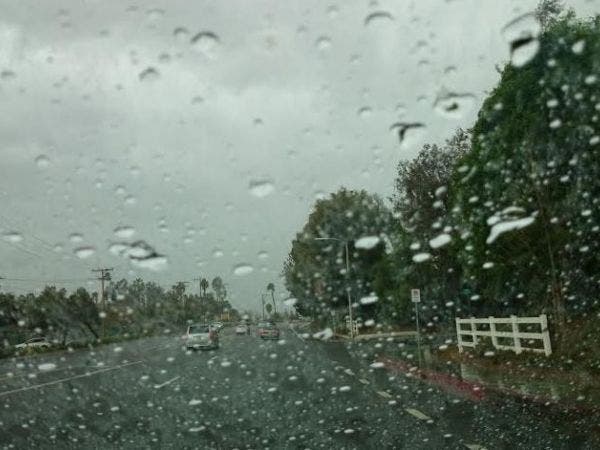
RIVERSIDE COUNTY, CA – The first in a series of Pacific storms poised to deliver torrential rain, heavy mountain snow and gusty wind to Riverside County through early next week is expected to move into the region late tonight.
A National Weather Service winter weather advisory for the mountains will be in effect from 10 p.m. Wednesday until 4 a.m. Friday, as will a wind advisory for the San Gorgonio Pass zone, which includes the cities of Banning and Desert Hot Springs.
A winter storm watch for the mountains will extend from late Thursday night through late Friday night, and a high wind watch for the San Gorgonio Pass area will run from late Thursday night though Saturday morning.
>>CLICK HERE FOR MURRIETA FORECAST<<
"After a dry day today, a series of storm systems will move through the region tonight through early Tuesday," according to the weather service. "Rain and mountain snow will be heaviest and westerly winds will be strongest Thursday morning, Friday afternoon and Sunday night, along with a slight chance of thunderstorms Thursday and Friday."
Mostly moderate rain, a slight chance of thunderstorms and an accumulation of up to 10 inches of mountain snow is expected with the first storm. A stronger storm on Friday will bring heavier rain, more snow, strong winds and further the possibility of thunderstorms.
Showers will taper off some before a third and warmer storm moves through the region Sunday night through Monday. The snow level with the third storm could fall to as low as 3,500 feet, according to the weather service.
From Thursday through Monday, the storms will drop heavy snowfall in the mountains, expected to range from 6 inches to a foot between 5,000 feet and 6,000 feet, 1 to 2 feet between 6,000 and 7,000 feet and 2 to 3 feet on higher peaks.
Preliminary data for the five-day period also indicated the storms would deliver three-quarters of an inch to 1.5 inches of rain to the Coachella Valley, 3 to 6 inches to Riverside and the surrounding valleys and 6 inches to a foot of rain in the mountains.
Along the San Gorgonio Pass, southwest to west winds of 20 to 35 miles per hour with gusts of 50 mph or higher overnight through Thursday will ramp up to 25 to 45 mph with gusts topping 65 mph Friday into Saturday morning, according to the NWS.
Forecasters warned that the heavy rain may cause flooding in rivers and along burn areas. Residents living in flood prone areas were urged to "take appropriate precautions."
"Soils will very likely be saturated by this time, so the flood threat will be greatest with this third storm," according to the weather service. "Rivers and burn areas will have to be watched closely for flooding and debris flows."
The inclement weather may also lead to hazardous travel conditions such as slick roads. Fog and blowing snow in the mountains may skew visibility along mountain roadways, according to the NWS.
Forecasters said it was unlikely that fair weather would return before Tuesday.
See video below of SR-243 at milepost 10.8. CalTrans workers and geologists remove loose boulders and debris above the mountain roadway in anticipation of a series of strong winter storms.
--City News Service/Photo courtesy Mirna Alfonso, Patch