Weather
Storms, Winds to Lash Area for Next Several Days
See the weather forecast through the weekend for Redwood City-Woodside ...
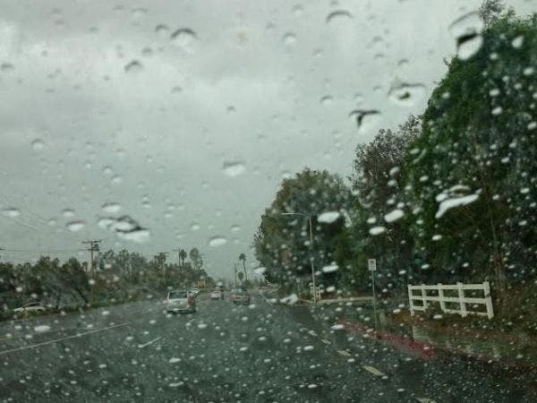
SAN MATEO COUNTY, CA – A series of storms will be moving through the Bay Area over the next several days, bringing heavy winds and more rain to an already saturated region, according to the National Weather Service.
Starting today and, with periods of respite, running through Monday, three weather systems will dump from between 1 inch and 3 inches of rain throughout the Bay Area, with the heaviest downpours expected in the
North Bay, according to forecaster Steve Anderson.
Winds from 40 mph to 50 mph will also arrive today, prompting a high wind advisory and raising the specter of more toppled trees and downed power lines.
Find out what's happening in Redwood City-Woodsidefor free with the latest updates from Patch.
The first round of rain will roll through today, picking up again on Friday and leading to a short break on Saturday, Anderson said.
On Sunday, another round of wet weather is expected to arrive and will taper off Monday afternoon, leading to mostly clear weather into the rest of next week.
Find out what's happening in Redwood City-Woodsidefor free with the latest updates from Patch.
>>CLICK HERE FOR REDWOOD CITY and WOODSIDE FORECAST<<
The dark and stormy weather has led to the closure of Muir Woods National Monument in Marin County and the continued closure of Lake Del Valle Regional Park in southeast Alameda County.
The park's main feature is a large reservoir that flooded during last week's storms and, while the waters have receded, there are still large areas inundated by debris, according to East Bay Regional Park District
spokeswoman Isa Polt-Jones.
Also, part of the Stream Trail in Oakland's Redwood Regional Park is closed due to downed trees and parts of the Iron Horse Regional Trail in Concord have been rendered off-limits because of localized flooding,
Polt-Jones said.
Anyone planning outdoor excursions over the next few days should check in with the park district's website or give them a call to make sure the areas they want to visit are still open.
"We'll be very busy, I'm sure," Polt-Jones said.
Additionally, the weather will bring the possibility of a high surf advisory on Friday and continuing though Saturday.
"Stay well back from the water," Anderson said. "There will be a lot of water flowing into the ocean, as well as a lot of debris logs and what have you in the surf zone, and that will create more hazards than normal."
The storms do have a silver lining, however, in the guise of relatively mild temperatures, Anderson said.
The overnight lows will sink into the 40s and the daytime highs will crest somewhere in the 50s.
ALSO SEE:
- Snow Report for Peninsula Residents Headed to Tahoe: Jan. 18
- Be Safe: Hazardous Coastal Conditions Coming Along With Storm
--Bay City News/Photo courtesy Mirna Alfonso/ Patch