Community Corner
Devil’s Canyon in the San Gabriel Mountains Offers Angelic Peace
This week's hike in the San Gabriels focuses on Devil's Canyon, a rarely-traveled area saddled in the middle of of the San Gabriel Mountains.


Recently, I have hiked on well-traveled trails around the Pasadena area. However, yesterday, I decided to venture into one of the most desolate and least-traveled areas of the San Gabriel Mountains: the Devil’s Canyon area of the San Gabriel Wilderness.
After an hour-long car ride, my friend Victor and I finally arrived to the parking lot for Devil’s Canyon, which is located about halfway between Newcomb’s Ranch and Three Points on the Angeles Crest Highway. My car was the only car in the parking lot; “Peace!” I declared to myself.
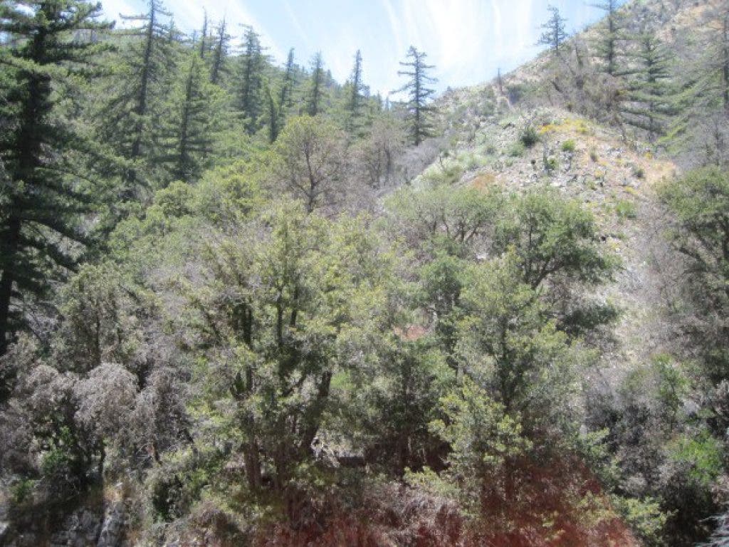
We found the trailhead across the street from the parking lot and began the gentle descent down into the canyon. The first section of the trail offered beautiful views of the beautiful San Gabriel Wilderness all the way down to the West Fork and Cogswell Reservoir areas. On the trail itself, I noticed a numerous amount of bear tracks, affirming my notion that this was certainly a lesser-traveled trail.
Find out what's happening in Sierra Madrefor free with the latest updates from Patch.
About half a mile into the hike, we noticed more and more singed trees from the Station Fire. Though this burned flora was inconsistent, it did provide some obstacles along the trail. There were a few spots where we would have to go around deadfall on the trail on our hands and knees. Nonetheless, with trekking poles and a bit of determination, these areas were easily traversed.
As Victor and I continued onward, the view overlooking the entire wilderness canopy evolved into close up views of canyons, a creek, and the forest floor, reminiscent of the Chantry Flat area. We also crossed grassy areas, not unlike the prairies I frequented in Illinois during my youth. Finally, after two miles of downward hiking, we reached our goal: a glen, surrounded by multiple waterfalls and saddled at the intersection of two separate canyons. I enjoyed a brief moment of rest before beginning the return trip back to the car.
Find out what's happening in Sierra Madrefor free with the latest updates from Patch.
In contrast to its ominous name, Devil’s Canyon certainly offers exquisite landscapes and escapes from the crowded Los Angeles basin. I would recommend this hike to anyone in search of a break from the hustle and bustle of urban life.
Hike At A Glance:
Difficulty Level (1-10): 4
Distance: 4-5 miles roundtrip
Scenery: In the beginning, the trail offers a complete view of Devil’s Canyon and the San Gabriel Wilderness. However, as the trail descends deeper into the canyon, one is treated to close up views of canyons, streams, waterfalls, and wildflowers.
Best time to go: Year-round, but snow does accumulate in the winter
Trail condition: Fairly well marked. However, there are a few spots where deadfall crosses the trail. Also, there are a few steep 5-10’ areas of scree. If someone is really skittish around loose rock and narrow trails, this may not be the best hike for them.
Other considerations: There were a LOT of bear prints in this canyon; take necessary precautions. Also, trekking poles are highly recommend on this hike.
Getting there: Until the SR 2/Angeles Crest Highway is opened in La Canada, one must take the detour route. Take the 210 to Foothill Blvd (in Sunland). Take Foothill east to Oro Vista and follow that north to where it becomes Big Tujunga Canyon Road. After 20 minutes or so, turn right on Angeles Forest Highway and take that down to the Crest Highway/SR 2. Turn left and follow that for awhile. A couple miles after Newcomb’s Ranch (good food here!), you will see the Devil’s Canyon parking lot on the left. Park here, display your Adventure Pass (available at REI or most local outdoor stores), and connect to the trail across the street.