Community Corner
Mount Williamson: An Accessible Subalpine Paradise
This week's hike in the San Gabriels profiles one of the easiest subalpine peaks to attain: the 2.2 mile hike up to the summit of Mount Williamson from Islip Saddle.
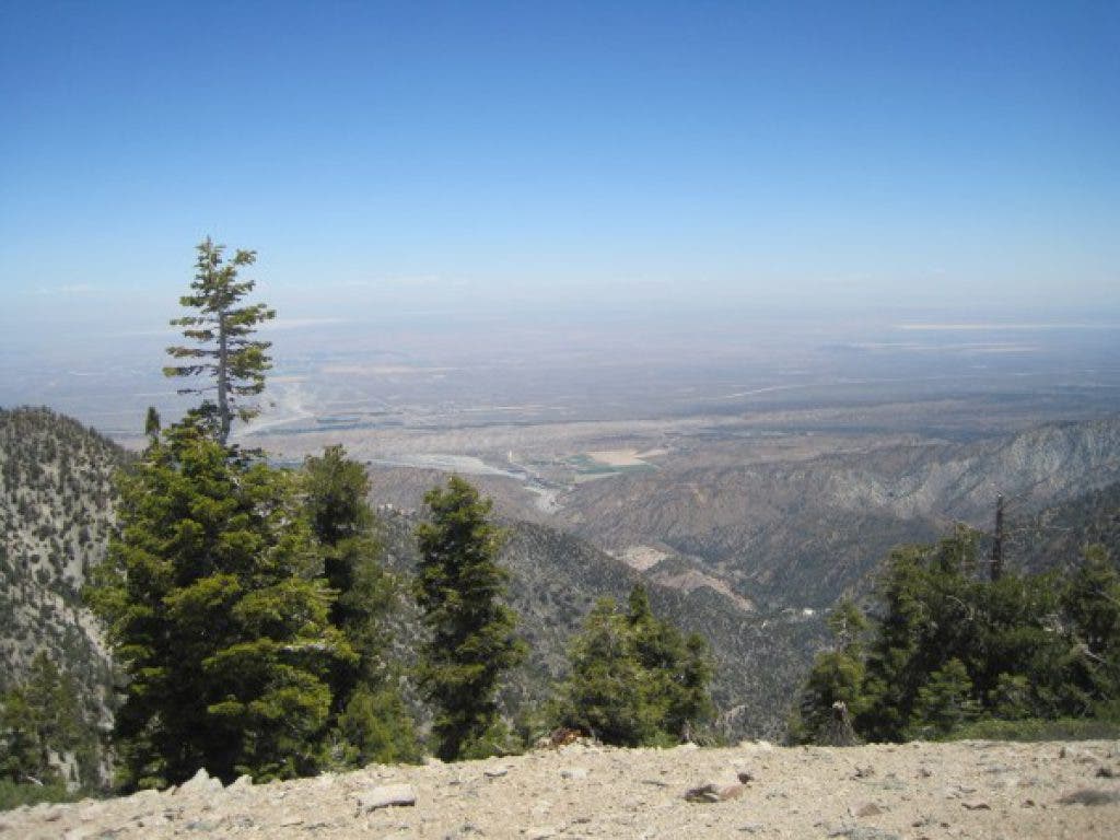


There is a common conception of subalpine landscapes as being desolate and difficult to reach. However, this is not always the case, as evidenced by my recent trip to Mount Williamson.
Mount Williamson is an 8,214’ mountain in the northern San Gabriel Mountains. The easiest way to hike Williamson is via Islip Saddle, a small parking lot area located off of Angeles Crest Highway. Once you have reached Islip Saddle, you will have your choice of trails that each jet off in very divergent directions.
In order to hike up to Mount Williamson, you will hike on a small section of the Pacific Crest Trail that obviously begins behind the restroom on the north side of the parking lot. The trail immediately begins a sharp ascent along the Eastern edge of Mount Williamson. Common subalpine plants like chaparral and snowplants highlight this ridge trail, contrasting the decomposed granite as eyeliner contrasts one’s skin tone. For two miles, this trail winds along, presenting vertigo-inspiring views of canyon after canyon.
Find out what's happening in Sierra Madrefor free with the latest updates from Patch.
At just shy of 8,000,’ a junction in the trail appears. If you would like to continue along the PCT and Pleasant View Ridge, you can follow the left arm of the trail. However, to summit Mount Williamson, you must take the less-maintained branch on the right-hand side.
This is the only part of the trail that becomes steep and requires cross-country trekking. Fortunately, you will only hike up this ridge for a couple tenths of a mile.
Find out what's happening in Sierra Madrefor free with the latest updates from Patch.
Once past the steepest part, the level, exposed summit area will make its face visible - and you can celebrate conquering one of the least-traveled subalpine summits of the San Gabriel Mountains while only ascending 1,500 feet!
Hike At A Glance
Difficulty Level (1-10): 4
Distance: 4.5 miles roundtrip
Scenery: This trail runs along a narrow ridge of Mount Williamson and presents excellent views of the entire San Gabriel Mountain Range, as well as the nearby Devil’s Punchbowl, Mojave Desert, and the southern Sierra Nevada Mountains.
Best time to go: May to October. If you go between November and April, it is common to have ice and snow on this trail, and crampons and ice axes would likely be necessary.
Trail condition: Well marked the first 2 miles or so. After that, you need to simply follow the ridge to the top.
Other considerations: I would avoid this area if you have vertigo or are uncomfortable around steep drop-offs. Also, like anywhere in the San Gabriels, beware of any hazards that are typically in the mountains: snakes, bees, and anything else.
Getting there: Take SR 2/Angeles Crest Highway north from La Canada. You will drive for about 40 minutes, past Newcombs Ranch and Eagle’s Roost. Finally, you will reach Islip Saddle. Park in the parking lot. The trail begins behind the outhouse. Display your required Adventure Pass in your car (an Adventure Pass may be purchased from REI, most ranger stations, or many local sporting goods stores for $5/day or $30/year).