Weather
Finally! Cool Relief On Way To Temecula
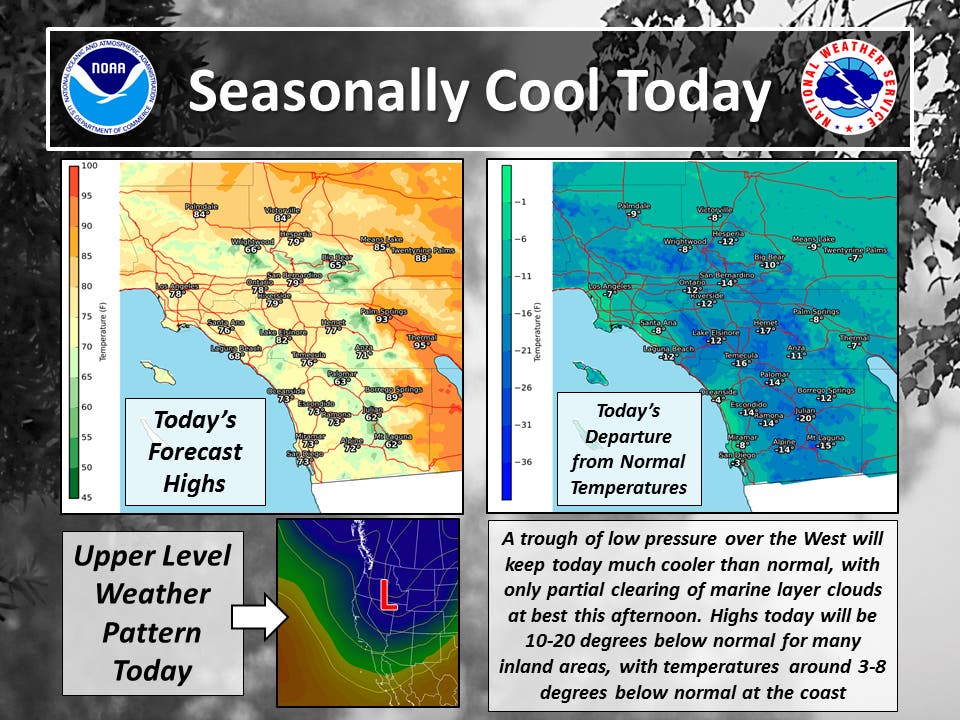
"The weather will be coolest [Friday] with a deep marine layer and only partial afternoon clearing," the NWS says for the coming days.


TEMECULA, CA — After so many weeks of record-breaking heat across SoCal, the Temecula Valley area will finally see some cooler temperatures continue throughout the weekend. Below normal temperatures are forecast for the coming days, with Friday offering especially cool weather.
"A trough of low pressure over the western United States will continue through the next week," the National Weather Service said in its forecast discussion. "The weather will be coolest [Friday] with a deep marine layer and only partial afternoon clearing, with a warming trend and less deep marine layer over the weekend and Monday as the trough weakens a bit. Some cooling will occur again around the middle of next week. Locally gusty west winds will occur at times in the mountains and deserts."
Find out what's happening in Temeculafor free with the latest updates from Patch.
As for Temecula in particular, here's the forecast for the coming days, via the NWS:
Friday
Cloudy, then gradually becoming mostly sunny, with a high near 74. Southwest wind 5 to 10 mph.
Find out what's happening in Temeculafor free with the latest updates from Patch.
Friday Night
Mostly cloudy, with a low around 59. Southwest wind 5 to 10 mph becoming light west in the evening. Winds could gust as high as 20 mph.
Saturday
Partly sunny, with a high near 77. Light southwest wind increasing to 5 to 10 mph in the afternoon. Winds could gust as high as 20 mph.
Saturday Night
Patchy fog after 11pm. Otherwise, mostly cloudy, with a low around 59. Southwest wind 10 to 15 mph becoming light in the evening. Winds could gust as high as 20 mph.
Sunday
Patchy fog before 11am. Otherwise, mostly cloudy, then gradually becoming sunny, with a high near 77. Light south wind becoming southwest 10 to 15 mph in the afternoon. Winds could gust as high as 20 mph.
Sunday Night
Mostly clear, with a low around 58.
Monday
Sunny, with a high near 82.
Monday Night
Patchy fog after 11pm. Otherwise, increasing clouds, with a low around 58.
Tuesday
Patchy fog before 11am. Otherwise, cloudy through mid morning, then gradual clearing, with a high near 74.
Tuesday Night
Patchy fog after 11pm. Otherwise, partly cloudy, with a low around 58.
Image via National Weather Service
Get more local news delivered straight to your inbox. Sign up for free Patch newsletters and alerts.