Weather
Temecula To See A Wet Thanksgiving
Plus, how the long holiday weekend is expected to shape up weather-wise.

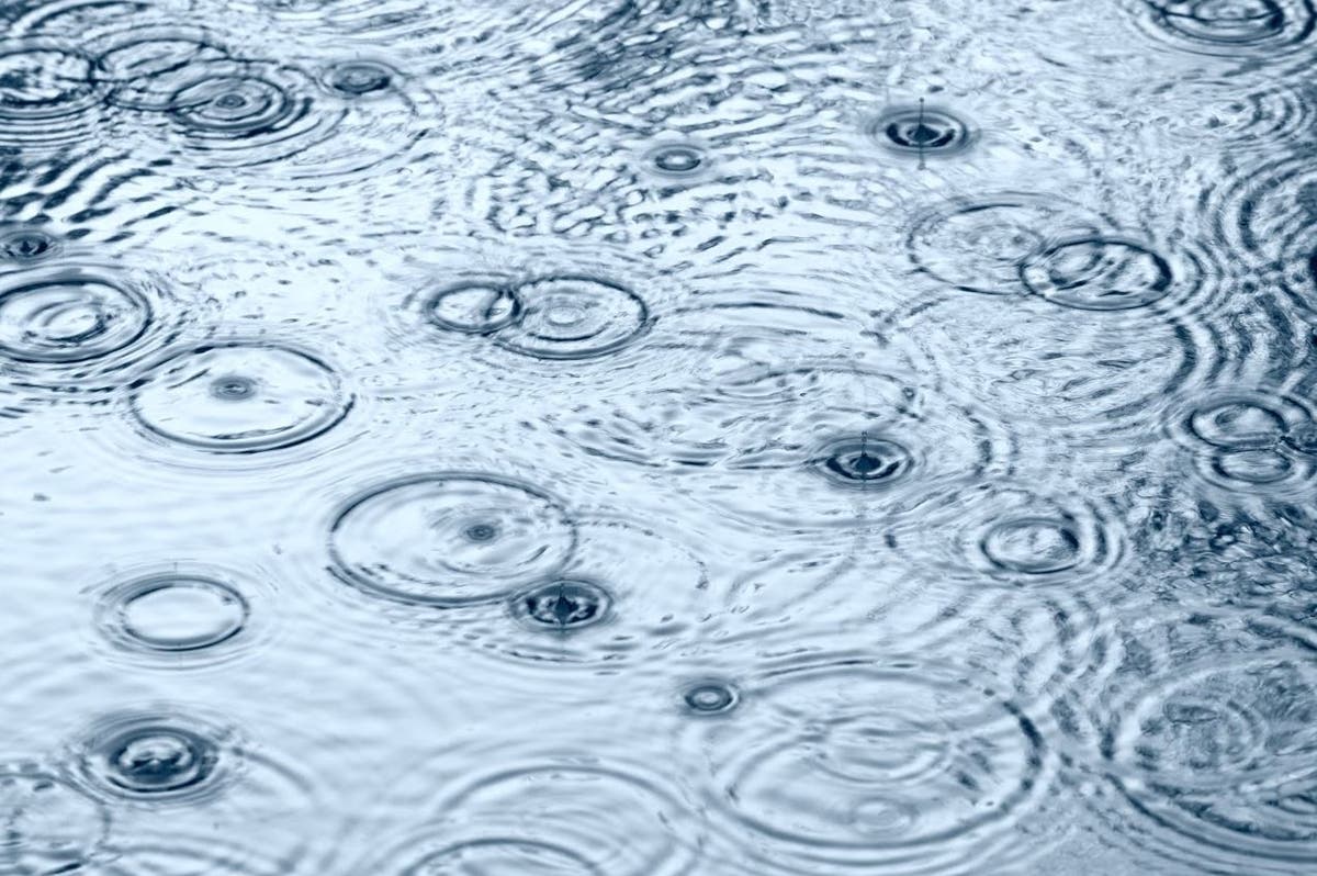
RIVERSIDE COUNTY, CA — If you're planning on celebrating Thanksgiving in the Temecula area, get those umbrellas out. Weather forecasters are calling for a wet Turkey Day. However, it's not expected to last long.
A low-pressure system sweeping into Southern California could produce light rain throughout the Inland Empire Wednesday evening and continue into Thanksgiving Day, but the showers will not be intense, and there's little concern about mud and debris flows posing a threat to homes and roads in fire-scorched areas, according to the National Weather Service and Riverside County officials. The rain is expected to dry up by Thanksgiving evening.
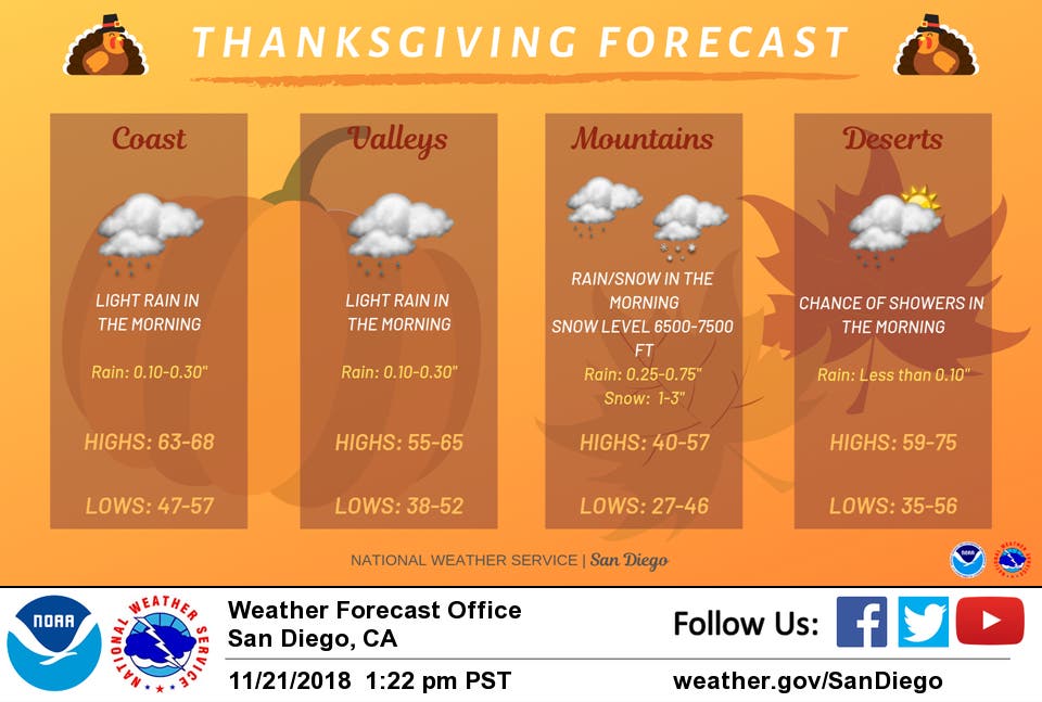
The Riverside metropolitan area and the San Gorgonio Pass near Banning are predicted to receive between one-tenth of an inch and one-quarter of an inch of rainfall while the Coachella Valley is predicted to receive no rainfall. The Temecula Valley could see between a tenth and a quarter inch of rain.
Find out what's happening in Temeculafor free with the latest updates from Patch.
Here's the full Temecula forecast through Thanksgiving weekend, courtesy of the National Weather Service:
Wednesday Afternoon
Mostly sunny, with a high near 68. Southwest wind around 10 mph.
Wednesday Night
Rain likely, mainly after 10pm. Mostly cloudy, with a low around 55. South wind around 5 mph. Chance of precipitation is 60%. New precipitation amounts between a tenth and quarter of an inch possible.
Find out what's happening in Temeculafor free with the latest updates from Patch.
Thanksgiving Day
Rain likely before 10am. Mostly cloudy, then gradually becoming sunny, with a high near 65. South wind 5 to 10 mph becoming west in the morning. Winds could gust as high as 20 mph. Chance of precipitation is 70%. New precipitation amounts of less than a tenth of an inch possible.
Thursday Night
Partly cloudy, with a low around 50. South wind around 5 mph.
Friday
Mostly sunny, with a high near 67. South wind around 5 mph.
Friday Night
Partly cloudy, with a low around 51.
Saturday
Sunny, with a high near 68.
Saturday Night
Mostly clear, with a low around 51.
Sunday
Sunny, with a high near 74.
Sunday Night
Mostly clear, with a low around 51.
The Riverside County Emergency Management Department stated that the likelihood of flash flooding, mud and debris flows is low, and so are risks to properties in the vicinity of the Cranston and Holy Fire burn areas. However, county officials said they will continue to monitor weather patterns and send out emergency notifications if they are needed.
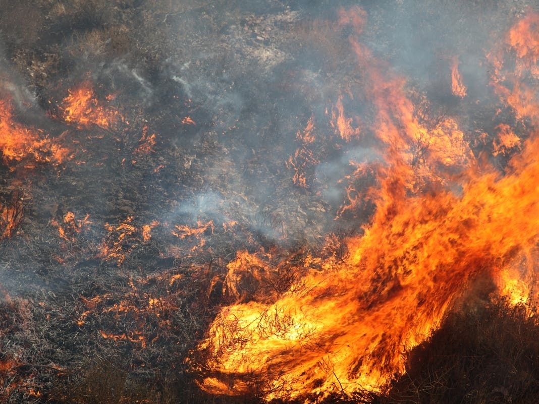
The Cranston Fire blackened just over 13,000 acres between Hemet and Idyllwild in late July and early August. The alleged arson blaze stripped woodlands in the San Bernardino National Forest, increasing the chances of mud slides and other damaging events.
The Holy Fire, also the work of an alleged arsonist, charred 23,000 acres between Aug. 6 and Sept. 13 in the Cleveland National Forest, impacting the Temescal Valley and Lake Elsinore.
County officials have held a series of meetings with residents since late September to highlight what they can do in advance to help protect their homes and what to do in the event of flooding and debris flows.
— City News Service contributed to this report / Image via Shutterstock
Get more local news delivered straight to your inbox. Sign up for free Patch newsletters and alerts.