Weather
Wind Speeds In Riverside County: How Windy Was It?
Overnight & through Thursday morning, Santa Ana Winds have howled through canyons & the county. Here are the strongest wind speeds recorded.

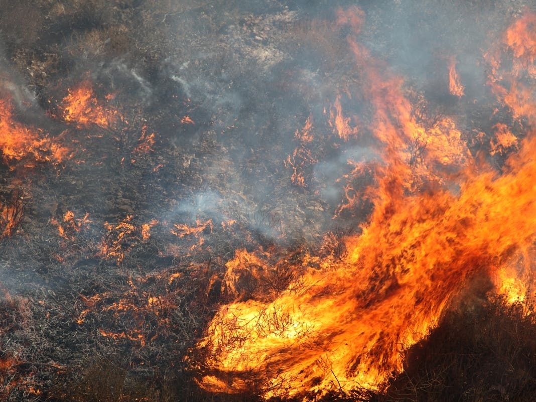
TEMECULA, CA — As the winds continue to howl across the Inland Empire, critical fire weather conditions remained in effect through Friday at 5 p.m., according to the National Weather Service.
Among the top wind speeds recorded in the last 24 hours in SoCal, a Riverside County wind gust was clocked at 75 miles per hour, off Highland Springs Avenue in Beaumont. (See full list of top speeds below)
Extremely low humidity was expected to continue into Saturday, but with weaker and less widespread winds, with offshore flow mostly confined to canyons, passes and foothills, the NWS reported.
Find out what's happening in Temeculafor free with the latest updates from Patch.
Onshore flow will return briefly Saturday afternoon into Sunday morning, however winds may return late Sunday night.
"Moderately strong offshore winds will likely redevelop Sunday evening and continue into Monday," the NWS reported. Winds would continue to blow east to northeast from 25 to 35 MPH, with gusts from 50 to 70 mph or higher through and below passes and canyons, the NWS said.
The National Weather Service released the highest wind speeds across the southland overnight and into Friday.
Find out what's happening in Temeculafor free with the latest updates from Patch.
The top 10 reported wind speeds in the Southland:
- Big Black Mountain 89 m.p.h., 2 a.m., Thursday, 4,055 ft. elevation
- Sill Hill (SDGE), 77 m.p.h., 5:20 a.m., Thursday, 3,556 ft. elevation
- Highland Springs 75 m.p.h., 5:16 a.m., Thursday, 2,232 ft. elevation
- Hellhole Canyon (SDGE), 72 m.p.h., 5 a.m., Thursday, 2,000 ft. elevation
- 4.9 W Palomar Mountain (HOLF), 71 m.p.h., 2 a.m., Thursday, 3,140 ft. elevation
- 9.2 NE Ramona (HPWREN), 71 m.p.h., 4:55 a.m., Thursday, 4,055 ft. elevation
- Alpine RAWS 66 m.p.h., 4:52 a.m., Thursday, 2,796 ft. elevation
- East Willows Road (SDGE), 64 m.p.h., 6:20 a.m., Thursday, 2,753 ft. elevation
- Round Potrero (SDGE), 64 m.p.h., 1:50 a.m., Thursday, 2,634 ft. elevation
- Buckman Springs (SDGE), 63 m.p.h., 6 a.m., Thursday, 3,252 ft. elevation
Other Top Speeds:
...San Gorgonio Pass Near Banning...
- Cabazon 45 m.p.h., 1:14 a.m., Thursday, 2,154 ft. elevation
- Mias Canyon (SCE), 40 m.p.h., 12:20 a.m., Thursday, 2,759 ft. elevation
- 6.2 S Morongo Valley (SGXWFO) 38 m.p.h., 1245 p.m., Wednesday, 1,509 ft. elevation
- 3.1 E Cabazon (SCE), 36 m.p.h., 11:10 p.m., Wednesday, 1,478 ft. elevation
- 3.5 S Morongo Valley (SCE), 35 m.p.h., 12 p.m., Wednesday, 1,901 ft. elevation
...San Bernardino and Riverside County Valleys-The Inland Empire...
- Highland Springs 75 m.p.h., 5:16 a.m., Thursday, 2,232 ft. elevation
- Devil Canyon (SCE), 62 m.p.h., 6:40 a.m., Thursday, 2,316 ft. elevation
- 5.6 S Lytle Creek (SCE), 57 m.p.h., 3:40 a.m., Thursday, 2,499 ft. elevation
- Lytle Creek Wash (SCE), 55 m.p.h., 5:50 a.m., Thursday, 2,086 ft. elevation
- Lytle Creek Rd (SCE), 55 m.p.h., 6:20 a.m., Thursday, 1,858 ft. elevation
- 1.0 N Devore (SCE), 54 m.p.h., 5:50 a.m., Thursday, 2,656 ft. elevation
- Grand Terrace 47 m.p.h., 2:05 p.m., Wednesday, 1.079 ft. elevation
- Meyers Canyon (SCE), 47 m.p.h., 11:40 p.m., Wednesday, 2.028 ft. elevation
- Devore 46 m.p.h., 11:10 p.m., Wednesday, 1,604 ft. elevation
- Badlands (SCE), 46 m.p.h., 1 p.m., Wednesday, 1,971 ft. elevation
- Deer Canyon (SCE), 46 m.p.h., 3:40 a.m., Thursday, 2,638 ft. elevation
- 2.1 E San Jacinto (SCE), 46 m.p.h., 10:30 p.m., Wednesday, 1,627 ft. elevation
- 2.0 W Devore (SCE), 44 m.p.h., 6:30 a.m., Thursday, 2,399 ft. elevation
- Chino Hills 3 (SCE), 44 m.p.h., 9:30 a.m., Wednesday, 808 ft. elevation
- Coyote Canyon 40 m.p.h., 10:55 a.m., Wednesday, 1,706 ft. elevation
- 4.0 E San Jacinto (SCE), 40 m.p.h., 12 a.m., Thursday, 1,827 ft. elevation
- Rialto 1 39 m.p.h., 11:10 a.m., Wednesday, 1,142 ft. elevation
- Chino Airport 39 m.p.h., 9:28 a.m., Wednesday, 626 ft. elevation
- Ontario Airport 39 m.p.h., 0925 p.m., Wednesday, 895 ft. elevation
- Rialto (SCE), 39 m.p.h., 1150 a.m., Wednesday, 1,448 ft. elevation
- San Jacinto 1 38 m.p.h., 1059 p.m., Wednesday, 1,522 ft. elevation
- Butterfield Valley (SCE), 38 m.p.h., 0110 a.m., Thursday, 1,544 ft. elevation
- 6.1 E Temecula (SCE), 37 m.p.h., 0340 a.m., Thursday, 1,169 ft. elevation
- 2.2 NE Fontana (SGXWFO), 36 m.p.h., 0330 a.m., Thursday, 1,422 ft. elevation
- Eastvale 36 m.p.h., 0556 a.m., Thursday, 816 ft. elevation
- Rancho Cucamonga (SCE), 36 m.p.h., 2:50 a.m., Thursday, 2,279 ft. elevation
- 3.2 NE Rialto (UPR), 36 m.p.h., 6 a.m., Wednesday, 1,312 ft. elevation
- Riverside Airport 35 m.p.h., 12:27 p.m., Wednesday, 749 ft. elevation
- Moreno Valley Fwy (SCE), 35 m.p.h., 4:40 a.m., Thursday, 1,707 ft. elevation
- 5.1 E Rainbow (SCE), 35 m.p.h., 12 a.m., Thursday, 1,294 ft. elevation
...San Bernardino County Mountains...
- 1.3 SW Crestline (SGXWFO), 57 m.p.h., 11 p.m., Wednesday, 5,297 ft. elevation
- Banning RAWS 47 m.p.h., 5:13 a.m., Thursday, 3,606 ft. elevation
- Heaps Peak 41 m.p.h., 8:15 p.m., Wednesday, 6,455 ft. elevation
- 3.4 NE Running Springs (SCE), 39 m.p.h., 1:40 a.m., Thursday, 6,168 ft. elevation
- Waterman Canyon (SCE), 38 m.p.h., 6:40 p.m., Wednesday, 3,109 ft. elevation
- Running Springs (SCE), 37 m.p.h., 1:10 a.m., Thursday, 6,194 ft. elevation
- 1.2 E Running Springs (SCE), 37 m.p.h., 3:4o a.m., Thursday, 6,282 ft. elevation
- 2.0 NW Lake Arrowhead (SCE), 36 m.p.h., 11:50 a.m., Wednesday, 5,350 ft. elevation
...Riverside County Mountains...
- 2.0 E Mountain Center (SCE), 57 m.p.h., 10:50 p.m., Wednesday, 5,142 ft. elevation
- 4.1 E Mountain Center (SCE), 55 m.p.h., 11 p.m., Wednesday, 5,151 ft. elevation
- Poppet Flats RAWS 52 m.p.h., 6:14 a.m., Thursday, 3,830 ft. elevation
- 3.7 SW Cabazon (SCE), 44 m.p.h., 6 a.m., Thursday, 3,799 ft. elevation
- San Marcos 3 43 m.p.h., 2:17 a.m., Thursday, 4,751 ft. elevation
- 9.0 SE Hemet (SCE), 36 m.p.h., 11:20 p.m., Wednesday, 3,294 ft. elevation
- 5.5 S Banning (SCE), 35 m.p.h., 6:20 a.m., Thursday, 3,802 ft. elevation
Get more local news delivered straight to your inbox. Sign up for free Patch newsletters and alerts.