Politics & Government
Leaders Lament Lack of Levee Improvements
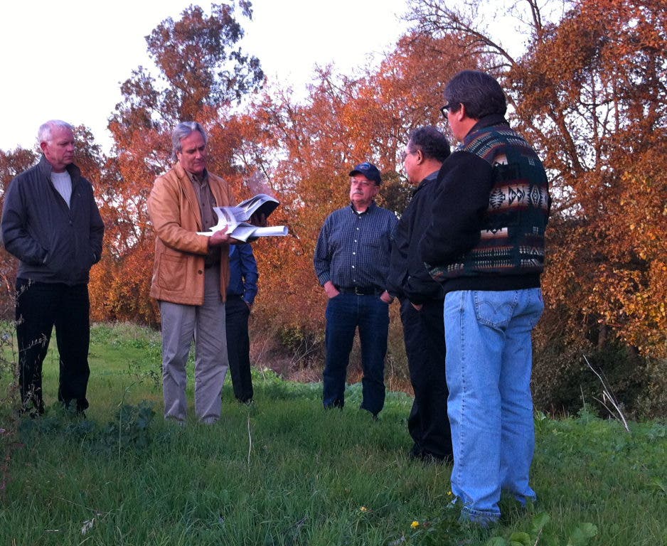
The Watsonville City Council toured the Pajaro Valley levee system Tuesday afternoon.




A flood more than five decades ago spurred government officials to draw up a levee improvement plan aimed at controlling the Pajaro River during the worst winter storms.
Entering the rainy season 56 years later, the goals of project remain unfulfilled and, Tuesday, Watsonville City Council members toured the levee system with city and county staffers to learn more about the reality along the river.
The goal of the federal levee improvement project is to build 100-year storm protection along the Pajaro River and its tributaries, including Salsipuedes Creek. That means there is a 1 percent chance the levee could be breached in during a rainy season.
Find out what's happening in Watsonvillefor free with the latest updates from Patch.
The $200 million project has not been funded; the federal government is responsible for three quarters of the cost.
Small projects spearheaded by the county have maintained the levee in recent years. Those include brush clearing, mowing, spraying and—in the near future—some bench reduction along the Pajaro River between Walker Street and Highway 1. That will involve cutting the river's benches down 4 to 8 feet and removing 300,000 cubic feet of debris from the flood channel, according to Bruce Laclergue, Santa Cruz County's flood control manager.
Find out what's happening in Watsonvillefor free with the latest updates from Patch.
"We will be carving a new step, a new terrace," Laclergue said, standing on the top of the river levee on the Pajaro River. There, the man-made flood control system looks down on a grassy riverbank spotted with willow trees and homeless camps on one side and strawberry fields on the other.
But upstream, on Salsipuedes Creek near , the waterway's bench is nearly level with the top of the levee, which divides the creek from a densely populated neighborhood.
Excavating that area will not protect the nearby neighborhoods because flood control measures upstream have not been completed—extending the levees 2 miles is part of the federal improvement project, which once was supposed to be completed by now.
"The federal project is probably never going to happen," City Manager Carlos Palacios said. "I've lost faith in it."
The Lower Pajaro Levee Reconstruction Project involves rebuilding the U.S. Army Corps of Engineers flood protection levees along 11 miles of the lower Pajaro River from the ocean to Murphy’s Crossing Road and along 5 miles of Salsipuedes and Corralitos creeks, which drain into the river, according to the Pajaro Watershed Information Center. The levee was constructed in 1949.
LacLergue said the earliest the federal project would break ground would be 2016.
The levees along Salsipuedes Creek only provide 5-year storm protection, meaning there's a 20 percent chance they will be breached in any given year, according to LacLergue.
"This is the lowest level of protection on the Pajaro River or its tributaries," he said.
Areas of the city flooded in 1998, though that high water disaster was blamed on backed-up storm drains, not a levee failure. Three years prior, in 1995, the levee broke on the North Monterey County side of the river, causing $50 million damage in the Pajaro community.
Beyond funding, levee maintenance is challenging because a significant stretch of the levee is in Monterey County, which has less money to trim trees, mow down brush and dig out the river's bench than Santa Cruz County. Also, threatened and endangered species that live in river and the surrounding riparian area—steelhead, the red-legged frog and Western pond turtles—add hurdles to river-related projects.
Palacios quizzed county employees, who are charged with maintaining the levee system, about what could be done now to improve the flood control. He said residents in Bay Village and the Vista Montaña neighborhoods—adjacent to Salsipuedes Creek—pay taxes and want results.
"They want to see action here," Palacios said, gesturing toward homes situated just a few yards past the outer edge of the levee.
LacLergue said nothing more will be done to improve the levees before spring.
"We're concerned about eminent threats," Watsonville Mayor Daniel Dodge said.
During the height of the wet season last year, some Watsonville creeks lapped at the edges of the levee; rain is in the weekend forecast.
Get more local news delivered straight to your inbox. Sign up for free Patch newsletters and alerts.