Weather
Thunderstorms, Heavy Rain And Wet Snow All Forecast In CT: Latest Updates
Find out the anticipated timeline for heavy rain with some wet snow.


It will become increasingly rainy as the day progresses Thursday, with a chance for thunderstorms, according to meteorologists.
The National Weather Service reports low pressure is impacting the state today, with precipitation spreading across the state this afternoon.
“A thunderstorm remains possible, especially for (southwest) areas,” where there is a marginal risk for severe storms, the National Weather Service said.
Find out what's happening in Across Connecticutfor free with the latest updates from Patch.
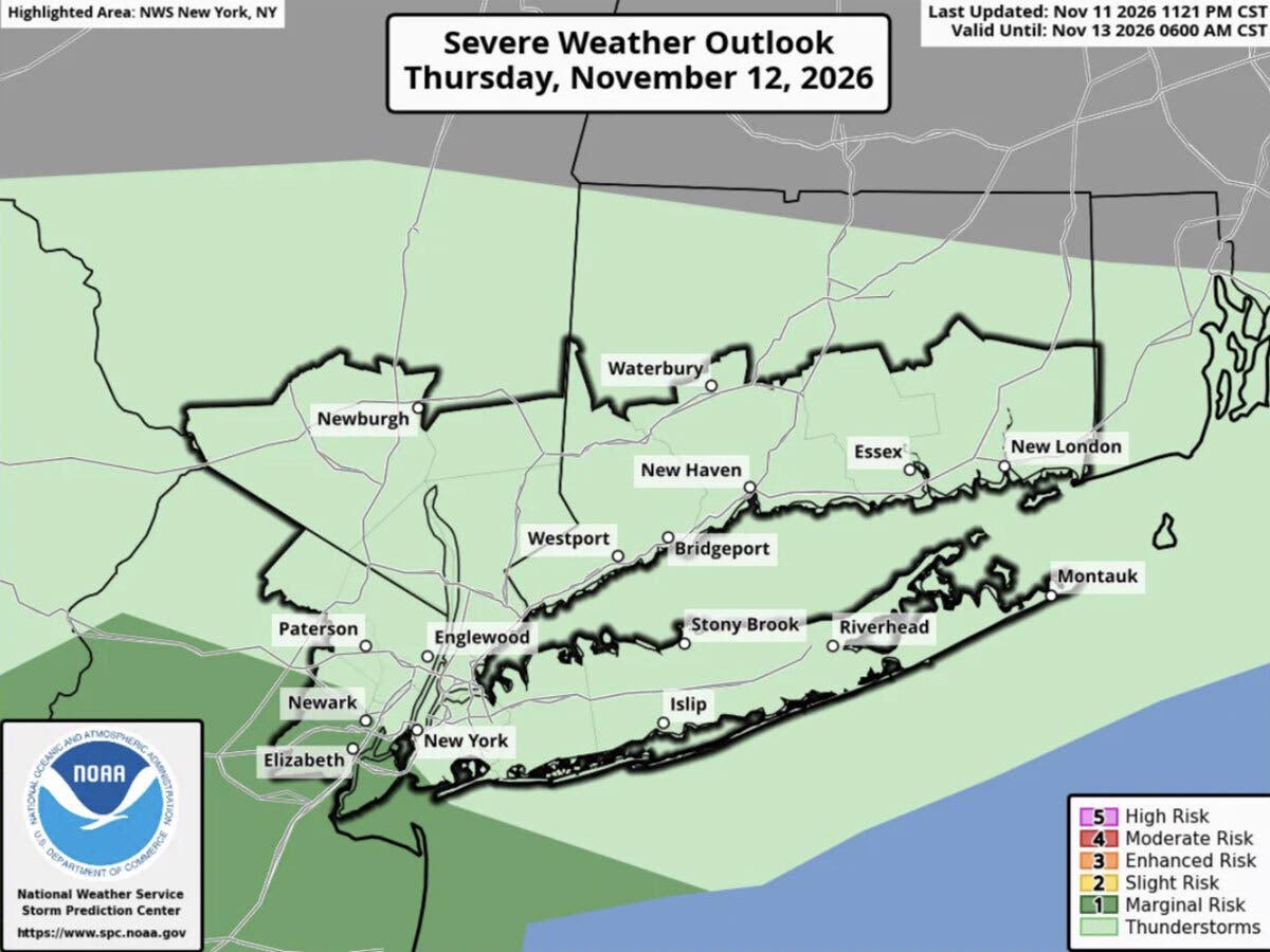
Today also will become windy, with winds of up to 20 miles per hour, and temperatures in the 50s and lower 60s. Rainfall of up to one and a half inches is expected between now and Friday night, its forecasters said.
“A widespread cold rain is expected late today through Friday. For the higher elevations, rain flips to or mixes with wet snow, with minor accumulations possible,” the National Weather Service’s Boston office reported.
Find out what's happening in Across Connecticutfor free with the latest updates from Patch.
In Connecticut, any wet snow is expected to be limited to northern and high elevation areas of the state.
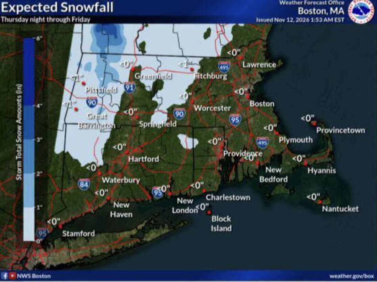
WFSB predicts the steadiest rain of the day today will be around sunset, with the rain impacting tonight’s evening commute. The storm system will produce rain, then a little snow, the station predicts.
“As a second area of low pressure develops and moves offshore tomorrow, colder air is drawn southward across CT changing rain to wet snow,” WFSB predicts. “We end the workweek with a *First Alert Weather Day* for the 1st flakes of the season! While snow impacts will be minimal, a slushy accumulation will be possible on unpaved/grassy surfaces across the higher terrain of NW and NE CT (a coating to 1”). Roads will just be wet. Otherwise… it’s a wet, breezy, raw end to the workweek.”
WTNH is predicting a chilly rain and late day gusts of up to 35 miles per hour for most of Connecticut starting early this evening.
WTNH’s forecast is for “some wet snow to mix in at times Friday, with some minor, slushy accumulations possible for the highest elevations.”
Read More:
- Horse Euthanized After Being Injured In Collision: State Police
- ICE Arrests 18-Year-Old Downtown
- Baby Stops Breathing, Police Officer Rushes To Help
Here are the forecast details for southern Connecticut via the National Weather Service:
Today: Rain, mainly after 1 p.m. High near 58. East wind 10 to 15 mph. Chance of precipitation is 100%. New precipitation amounts between a quarter and half of an inch possible.
Tonight: Rain. Low around 35. Northeast wind around 14 mph, with gusts as high as 25 mph. Chance of precipitation is 80%. New precipitation amounts between a quarter and half of an inch possible.
Friday: Rain. High near 47. North wind 10 to 15 mph, with gusts as high as 25 mph. Chance of precipitation is 100%. New precipitation amounts between a quarter and half of an inch possible.
Friday Night: A 20 percent chance of rain. Mostly cloudy, with a low around 31. North wind around 7 mph.
Saturday: Partly sunny, with a high near 48. Northwest wind 8 to 11 mph.
Saturday Night: Partly cloudy, with a low around 31.
Sunday: Mostly sunny, with a high near 51.
Sunday Night: Partly cloudy, with a low around 34.
Monday: Sunny, with a high near 52.
Monday Night: Mostly clear, with a low around 32.
Tuesday: Sunny, with a high near 53.
Tuesday Night: Mostly clear, with a low around 33.
Wednesday: Sunny, with a high near 57.
Here are the forecast details for northern Connecticut via the National Weather Service:
Today: Rain likely, mainly after 5 p.m. Cloudy, with a high near 53. Northeast wind 6 to 13 mph, with gusts as high as 23 mph. Chance of precipitation is 60%. New precipitation amounts of less than a tenth of an inch possible.
Tonight: Rain. Low around 37. North wind around 15 mph. Chance of precipitation is 100%. New precipitation amounts between a quarter and half of an inch possible.
Friday: Rain likely, mainly before 1 p.m. Cloudy, with a high near 41. North wind 9 to 15 mph. Chance of precipitation is 70%. New precipitation amounts between a quarter and half of an inch possible.
Friday Night: Cloudy, with a low around 33. North wind around 7 mph.
Saturday: Mostly cloudy, with a high near 47. Northwest wind 5 to 10 mph, with gusts as high as 21 mph.
Saturday Night: Partly cloudy, with a low around 27. Northwest wind around 6 mph.
Sunday: Mostly sunny, with a high near 50. Northwest wind 5 to 11 mph, with gusts as high as 21 mph.
Sunday Night: Partly cloudy, with a low around 29. Northwest wind 3 to 6 mph.
Monday: Mostly sunny, with a high near 51. Northwest wind 3 to 7 mph.
Monday Night: Mostly clear, with a low around 27. Light northwest wind.
Tuesday: Sunny, with a high near 54. Light northwest wind.
Tuesday Night: Clear, with a low around 26. Calm wind.
Wednesday: Sunny, with a high near 58. Light northwest wind.
Get more local news delivered straight to your inbox. Sign up for free Patch newsletters and alerts.