Home & Garden
Brookfield Weather Alert: Special Weather Statement Issued
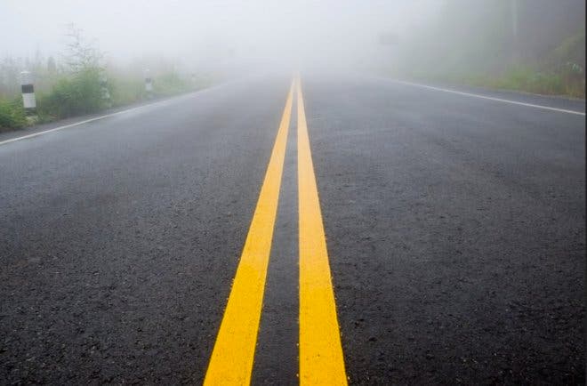
If you're traveling from Brookfield on Christmas Eve, the National Weather Service is urging drivers to slow down and leave extra time.

By Brian McCready
As tens of thousands of Connecticut residents and millions of Americans take to the roads this Christmas Eve weather is always a primary concern.
Obviously, with temps in the mid to upper 60s, snow and icy conditions will not be an issue but the National Weather Service has issued a “Special Weather Statement” for the area for Christmas Eve.
The weather service says we’ll be contending with fog that may linger around for most of Thursday and into the early morning hours of Christmas Day.
Here is what the National Weather Service writes, “AREAS OF FOG...LOCALLY DENSE...WILL CONTINUE TO VARY VISIBILITIES BETWEEN ONE QUARTER MILE AND ONE MILE ACROSS THE AREA THIS MORNING.
VISIBILITIES WILL GRADUALLY IMPROVE THROUGH THE MORNING...BUT IMMEDIATE COASTAL COMMUNITIES MAY SEE FOG LINGER INTO THE AFTERNOON.
BE ALERT FOR RAPIDLY LOWERING VISIBILITIES...SLOW DOWN...AND ALLOW EXTRA TIME TO REACH YOUR DESTINATION.”
And while conditions will improve during the day, the weather service writes, showers and patchy fog are expected to return Christmas Eve at night, which could make driving a challenge.
In fact, fog may be an issue up until early Christmas Day morning.
On Christmas Day itself we can expect sunny skies and temps in the low 60s.
Then there is a chance of rain for each day from Saturday through Tuesday.
Get more local news delivered straight to your inbox. Sign up for free Patch newsletters and alerts.