Community Corner
Multi-Day Snow and Ice Chance Remains for Canton
One Connecticut meteorologist says "the prolonged storm is looking less impressive."

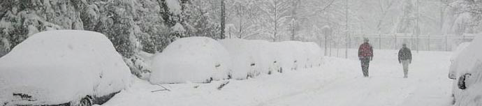
Yesterday, we shared with you the National Weather Service’s Hazardous Weather Outlook statement, which predicted there could be more than eight inches of snow accumulation beginning late Saturday and into Tuesday.
Well apparently a lot has changed in 24 hours. Yes, there is still a chance for periods of light snow on Saturday, Sunday, and Monday but the National Weather Service is no longer predicting eight inches of snow accumulation for most of the state.
In fact the snowfall projections are all over the place. WFSB 3 Meteorologist Mark Dixon predicts there could be 2-4 inches of snow by the end of Sunday and possibly more on Monday. He estimates 6-12 inches is possible for the state if it in fact remains all snow.
Find out what's happening in Cantonfor free with the latest updates from Patch.
NBC Connecticut Meteorologist Bob Maxon estimates that a few inches of snow is possible on Sunday with more on Monday.
WTNH News 8 Meteorologist Gil Simmons predicts that the Connecticut Shoreline will receive mixed precipitation and overall “the prolonged storm is looking less impressive.”
Find out what's happening in Cantonfor free with the latest updates from Patch.
In fact NBC Meteorologist Brad Field is already looking toward next weekends potential blockbuster storm.
“confidence growing that next 2 weeks + are harsh with bouts of more snow and sub-zero cold...next weekend looks PARTICULARLY harsh…,” Field wrote on social media.
Here’s what the National Weather Service forecast:
- Tonight Partly cloudy, with a low around 13. West wind 6 to 8 mph.
- Saturday A chance of snow, mainly after 7am. Cloudy, with a high near 27. Southwest wind 3 to 6 mph. Chance of precipitation is 50%. New snow accumulation of around an inch possible.
- Saturday Night A chance of snow. Cloudy, with a low around 22. South wind around 5 mph becoming calm in the evening. Chance of precipitation is 50%. New snow accumulation of less than one inch possible.
- Sunday Snow likely, mainly after 3pm. Cloudy, with a high near 30. Northeast wind 3 to 7 mph. Chance of precipitation is 60%. New snow accumulation of 1 to 2 inches possible.
- Sunday Night Snow likely. Cloudy, with a low around 21. Northeast wind 9 to 11 mph. Chance of precipitation is 70%.
- Monday Snow likely. Cloudy, with a high near 27. Chance of precipitation is 70%.
Get more local news delivered straight to your inbox. Sign up for free Patch newsletters and alerts.