Weather
Hour-By-Hour Forecast Of Upcoming Snowstorm In Connecticut
We'll let you know when the snow is expected to begin and end, and what impact it may have on your travel plans Saturday.

If you’re headed out Friday night enjoy, the snow won’t impact your plans at all. Some flurries may move into Connecticut after midnight but the real accumulating snow won’t really get going until after 2 a.m.
Once the snow does get going it’s going to accumulate quickly as bands of moderate to heavy snow will move into Connecticut before daybreak. If you have travel plans between 8 a.m. and noon expect snow covered roads and likely some icing too, which will make travel messy and potentially hazardous in places.
Here’s the latest details on the snow on its way into Connecticut. A Winter Weather Advisory is still in effect for all of the state and the snow is expected to get going just before dawn.
Find out what's happening in Cheshirefor free with the latest updates from Patch.
The snow may be falling moderately and sometimes even heavily during the morning on Saturday. Snow accumulation estimates are mainly 2-4 inches for most of the state, according to NBC Connecticut, and possibly 4-6 inches of snow north and west of Interstate 84.
New London County may only see 1-2 inches because temps will rise faster there and lead to a quicker changeover to rain, NBC Connecticut reports.
Find out what's happening in Cheshirefor free with the latest updates from Patch.
WTNH News 8 in its updated forecast is predicting the snowflakes start falling between 2 a.m. and 4 a.m. Temps will be very cold only in the teens and 20s.
Snow will continue until 8 a.m. and that is when the change to a mix and then plain rain begins on the coast first, News 8 reports. News 8 predicts most places receiving 3-4 inches of snow before the changeover to rain.
Rain may even be heavy at the coast Saturday around noon. Temps will rise during the day to 40 degrees. It may also be windy in the afternoon with gusts between 15-25 mph.
The entire state will see rain on Sunday and temps will quickly skyrocket into the mid 50s and up to a half inch of rain is possible. The next chance for snow is next Thursday, according to the National Weather Service.
Here’s a timeline of snow, ice and rain for Saturday morning and afternoon via the National Weather Service:
Midnight: Snow flurries possible
2 a.m. - 4 a.m.: Steady snow begins to cover the state
4 a.m. - 8 a.m.: Moderate to heavy bans of snow arrive
10 a.m.: Areas on the coast see a chance over to plain rain. New London County is first for the changeover.
11 a.m.: Areas more inland including Danbury, Naugatuck, Hamden, and Middletown will see the changeover to sleet and ice from 11 a.m. to 1 p.m.
1 p.m.: Areas inland in southern Connecticut will see the mixed precipitation change to just plain rain.
2 p.m.: Snow and ice in Hartford and Tolland counties begins to end as some light rain showers.
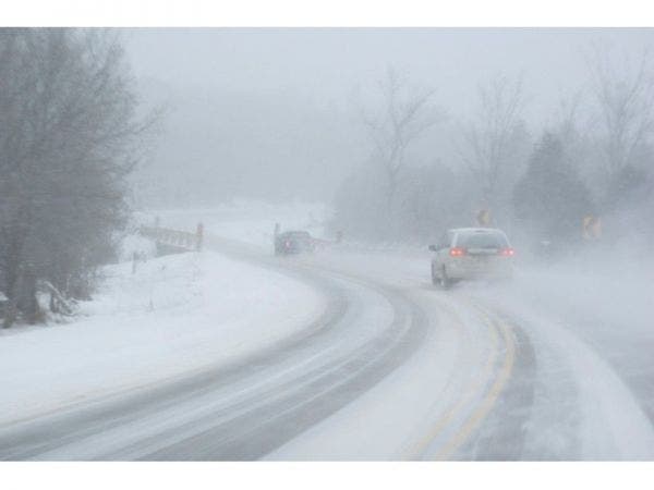
Patch file photo
Get more local news delivered straight to your inbox. Sign up for free Patch newsletters and alerts.