Weather
CT Weather: Heavy Snow, Sleet Cause Havoc On Roadways
The National Weather Service has issued Winter Storm Warnings for much of the state as snow estimates have risen significantly.

It was a nightmarish commute for motorists all across Connecticut as a surprise heavy snowstorm moved into the state Thursday afternoon and at times dropped two to three inches of snow per hour. The heavy snow caused numerous accidents, closed highways, and left motorists stranded for hours as the snow became too difficult to traverse.
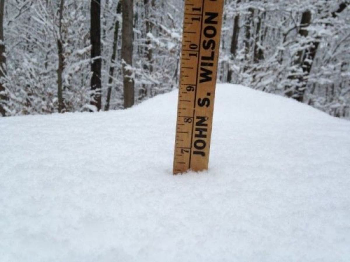
Initially, snow totals were expected to be 1 to 3 inches on the coast and 2 to 4 inches of snow inland and in northern parts of Connecticut. But many places saw in excess of six inches of snow in a very short amount of time, which made it impossible for plow operators and the state Department of Transportation to keep up.
There have been reports of motorists sitting in their cars for hours and some people running out of gas.
Find out what's happening in Greenwichfor free with the latest updates from Patch.
One Patch reader said late Thursday, "My son has been sitting on that highway for more than 2 hours...still not moving... because traffic still at standstill."
As of 11:30 p.m. sleet had moved into the state and by early Friday the snow and ice would change to plain rain which will create a slushy morning commute to work. The rain should end by Friday morning. Once the rain ends, we're looking at a dry and cold weather weekend.
Find out what's happening in Greenwichfor free with the latest updates from Patch.
Stuck on I-691 East near #Southington #WTNHweather pic.twitter.com/nfamcz94LV
— CTLaSalle Blanks (@CTLaSalleBlanks) November 16, 2018
@CTDOT_Statewide @CTDOT_District4 Can e get some plow trucks on the Merritt Parkway South between Exits 61 and 59. The roads are a disaster and the dangerous before the tunnel. @GovMalloyOffice @wnpr pic.twitter.com/mKP5Z0p4Dz
— Shafiq RF Abdussabur (@boldminds) November 16, 2018
Extremely challenging for @AAAHartford rescue crews responding to hundreds of calls. Many from drivers off the road. https://t.co/WqaGoXTtRO
— AAA Hartford News (@AAAHartfordNews) November 16, 2018
When we say slow down on the roads .. roads are bad, we mean it. Look what happened in front of @SnowMonsterCT in New Haven #nbcct @NBCConnecticut pic.twitter.com/19bZC5H1a5
— Darren Sweeney NBCCT (@DarrenSweeney) November 15, 2018
Here are the latest advisories from the NWS:
Connecticut coast: Wet snow and mixed precipitation expected. Total snow accumulations of 3 to 6 inches, highest away from the immediate coastline, and ice accumulations of a light glaze expected. Snowfall rates of 1 inch per hour possible. Winds gusting as high as 45 mph.
Inland sections of Southern Connecticut: Heavy snow and then mixed precipitation expected. Total snow accumulations of 4 to 7 inches and ice accumulations of around one tenth of an inch expected. Snowfall rates of 1 to 2 inches per hour possible. Winds gusting as high as 40 mph.
Northern Connecticut: Heavy snow followed by a mixture of sleet and freezing rain. Total snow accumulations of 4 to 7 inches and ice accumulations of around one tenth of an inch expected.
The latest from CT's local weather experts:
Here are the Expected Changeover Times for snow to a wintry mix, then to plain rain. pic.twitter.com/7xQ2ct72IX
— NWS New York NY (@NWSNewYorkNY) November 15, 2018
New map - this is a bigger change in southern CT than in northern areas where we raised the range by an inch. **Locally higher amounts are possible for the lucky ones that get caught in a heavier snow band for a while. Sloppy after the change to ice/rain! pic.twitter.com/lHjfaNlab8
— Rachel Frank (@RachelFrank_CT) November 15, 2018
Snow will come in like a wall and stick to everything rapidly. Prepare for deteriorating roads 3p-6p. #nbcct pic.twitter.com/ntnU9mNwT9
— Ryan Hanrahan (@ryanhanrahan) November 15, 2018
The timing is the same it's just the front end burst of snow is so impressive. 1"-2" per hour snowfall rates add up quick!! If you get 1-2 hours more snow than expected, that's a big difference in how much accumulates!
— Rachel Frank (@RachelFrank_CT) November 15, 2018
See also: Teacher’s Retirement Letter Causes Controversy
Connecticut Professor Confronted In 'Anti-Predator' Video
This will not be a major "snowstorm," for Connecticut but what is problematic is the timing of this season's first winter storm and the fact that a period of icing is expected across all of Connecticut. Snow will begin this afternoon, quickly mix with sleet, and then change to rain by late Thursday or early Friday morning.
A Winter Storm Warning has just been added for Northern Connecticut AND inland sections of Southern Connecticut for between 4 and 7 inches of snow, while the immediate Connecticut coast may receive between 2 to 4 inches of snow and is operating under a Winter Weather Advisory.
Snow and ice will make travel very treacherous this evening and tonight. The evening commute home may be a very slippery one for motorists.
The anticipated timing of this storm has already led to some school districts to cancel after-school activities and in some cases dismiss early Thursday. (Want to know what is going on in your local community? Sign up for Patch's free daily newsletter and breaking news alerts from more than 100 Connecticut communities, click here.)
In prep for the coming snow, #CTDOT has pretreated bridges and highways in #CT. The state snowplow fleet is prepped to clear the roadways. It’s the first snow of the season and winter driving awareness is important – please use caution if you have to drive this afternoon.
— Governor Dan Malloy (@GovMalloyOffice) November 15, 2018
1" per hour snowfall rates expected to New Haven between 4 and 5 p.m. and 1" per hour rates to Hartford between 5 p.m. and 6 p.m. Snow will accumulate readily on the roads as temperatures drop when the snow begins. Will be a messy commute. #nbcct pic.twitter.com/wCJfwQmYOr
— Ryan Hanrahan (@ryanhanrahan) November 15, 2018
A Winter Weather Advisory is in effect from 2 to 11 p.m. on the immediate Connecticut coast.
"WHAT...Mixed precipitation expected. Total snow accumulations of up to two inches and ice accumulations of a light glaze expected. Winds gusting as high as 35 mph.
Inland sections of Southern Connecticut have a Winter Storm Warning until 4 a.m. Friday.
"Heavy snow and then mixed precipitation expected. Total snow accumulations of 4 to 7 inches and ice accumulations of around one tenth of an inch expected. Snowfall rates of 1 to 2 inches per hour possible. Winds gusting as high as 40 mph."
For Hartford, Tolland and Windham counties, a Winter Storm Warning is in effect from 4 p.m. to 7 a.m. Friday.
"Heavy snow followed by a mixture of sleet and freezing rain. Total snow accumulations of 4 to 7 inches and ice accumulations of around one tenth of an inch expected."
Litchfield County: "Mixed precipitation expected. Total snow and sleet accumulations of 4 to 7 inches...Ice accumulations of up to one tenth of an inch expected."
Here is an hour-by-hour look of snow, ice and rain that is forecast at the Connecticut coast, interior sections and Northern Connecticut:
*Connecticut coast:
2 p.m.: 34 degrees, 72 percent chance of precipitation, 20 mph wind gusts
5 p.m.: 33 degrees, 100 percent chance of precipitation, 31 mph wind gusts
8 p.m.: 33 degrees, 100 percent chance of precipitation, 37 mph wind gusts
11 p.m.: 36 degrees, 100 percent chance of precipitation, 41 mph wind gusts
2 a.m.: 36 degrees, 100 percent chance of precipitation, 38 mph wind gusts
5 a.m.: 40 degrees, 87 percent chance of precipitation, 21 mph wind gusts
8 a.m.: 40 degrees, 44 percent chance of precipitation, 18 mph wind gusts
There is a chance of snow after 2 p.m. From 2 p.m. to 8 p.m. one inch of snow is expected. Sleet is expected to mix with the snow from 2 to 8 p.m. tonight. After 8 p.m. plain rain is expected which could add up to .35 tenths of an inch of rain. The rain ends by 8 a.m. Friday.
*Inland sections of Southern Connecticut:
1 p.m.: 32 degrees, 40 percent chance of precipitation, 0 mph wind gusts
4 p.m.: 31 degrees, 84 percent chance of precipitation, 22 mph wind gusts
7 p.m.: 28 degrees, 100 percent chance of precipitation, 32 mph wind gusts
10 p.m.: 31 degrees, 100 percent chance of precipitation, 36 mph wind gusts
1 a.m.: 33 degrees, 100 percent chance of precipitation, 31 mph wind gusts
4 a.m.: 35 degrees, 100 percent chance of precipitation, 26 mph wind gusts
7 a.m.: 37 degrees, 73 percent chance of precipitation, 15 mph wind gusts
There is a chance of snow after 1 p.m. From 1 p.m. to 10 p.m. 2.1 inches of snow is expected. Sleet and freezing rain is expected to mix with the snow from 2 to 10 p.m. tonight. After 11 p.m. plain rain is expected. The rain ends by 10 a.m. Friday. A total of 4 to 7 inches of snow is now expected.
*Northern sections of Connecticut:
3 p.m.: 30 degrees, 47 percent chance of precipitation, 5 mph wind gusts
6 p.m.: 31 degrees, 86 percent chance of precipitation, 6 mph wind gusts
9 p.m.: 32 degrees, 100 percent chance of precipitation, 6 mph wind gusts
12 a.m.: 33 degrees, 100 percent chance of precipitation, 23 mph wind gusts
3 a.m.: 35 degrees, 87 percent chance of precipitation, 25 mph wind gusts
6 a.m.: 36 degrees, 87 percent chance of precipitation, 24 mph wind gusts
9 a.m.: 38 degrees, 67 percent chance of precipitation, 22 mph wind gusts
There is a chance of snow after 2 p.m. From 2 p.m. to 8 p.m. 1.2 inches of snow is expected. Sleet, freezing rain and plain rain are all expected to mix with the snow from 5 p.m. to 1 a.m. tonight. The plain rain ends by late Friday morning. A total of 4 to 7 inches of snow is now expected.
See also: Hotel Owner Charged in Prostitution Case: State Police
Teacher’s Retirement Letter Causes Controversy
Photo credit: Lanning Taliaferro/Patch
Get more local news delivered straight to your inbox. Sign up for free Patch newsletters and alerts.