Weather
Hurricane Matthew Impact To Connecticut Shifts Overnight
Hurricane Matthew's potential impact to Connecticut shifted overnight as forecasters now predict the massive storm will veer east.

For about five minutes yesterday the alarm was kind of sounded in Connecticut in regards to Hurricane Matthew as all of a sudden the "cone of uncertainty" now included our state for the first time. And, in less than 24 hours, it’s looking like the weekend may be largely sunny and Matthew could be headed out to sea and offer very little, if any, impact to Connecticut’s weather.
The National Weather Service in its updated forecast for Connecticut Wednesday morning still has a "Hazardous Weather Outlook" in effect but it's admitting the chances of the state being impacted by Matthew are declining.
“While trends in the forecast point to a lower probability of the area being impacted by Hurricane Matthew, it remains prudent to stay on top of the latest forecast,” the National Weather Service says of Connecticut.
Find out what's happening in Greenwichfor free with the latest updates from Patch.
While the National Weather Service is remaining cautious two top Connecticut meteorologists say the new track for Matthew is definitely good news for Connecticut.
NBC Connecticut Meteorologist Ryan Hanrahan said on social media “I said last night at 4pm I expected a dramatic shift south with the cone. Well here it is! We're getting close to sounding the all clear for Connecticut.”
Find out what's happening in Greenwichfor free with the latest updates from Patch.
In a detailed blog post on NBC Connecticut Tuesday evening, Hanrahan explains that Connecticut could still see some rain and wind but only if Matthew tracks close to Cape Cod this weekend. But the “most likely scenario” is that the powerful hurricane will “track fairly far offshore,” Hanrahan wrote.
WTNH News 8 Meteorologist Gil Simmons wrote on social media that “Hurricane Matthew is expected to stay far from Connecticut! This is great news! However, it will be a big impact to Florida, Georgia and South Carolina.”
NBC Connecticut Meteorologist Darren Sweeney also said, “Model trends continue to point to a more southern trend for CT, which means our weekend weather is looking better and better. Still must watch the trends as the storm interacts with land. CT is now out of the cone of uncertainty.”
- Creepy Clown Reports Popping Up in Several Connecticut Towns
- Forbes 400: 8 Connecticut Residents Among Wealthiest Americans
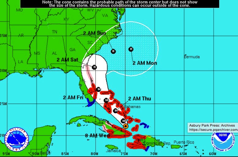
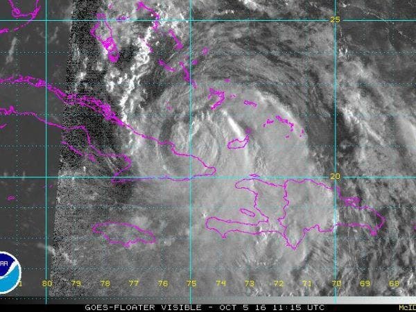
Hurricane Matthew weakened somewhat after its Tuesday run-ins with Haiti and Cuba, but it still remained a powerful Category 3 storm Wednesday morning. Packing maximum sustained winds of 115 mph, the storm is on a path that will bring it to the Bahamas and possibly Florida over the next day, according to the National Hurricane Center.
Matthew is expected to make a northwest turn on Wednesday as it moves across the Bahamas through Thursday. The storm “is expected to be very near the east coast of Florida by Thursday evening,” forecasters wrote in the 8 a.m. update.
As of Wednesday morning, forecasters anticipated Matthew’s strength would increase again over the next few days. Hurricane-force winds were extending out from Matthew by 40 miles. Tropical storm-force winds extended out up to 160 miles.
Additional reporting by Sherri Lonon
Graphics courtesy of NOAA
Get more local news delivered straight to your inbox. Sign up for free Patch newsletters and alerts.