Community Corner
WEATHER UPDATE: More Snow for Thursday Morning's Commute, Sub-Zero Wind Chills Forecast for Greenwich
The National Weather Service has issued a Hazardous Weather Outlook for Thursday, and a snow, ice and rain storm may hit us this weekend.

By Brian McCready and Barbara Heins (Patch Staff)
It appears Mother Nature is in the business of nickel-and-diming us when it comes to snow now.
The National Weather Service has issued a Hazardous Weather Outlook for 1 to 2 inches of snow to fall late tonight and smack dab in the middle of Thursday morning’s commute to work.
Find out what's happening in Greenwichfor free with the latest updates from Patch.
WTNH News 8’s Meteorologist Gil Simmons writes on his Facebook page, “quiet weather today but changes tonight/tomorrow. Snow squalls likely Thursday morning, plan on a slow commute.”
And in reality the one or two new inches of snow isn’t really the greatest concern. As part of its Hazardous Weather Outlook, the National Weather Service states wind chill values will fall as low as 20 to 25 below zero Thursday night through Friday morning.
Find out what's happening in Greenwichfor free with the latest updates from Patch.
Wind chills will remain below zero throughout the day on Friday and Friday night.
And the weekend is still days away but right now we could be looking at a nasty mix of snow, ice and then plain rain, which could compromise roofs that are already under a lot of snow, writes NBC Connecticut Meteorologist Darren Sweeney, on Facebook.
“Concerns for the weekend! Snow, to ice, to RAIN??
It’s only midweek, but I am looking toward the weekend.
First and foremost, many will ask, with the impending (new) blast of frigid air, how can you be talking about RAIN? for the weekend?
First off: Snow showers will usher in another absolutely frigid air Thursday night into Friday.
Saturday: Increasing clouds with snow developing on Saturday night.
The problem? High pressure will be in a position off of the coast to NOT lock in cold air. In fact, a storm center may even go to our west and pull in some warmer air.
This is not a good thing. we already have problems with “roof loading”.. that’s a buildup of snow on our roofs (those living in eastern CT you are about 20 inches ahead of everyone else).
Adding LIQUID to this, means we could be dealing with roofs being compromised. Also, all drains are clogged, you get the picture .
While it’s hard to fathom that this cold pattern will support a change to rain, it’s been pretty consistent in the models.
I wanted to give a heads up, as today is a good day to get out there (if you can) OR call someone who can help. I know I will be out on my roof because it’s getting scary deep.”
Here is the latest hyper local forecast from the National Weather Service for Greenwich.
- Today: Partly sunny, with a high near 28. Wind chill values between 15 and 25. Light east wind.
- Tonight: Snow showers likely, mainly before 1am. Cloudy, with a low around 16. Wind chill values between 5 and 10. Light and variable wind becoming west 5 to 10 mph after midnight. Chance of precipitation is 60%. New snow accumulation of less than a half inch possible.
- Thursday: A slight chance of snow showers before 1pm. Mostly cloudy, with a high near 21. Wind chill values between zero and 5. Breezy, with a northwest wind 15 to 22 mph. Chance of precipitation is 20%.
- Thursday Night: Mostly cloudy, with a low around 0. Wind chill values between -5 and -15. West wind 16 to 18 mph, with gusts as high as 29 mph.
- Friday: Mostly sunny and cold, with a high near 14. Northwest wind 16 to 18 mph.
- Friday Night: Partly cloudy, with a low around -1.
- Saturday: A chance of snow after 3pm. Mostly cloudy, with a high near 30. Chance of precipitation is 30%.
- Saturday Night: Snow likely. Cloudy, with a low around 28. Chance of precipitation is 60%.
- Sunday: Rain, snow, and freezing rain likely. Cloudy, with a high near 43. Chance of precipitation is 60%.
- Sunday Night: A chance of rain, snow, and freezing rain. Mostly cloudy, with a low around 21. Chance of precipitation is 40%.
- Monday: A chance of snow and freezing rain. Partly sunny, with a high near 28. Chance of precipitation is 30%.
Other Patch stories:
- Second Congregational Church Valentine’s Day Benefit Raises $135,000 for Heart Care International
- Byram Couple Is Busted on Drug Charges After Police Seize Nearly a Pound of Pot
- State Senator Pushes for Major Tax Break for Veterans
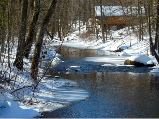
Photo credit: Barbara Heins.
Get more local news delivered straight to your inbox. Sign up for free Patch newsletters and alerts.