Community Corner
Naugatuck Blizzard 2015: Latest Forecast, Borough Plans, School Closings, and More
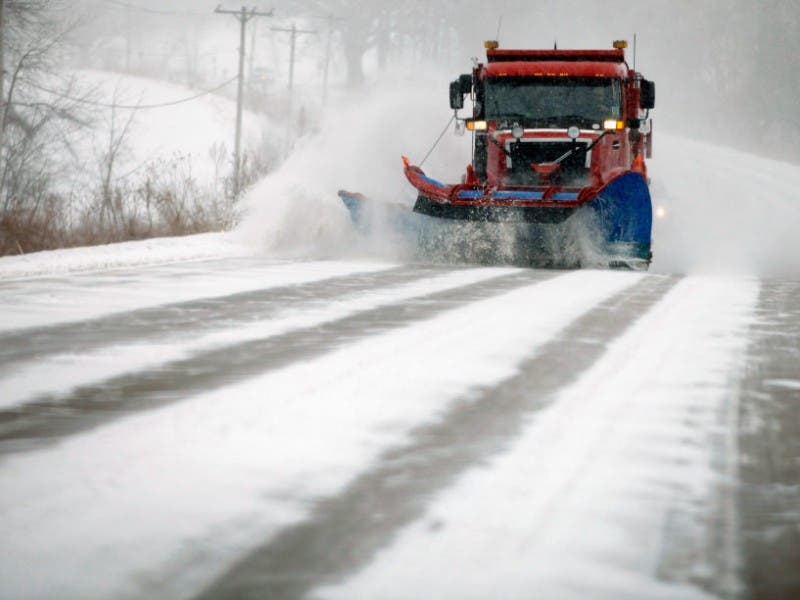
Check this post to get all your storm related coverage for Naugatuck.

- Governor Malloy Issues Travel Ban for Connecticut for Monday Evening
- Gov. Malloy: CT Blizzard Power Outages Could Last as Long as 48 Hours
- Naugatuck Blizzard 2015: Update from Mayor Bob Mezzo
- Check here for information on the Parking Ban
- Red Cross Offers Blizzard Preparation Safety Tips
- Naugatuck Residents: Here’s How You Can Report Power Outages
- Naugatuck Schools Make a Decision About School on Tuesday
- Naugatuck’s Hour-By-Hour Blizzard Forecast
Updated 8:30 p.m.
Snow with widespread blowing snow. The snow could be heavy at times. Some thunder is also possible. Low around 20. Wind chill values between 5 and 10. Blustery, with a north wind 17 to 22 mph, with gusts as high as 36 mph. Chance of precipitation is 100%. Total nighttime snow accumulation of 10 to 16 inches possible.
Tuesday Snow with widespread blowing snow. The snow could be heavy at times. Some thunder is also possible. High near 25. Wind chill values between 5 and 10. Blustery, with a north wind 15 to 21 mph, with gusts as high as 34 mph. Chance of precipitation is 100%. New snow accumulation of 7 to 11 inches possible.
Find out what's happening in Naugatuckfor free with the latest updates from Patch.
Tuesday Night Light snow, mainly before midnight. Low around 10. Wind chill values between -5 and 5. North wind 10 to 15 mph, with gusts as high as 25 mph. Chance of precipitation is 100%. New snow accumulation of 1 to 2 inches possible.
Updated National Weather Service forecast at 4 p.m.
Find out what's happening in Naugatuckfor free with the latest updates from Patch.
The National Weather Service is calling this a “crippling and potentially historic blizzard into Tuesday.”
What you need to know:
20-30 inches of snow accumulation
snowfall rates of 2-4 inches an hour
wind gusts could reach up to 70 miles per hour
Naugatuck’s latest hyperlocal forecast via the National Weather Service:
Late afternoon Snow. High near 24. Wind chill values between 10 and 15. Northeast wind around 14 mph, with gusts as high as 28 mph. Chance of precipitation is 90%. Total daytime snow accumulation of 1 to 2 inches possible.
Tonight Snow with widespread blowing snow. The snow could be heavy at times. Some thunder is also possible. Low around 20. Wind chill values between 5 and 10. Blustery, with a north wind 17 to 22 mph, with gusts as high as 38 mph. Chance of precipitation is 100%. New snow accumulation of 10 to 16 inches possible.
Tuesday Snow with widespread blowing snow. The snow could be heavy at times. Some thunder is also possible. High near 25. Wind chill values between 5 and 10. Blustery, with a north wind 15 to 21 mph, with gusts as high as 36 mph. Chance of precipitation is 100%. New snow accumulation of 7 to 11 inches possible.
Tuesday Night Light snow, mainly before midnight. Low around 10. Wind chill values between -5 and 5. North wind 10 to 15 mph, with gusts as high as 25 mph. Chance of precipitation is 100%. New snow accumulation of 1 to 2 inches possible.
Original post 10 a.m. As the state and the entire Northeast prepares for an historic blizzard, we will bring you the latest weather related news that will affect your day.
According to the National Weather Service, a blizzard warning is in effect from Jan. 26, 1 p.m. until Jan. 28, 12 a.m. All unnecessary travel is discouraged starting this afternoon.
While 1-3 inches of snow is expected to accumulate during the day, the heavy snow along with strong winds is expected to start after 7 p.m. The NWS is predicting a possible accumulation of 7-11 inches of snow tonight.
Here’s Naugatuck’s latest NWS forecast:
- Today: Light snow. High near 26. Wind chill values between 10 and 15. Northeast wind 13 to 16 mph. Chance of precipitation is 90%. Total daytime snow accumulation of 1 to 2 inches possible.
- Tonight: Light snow before 7pm, then snow with widespread blowing snow after 7pm. The snow could be heavy at times. Some thunder is also possible. Low around 20. Wind chill values between 5 and 10. Blustery, with a north wind 18 to 24 mph, with gusts as high as 37 mph. Chance of precipitation is 100%. New snow accumulation of 7 to 11 inches possible.
- Tuesday: Snow with widespread blowing snow. The snow could be heavy at times. Some thunder is also possible. High near 25. Wind chill values between 5 and 10. Blustery, with a north wind 21 to 24 mph, with gusts as high as 37 mph. Chance of precipitation is 100%. New snow accumulation of 8 to 12 inches possible.
- Tuesday Night: Light snow before 1am, then a chance of light snow between 1am and 4am. Low around 10. Wind chill values between -5 and 5. North wind 13 to 18 mph. Chance of precipitation is 100%. New snow accumulation of 1 to 2 inches possible.
- Wednesday: Mostly cloudy, then gradually becoming sunny, with a high near 24. North wind 10 to 13 mph.
- Wednesday Night: Partly cloudy, with a low around 8.
- Thursday: Partly sunny, with a high near 28.
- Thursday Night: Light snow likely. Cloudy, with a low around 22. Chance of precipitation is 60%.
- Friday: A chance of light snow. Mostly cloudy, with a high near 31. Chance of precipitation is 40%.
- Friday Night: Mostly cloudy, with a low around 8.
- Saturday: Mostly sunny and cold, with a high near 20.
- Saturday Night: Mostly cloudy, with a low around 6.
- Sunday: Partly sunny, with a high near 23.
Stay connected with our latest storm coverage:
Get weather alerts sent to your inbox by subscribing to the Patch.
Get more local news delivered straight to your inbox. Sign up for free Patch newsletters and alerts.