Home & Garden
NORTH BRANFORD WEATHER UPDATE: The Spring-Like Weather Continues ... For A While
When was the last time you saw the thermometer in the 40s?

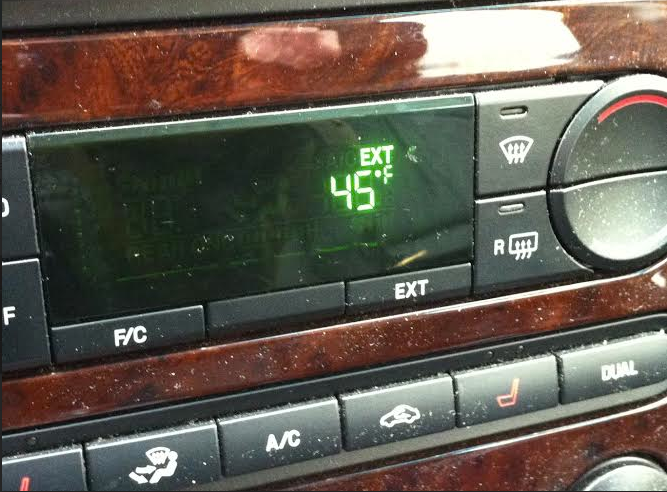
Ah, the first day of Daylight Saving Time — it was still light well into the evening and for the first time in weeks, the temperature was well above the freezing mark.
This weekend was the first since mid-January, that there hasn’t been a snowstorm or significant weather event. And in many towns and cities across the state with temperatures in the 40s, it’s a trend that should continue through the week. Although, weather forecasters and the National Weather Service are predicting that could change by week’s end.
Here’s what NBC Connecticut Meteorologist Darren Sweeney writes on his Facebook page, “Getting milder through Wednesday. Mildest day is Wednesday. Then, colder air starts trying to make a comeback at the end of the week.”
Find out what's happening in North Branfordfor free with the latest updates from Patch.
WFSB 3 TV Meteorologist Scot Haney writes “While we got a break from the stormy weather this weekend,, we won’t be as fortunate next weekend. A storm will move northward from the Gulf States while high pressure will set up shop to our north across Eastern Canada. The storm will likely move off the Mid-Atlantic Coast to the south of New England Saturday night and Sunday. Since the storm is still 6 days away I won’t get too specific just yet. However, it does look like we’ll have to deal with wet snow, sleet, and rain. Precipitation will probably develop on Saturday (although the timing is still in question) and it could linger well into Sunday.”
In the meantime — enjoy this balmy weather and hope we don’t have a ‘throwback Thursday’ to the near zero temps we’ve endured for the past seven weeks.
Find out what's happening in North Branfordfor free with the latest updates from Patch.
But in the interim, we may see a few flurries overnight Sunday into Monday.
Check back with North Branford Patch for the latest on whether schools may have delayed openings come Monday. Better yet, sign up for the North Branford Patch newsletter by clicking here so you have receive the most up-to-date news and more everyday.
Here is North Branford’s hyperlocal National Weather Service forecast:
- Tonight: Partly cloudy, with a low around 23. Northwest wind around 6 mph becoming calm in the evening.
- Monday: A chance of flurries before 10am. Mostly cloudy, then gradually becoming sunny, with a high near 46. Wind chill values between 25 and 35 early. Southwest wind 3 to 8 mph.
- Monday Night: Mostly clear, with a low around 22. Calm wind.
- Tuesday: A slight chance of light rain after 1pm. Increasing clouds, with a high near 46. Wind chill values between 25 and 35 early. Calm wind becoming south around 5 mph in the afternoon. Chance of precipitation is 20%.
- Tuesday Night: A slight chance of light rain. Mostly cloudy, with a low around 33. Calm wind. Chance of precipitation is 20%.
- Wednesday: Mostly sunny, with a high near 50.
- Wednesday Night: Mostly clear, with a low around 28.
- Thursday: Sunny, with a high near 43.
- Thursday Night: Partly cloudy, with a low around 23.
- Friday: Partly sunny, with a high near 38.
- Friday Night: A chance of snow. Mostly cloudy, with a low around 28. Chance of precipitation is 40%.
- Saturday: A chance of rain and snow. Mostly cloudy, with a high near 42. Chance of precipitation is 40%.
- Saturday Night: A chance of rain. Mostly cloudy, with a low around 31. Chance of precipitation is 30%.
- Sunday: Partly sunny, with a high near 44.
Other Patch stories:
- When To Spring Forward for Daylight Saving Time 2015
- Map: Nearly 100 Pedestrians Killed on Connecticut Roads Between 2011-2013
- On The North Branford Market: A 4-Bedroom Colonial on 2+ Acres
Photo credits: Barbara Heins. Photo #1: temperature on Sunday, March 8, 2015. Photo #2: A snowy birdhouse in Greenwich.
Get more local news delivered straight to your inbox. Sign up for free Patch newsletters and alerts.