Community Corner
UPDATE: Winter Weather Advisory Issued for Oxford
We'll let you know when the snow and mixed precipitation will begin and exactly how much accumulation is expected from this latest storm.

Weather update 6 p.m.
The National Weather Service has issued a Winter Weather Advisory from 2 p.m. on Saturday through midnight.
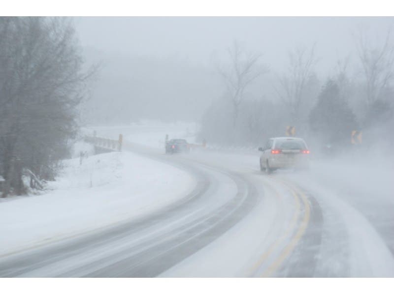
In the advisory, the weather service is predicting 1-4 inches of snow to accumulate, and the closer you are to the immediate coastline, the least amount of snow you’ll receive as more mixed precipitation is anticipated there.
Find out what's happening in Oxfordfor free with the latest updates from Patch.
Also a tenth of an inch of ice is also expected to accumulate.
Snow will begin Saturday afternoon and if you’re heading out at night, the heaviest snow will be done by 7 p.m., according to the National Weather Service.
Find out what's happening in Oxfordfor free with the latest updates from Patch.
Snow will change to freezing rain Saturday night and then to plain rain on Sunday morning as temperatures finally hit above freezing for seemingly the first time in a month.
Temperatures on Sunday could exceed 40 degrees.
“Impacts: snow covered roads coated with ice will make driving and walking hazardous,” the National Weather Service states.
Be careful!
Original post: As we bask in the glow of breaking a record dating back to 1966 for record cold on today’s date for Connecticut, our attention turns to a snow, sleet, freezing rain, and depending on where you live plain rain storm that will impact us mid-to-late afternoon on Saturday and ending by midday on Sunday.
If you’re curious about the record, a 1 degree temperature was recorded at Bridgeport at 6 a.m. Friday, which beat the previous record low of 2 degrees set in 1966.
Now back to the snow and mix threat.
WFSB 3 Meteorologist Scott Haney predicts 2-6 inches of snow to accumulate statewide with the highest totals coming north and west of Hartford.
Another major snowstorm is possible for midweek next week, Haney cautions.
NBC Connecticut meteorologists are predicting 2-4 inches of snow, sleet, and freezing rain to accumulate from this latest storm, and they too caution a major storm is possible for midweek.
WTNH News 8’s Meteorologist Gil Simmons is predicting light snow to begin between 4-7 p.m. on Saturday and it will change to ice overnight and possibly some plain rain for parts of the Connecticut Shoreline.
NBC Connecticut Meteorologist Darren Sweeney wrote on Facebook:
“Good news to the forecast I posted earlier in the week. The midday data is starting to come in line for the weekend.
Earlier data suggested a slug of moisture in the form of rain, which seemed unlikely given our very cold pattern well entrenched, but the data was consistent. Finally, the data looks more like it should, with LESS RAIN and MORE SNOW.
Yes, more snow is good news. No one needs the rain to soak into the snowpack on rooftops, garages, etc.
It looks to start late afternoon and wind down on Sunday morning. Not overly heavy and not a blockbuster snow. Several inches are possible. Start time: late afternoon Saturday, wrapping up Midday Sunday. It does appear some mixing will take place, but as for liquid reaching the ground, questionable.
This is not good news for towns struggling to keep snowbanks from blocking intersections, etc. It is good news for those of us who have snow building up on low pitched roofs.”
And of course this is what the National Weather Service is predicting specifically for Oxford:
Today, Sunny and cold, with a high near 9. Wind chill values between -5 and -15. Northwest wind 11 to 14 mph.
Tonight Mostly clear, with a low around -2. Wind chill values between -5 and -10. Northwest wind 5 to 7 mph becoming calm in the evening.
Saturday Snow likely, mainly after 5pm. Mostly cloudy, with a high near 29. Wind chill values between -10 and zero. Light south wind increasing to 5 to 10 mph in the morning. Chance of precipitation is 60%. New snow accumulation of around an inch possible.
Saturday Night Snow before 1am, then snow and freezing rain. Low around 28. Wind chill values between 15 and 20. South wind 5 to 9 mph. Chance of precipitation is 90%. New ice accumulation of less than a 0.1 of an inch possible. New snow accumulation of 2 to 4 inches possible.
Sunday Rain, snow, and freezing rain before 2pm, then a slight chance of rain between 2pm and 5pm, then a slight chance of rain and snow after 5pm. High near 38. West wind around 8 mph. Chance of precipitation is 80%. New ice accumulation of less than a 0.1 of an inch possible. New snow accumulation of less than a half inch possible.
Other stories on Patch:
Get more local news delivered straight to your inbox. Sign up for free Patch newsletters and alerts.