Home & Garden
UPDATE: Severe Thunderstorm Watch Extended For Ridgefield
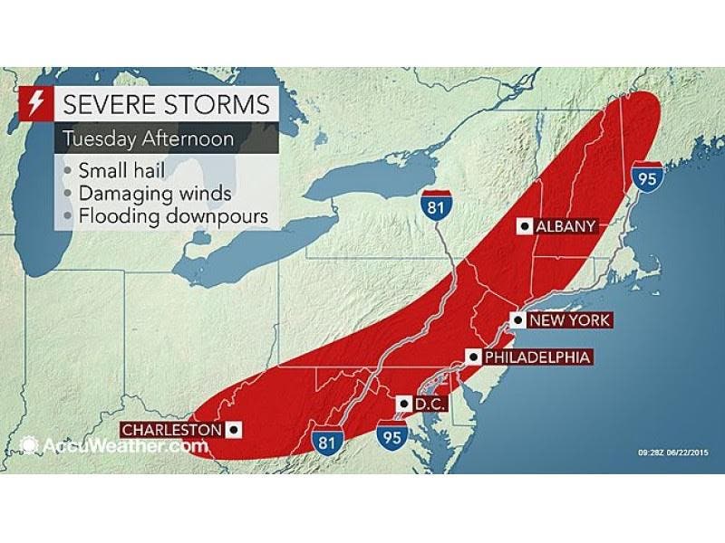
There is a chance for severe thunderstorms, heavy rains, large hail, and damaging winds today.

Update 4 p.m.: The severe thunderstorm watch has been extended until 9 p.m.
A severe thunderstorm warning is also in effect until 4:30 p.m., according to NWS.
Update: Already a quick change this morning by the National Weather Service, as the agency has now issued a “Severe Thunderstorm Watch” which is in effect for all of Connecticut from now until 4 p.m. Tuesday.
The entire state of Connecticut may see some severe weather this afternoon and evening as a “Hazardous Weather Outlook” has been issued for the state.
In a lot of places the morning sun will be replaced with clouds and then possibly severe thunderstorms that could produce heavy rains, damaging winds and hail, according to the National Weather Service.
It appears the biggest threat for the most severe weather this time is in northern Connecticut including Hartford and Tolland counties.
The weather service writes the severe weather is expected there between 2 p.m. and 8 p.m.
“These storms will likely contain damaging winds capable of knocking down trees and powerlines resulting in potential power outages,” the National Weather Service writes, while adding there is a “very low risk of an isolated tornado along with torrential downpours and localized flooding.”
Wind gusts of 70 mph or greater and even hail up to the size of golfballs are even possible.
For Fairfield, New Haven, Middlesex, and New London counties “severe thunderstorm development is possible this afternoon and evening as a cold front tracks through the region. Damaging wind gusts and large hail will be the primary threats,” the weather service writes.
The greatest chance for severe weather in the southern half of the state is between 4 p.m. and 9 p.m., according to the National Weather Service.
And as a reminder when severe weather is forecast, you really never know until the exact moment whether it’s actually going to materialize.
NBC Connecticut Meteorologist Ryan Hanrahan writes on Facebook that “The evolution of today’s thunderstorm threat is still quite uncertain. Storms and clouds across NY and PA will weaken by the time they reach New England but their debris will produce widespread cloud cover during peak heating. This may serve to limit the overall severe threat. Be aware of the weather today - especially this afternoon - and hopefully we can get these storms to be on the weaker side of the spectrum.”
NBC Connecticut Meteorologist Darren Sweeney writes on Facebook that “Not much has changed in our thinking for the severe weather set up today. The key is sunshine and heating, the more we see the stronger the storm threat. Hail and damaging winds are the biggest threat along with an isolated tornado somewhere in southern New England. The severe storm prediction center has now placed us in an elevated risk ( previously we were slight risk).”
Photo credit: Accuweather.com
Get more local news delivered straight to your inbox. Sign up for free Patch newsletters and alerts.