Home & Garden
WEATHER UPDATE: Hazardous Weather Outlook Issued for the Area
We'll also give you the latest weekend weather update, which includes a chance of temps falling into the 30s at night.


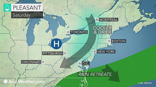
It’s been a beautiful week of weather thus far and we’re this close to the weekend but before we get there, we’ll have to deal with gray skies across all of Connecticut on Friday with a chance of showers and a thunderstorm or two.
The National Weather Service has issued a “Hazardous Weather Outlook” for Hartford and Tolland counties for a “low-risk” of an isolated strong storm or two on Friday and Friday evening.
There is no such advisory for southern Connecticut but the forecast still calls for off and on showers all day and a chance of a thunderstorm after 3 p.m.
Find out what's happening in Rocky Hillfor free with the latest updates from Patch.
Friday’s forecast isn’t a washout as we’re looking at no more than a quarter of an inch of rain for Connecticut. The showers end around midnight and will lead to a pretty perfect autumn weekend.
On Saturday, nothing but sunshine and temps in the low to mid 60s, it will be a bit gusty with winds up to 17 mph.
Find out what's happening in Rocky Hillfor free with the latest updates from Patch.
The big story this weekend will be the cold at night. In northern Connecticut temps could dip into the upper 30s and there is a chance for patchy frost early Sunday. In southern Connecticut temps will be near 40 degrees.
On Sunday, temps rebound into the upper 60s with more sunshine predicted. Temps at night aren’t as cold as Saturday as temps will be in the uppers 40s for most of the state.
Have a great weekend!
Photo credit: Accuweather.com.
Get more local news delivered straight to your inbox. Sign up for free Patch newsletters and alerts.