Community Corner
'Crippling and Potentially Historic Blizzard' Takes Aim at Trumbull
Remember the blizzard of 2013? This is part two.

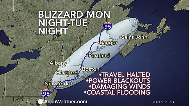
Calling it a “crippling and potentially historic blizzard” the National Weather Service is advising against traveling from Monday evening through Tuesday because a blizzard is forecast to dump up to 34 inches of snow on Trumbull.
The National Weather Service just scrapped its Blizzard Watch and replaced it with a Blizzard Warning, which begins at 1 p.m. Monday and runs until midnight.
The National Weather Service predicts that snow will fall at a rate of 2-4 inches of snow per hour.
Winds will be gusting between 30-40 miles per hour with gusts up to 65 miles per hour.
Windchill values can reach as low as -5 degrees.
Find out what's happening in Trumbullfor free with the latest updates from Patch.
The details:
Light snow begins in the morning accumulating 1-3 inches of snow by Monday evening’s commute.
Snow intensifies Monday night and the heaviest snow is forecast from midnight Tuesday until Tuesday afternoon.
The National Weather Service is not playing around when it comes to the severity of this storm saying it could lead to “life-threatening conditions” and that traveling will be “extremely dangerous.”
White-out conditions are expected and if you do travel the National Weather Service urges you to bring a survival kit.
Get more local news delivered straight to your inbox. Sign up for free Patch newsletters and alerts.