Community Corner
Dead Ends
Some topics look promising, but they quickly trail off into uncertainty, and attempting to follow the trail leads only to more questions.
They are two words, two things or places, and not one, into which I’d initially conflated them. Mamacoke and Manitock. Two names that evoke rich histories and intriguing goings-on, names so foreign they turn my Word document into a sea of red squiggles.
They attach themselves to points on the map, man-made and natural: Mamacoke Road, Mamacoke Cove, Mamacoke Island. Manitock Hill, Manitock Spring, Manitock Spring Water Company. The latter is sometimes Manatuck, and the Internet seems to want it to be Manotick, which is the one thing it definitely is not. (Though there is a Manotick, in Ottawa.)
I don’t know for sure what they mean, but one dictionary I found says they are Algonquian for “a great hook” (Mamacoke) and “a place of observation, a lookout” (Manitock.)
Find out what's happening in Waterfordfor free with the latest updates from Patch.
When they are mentioned in books, they reveal tiny snippets of history, but not the history I want. Christopher, James, Stephen, and Sylvester Miner lived on Manitock Hill. They were veterans of the Revolutionary War. So was William Tyack, who was an Indian, and whose ancestors lived near Tyack Swamp, which is on Manitock Hill. There is a moraine at Manitock Hill, created by glaciers scraping the earth 20,000 years ago. It’s only a minor moraine.
Quaker Hill was once known as Upper Mamacock; whether that’s a typo, an alternate spelling of Mamacoke, or another name entirely, I don’t know. European settlers found “established indigenous hay” there in 1645. Later, in the late 1800s, wooden ships were built there, but almost all evidence of this enterprise is gone now.
Find out what's happening in Waterfordfor free with the latest updates from Patch.
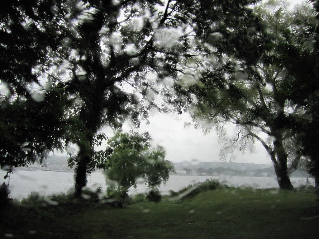
I think that maybe if I see some of these places myself, something about them will somehow magically become clear to me. I head out in a drizzle that soon turns to a downpour. By the time I get to Manitock Hill, the roads are beginning to flood, and then I miss my turn, and I’m annoyed. I wonder what’s Algonquian for “rain”, and “annoying”, and “why doesn’t this town have more storm drains?” The road up the hill itself, if the map on my iPhone is to be believed (which sometimes it’s not) looks narrow and inhospitable. I can imagine myself getting up it, finding nothing, and having to back the car all the way down through accumulating puddles.
So I give up, and in the still surprisingly persistent rain I drive towards Mamacoke Island - now a natural area owned by Connecticut College - on Benham Avenue, near Harrison’s Landing where they once built wooden boats. Maybe it’s just the weather, but I feel like I’m entering a world apart, a cross between a quiet beach-y neighborhood and a wilderness, with dense woods on both sides that soon open into a clearing. The history I want, if it’s there, is somewhere in those soggy impenetrable-looking woods. I cross the railroad tracks. Then the road ends, and I get a view of Mamacoke Cove through the downpour. Grey water, cold-looking, through a veil of trees.
Nearby Mamacoke Road is marked, fittingly, “Dead End,” and it is. It comes to an abrupt stop shortly after it begins. Luckily there is a small parking area to turn around in. As I do, I see a rust-colored blur in some trees ahead. A dog, I think. But it is a doe, and she lifts her head and watches me. She stays there, still and staring, as I reverse and drive away.