Weather
Hazardous Weather Outlook Issued for Connecticut Saturday
We have the latest on when the thunderstorms may roll through Connecticut this weekend and exactly how hot it's going to feel.

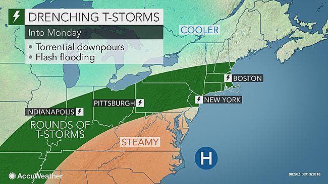
There’s been so much talk about the excessively high temperatures this week, which continues this weekend, and the seemingly out-of-nowhere thunderstorms that have been moving through Connecticut the past few days.
But, we’re now hearing and also seeing people talk a lot on social media about how we’d take this unsettled weather any day over the subzero temps and snow in January or February.
Is either a good choice? Ok, now back to the weekend forecast, which has been updated by the National Weather Service on Saturday.
Find out what's happening in Wethersfieldfor free with the latest updates from Patch.
A “Hazardous Weather Outlook” is in effect for the entire state because of you guessed it, the excessive heat and chance for isolated showers and thunderstorms to spout up and move through quickly.
The weather service says that any storms that move through will bring heavy rains and could lead to flooding concerns this weekend.
Find out what's happening in Wethersfieldfor free with the latest updates from Patch.
There are also “Air Quality Alerts” and “Excessive Heat Warnings” as the temps may be in the mid 90s but it will feel like 107 degrees for most of Connecticut on Saturday.
If you prefer cooler temps this weekend, you’ll want to head to northern Connecticut as it will ONLY feel like 102 degrees there on Sunday, while southern Connecticut will feel like a sauna and 108 degrees.
Here’s a detailed looked at the forecast and when the thunderstorms are most likely to move through on Saturday and Sunday in Connecticut.
Southern Connecticut:
Saturday: Scattered showers and thunderstorms, mainly after 2 p.m. 40 percent chance of storms during the afternoon. Heat index value as high as 107 degrees. And of course skies, somehow, will be mostly sunny, except if and when it’s thundering, lightning and downpouring.
Saturday night: More showers and storms up until 11 p.m. but a 30 percent chance for this to happen. Temps only fall back to 80 degrees.
Sunday: Same as Saturday’s forecast, showers and storms possible after 2 p.m. Mostly sunny and hot with highs near 96! It will feel like 108 degrees!
Sunday night: More showers and storms possible, 30 percent chance.
Northern Connecticut:
Saturday: Showers and thunderstorms possible after 2 p.m. Mostly cloudy, temps near 96 degrees and it will feel like 106. There is a 60 percent chance of rain here. Up to a quarter of an inch of rain is expected.
Saturday night: More showers and storms, ending around 1 a.m. Fog moves in and temps drop to about 75 degrees.
Sunday: More showers and storms, this time after 3 p.m. Partly sunny with temps around 95 degrees and it will feel like 102 degrees. Another quarter of an inch of rain is possible.
Sunday night: Storms and showers, if there is any, end by 8 p.m. Another tenth of an inch of rain is likely.
Photo credit: Accuweather.com
Get more local news delivered straight to your inbox. Sign up for free Patch newsletters and alerts.