Community Corner
WEATHER UPDATE: Rain, Sleet, and Snow to Lead to 'Slick Roads' This Evening
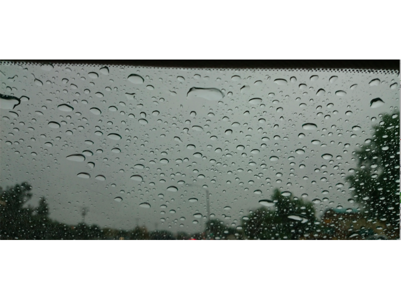
On the eve of April, snow and sleet are forecast for Wilton, which could lead to difficult driving conditions.

Just in time for April we’ll be seeing some snow flakes later today, possibly in time for the evening commute home from work.
This won’t amount to much of anything but because the temperature will be dropping and the precipitation will be failing it’s likely the roads may be slick.
The National Weather Service has issued a “Hazardous Weather Outlook” for Hartford and Tolland counties for light snow accumulation later today. Those areas could see up to an inch of snow, while the rest of Connecticut is forecast to see less than an inch of snow if that.
Find out what's happening in Wiltonfor free with the latest updates from Patch.
But the news isn’t all bad as NBC Connecticut Meteorologist Darren Sweeney writes below.
Again, be careful when driving later tonight.
Find out what's happening in Wiltonfor free with the latest updates from Patch.
WTNH News 8 Meteorologist Gil Simmons writes “Take your umbrella...A nasty finish to the day with rain, sleet and wet snow arriving 4PM-7PM. Slick roads likely this evening in many areas. Bridges are first to get slick. Be careful.”
News 12 writes “For this afternoon and evening. Roads will be messy and slippery tonight. Don’t expect a lot of accumulating snow but it is possible to see very light accumulations in some of our northern communities.”
NBC Connecticut Meteorologist Ryan Hanrahan writes, “A period of rain and snow later today with a weak storm passing underneath us. Can’t rule out some minor accumulation on grassy surfaces - particularly in hilly spots of southern Connecticut.”
And for some good news from NBC Connecticut Meteorologist Darren Sweeney.
“Some model data on Friday, wants to put us near 70! It all has to come together for it to happen, but after today’s snowflakes flying, lets hope. I think if we hit 70 on a Friday, there will be a statewide freakout!”
Here is today’s hyperlocal forecast for Wilton from the National Weather Service:
- Today: Rain before 5pm, then rain and snow. High near 43. Southwest wind around 6 mph. Chance of precipitation is 80%. Little or no snow accumulation expected.
- Tonight: Rain and snow before 1am, then a slight chance of snow between 1am and 2am. Low around 26. Light and variable wind becoming north 5 to 9 mph in the evening. Chance of precipitation is 90%. New snow accumulation of around an inch possible.
- Wednesday: Sunny, with a high near 44. Wind chill values between 20 and 30. Northwest wind 8 to 11 mph.
- Wednesday Night: Mostly clear, with a low around 27. Northwest wind around 5 mph becoming calm in the evening.
- Thursday: Mostly sunny, with a high near 51. Light southwest wind becoming south 6 to 11 mph in the morning.
- Thursday Night: A chance of showers and thunderstorms, mainly after 2am. Mostly cloudy, with a low around 45. Chance of precipitation is 40%.
- Friday: Showers likely, mainly after 7am. Mostly cloudy, with a high near 63. Chance of precipitation is 60%.
- Friday Night: A chance of showers. Mostly cloudy, with a low around 43. Chance of precipitation is 50%.
- Saturday: A chance of showers. Partly sunny, with a high near 51. Chance of precipitation is 30%.
- Saturday Night: Partly cloudy, with a low around 30.
- Sunday: Mostly sunny, with a high near 48.
- Sunday Night: Partly cloudy, with a low around 32.
More Stories on Patch:
- Employment Ends for Madison Teacher Accused of Sexual Assault
- No Referendum Needed to Accept $15 Million GE Gift for Sandy Hook Tragedy
- Cops: Pedestrians Scattered as Man Drove on Sidewalk
- Update: Bond Raised for Danbury Nanny Accused of Intentionally Burning Child
- NYC Police Question Harvey Weinstein of Westport After Groping Report
Patch File Photo
Want more weather alerts? Sign up below!
Get more local news delivered straight to your inbox. Sign up for free Patch newsletters and alerts.