Community Corner
Windsor Locks, East Windsor Weather Alert: Weekend Snow Total Prediction Increased
It appears the winter storm forecast for the weekend took a turn for the worse.

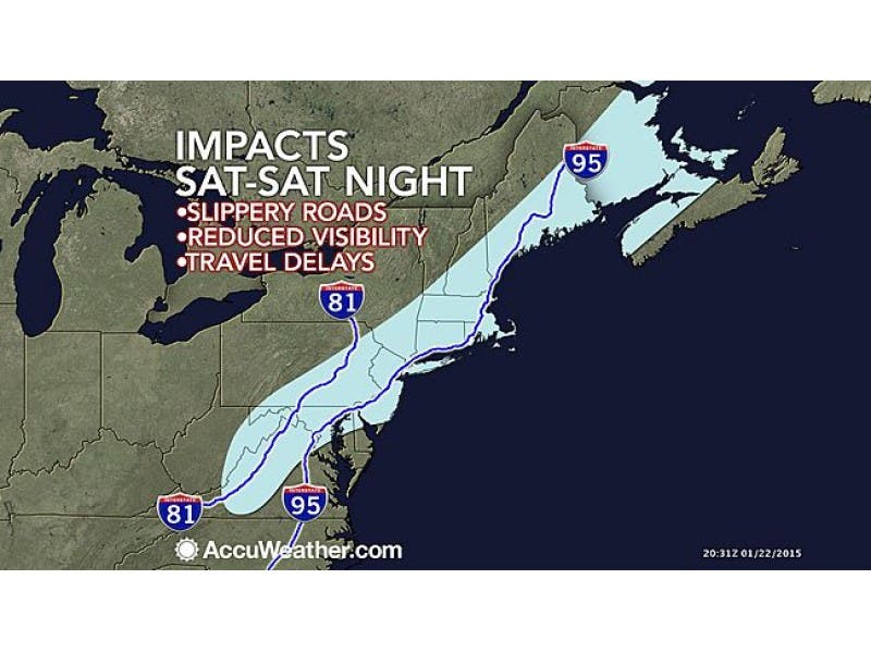
The National Weather Service has issued a winter storm watch for Hartford County in anticipation of Saturday’s storm.
Snow will begin falling Saturday morning and may mix with rain midway before changing back to snow during the late afternoon and evening. Totals of 4 to 7 inches of snow are possible.
Below is the NWS forecast for Hartford County:
Find out what's happening in Windsor Locks-East Windsorfor free with the latest updates from Patch.
- Friday: Sunny, with a high near 36. Calm wind becoming southwest around 6 mph in the afternoon.
- Friday Night: A chance of snow, mainly after 5am. Increasing clouds, with a low around 22. South wind 3 to 5 mph. Chance of precipitation is 30%. New snow accumulation of less than a half inch possible.
- Saturday: Rain and snow, becoming all snow after 4pm. High near 34. Calm wind becoming north 5 to 8 mph in the afternoon. Chance of precipitation is 80%. New snow accumulation of 2 to 4 inches possible.
- Saturday Night: A chance of snow, mainly before 10pm. Mostly cloudy, with a low around 27. West wind 9 to 11 mph, with gusts as high as 22 mph. Chance of precipitation is 40%.
- Sunday: Mostly sunny, with a high near 34.
- Sunday Night: A chance of snow after 3am. Mostly cloudy, with a low around 18. Chance of precipitation is 30%.
- Monday: A chance of snow. Mostly cloudy, with a high near 25. Chance of precipitation is 40%.
- Monday Night: A chance of snow showers. Mostly cloudy, with a low around 9. Chance of precipitation is 30%
Photo credit: Accuweather.com
Get more local news delivered straight to your inbox. Sign up for free Patch newsletters and alerts.