Community Corner
More Rain, Cold Temperatures in Store for Tampa Bay
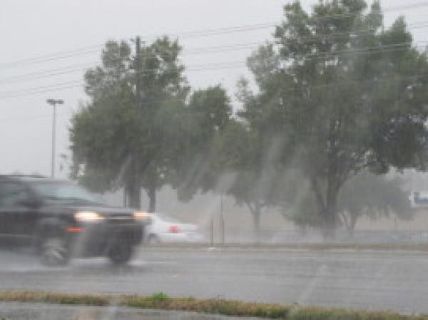
The Tampa Bay area is bracing for its first bite of winter-like weather.

A cold front moving through the Tampa Bay area will bring near-freezing temperatures to much of the region before a gradual warming trend arrives.
The National Weather Service in Ruskin is calling for a strong chance of showers Tuesday with a clearing out in the overnight hours. As those storms move away, however, temperatures throughout the Bay area expected to drop rather dramatically.
The high on Tuesday will climb to only the lower 50s with an anticipated low near freezing in much of the region. Freeze warnings, in fact, have gone up for counties just north of Tampa Bay, but the possibility of isolated spots of freezing temperatures to the south is also possible.
Find out what's happening in Land O' Lakesfor free with the latest updates from Patch.
The National Weather Service has also issued a rip current statement and high surf advisory for most of Tampa Bay’s coastal areas through Wednesday afternoon.
While Tuesday is expected to be a frigid one, gradual warming is anticipated to return on Wednesday. The forecast as of Tuesday morning calls for a high in the low 60s with lows in the lower 40s. Thursday’s high should climb to the upper 60s with a return to the 70s anticipated Friday and Saturday.
Find out what's happening in Land O' Lakesfor free with the latest updates from Patch.
For a complete look at Tampa Bay area weather, visit the National Weather Service online.
Get more local news delivered straight to your inbox. Sign up for free Patch newsletters and alerts.